 |
|
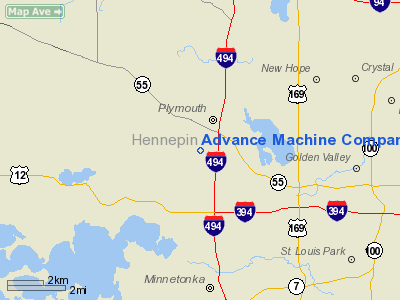
Advance Machine Company Heliport |
Location & QuickFacts
| FAA Information Effective: | 2008-09-25 |
| Airport Identifier: | MY85 |
| Airport Status: | Operational |
| Longitude/Latitude: | 093-28-10.8340W/45-00-06.8680N
-93.469676/45.001908 (Estimated) |
| Elevation: | 973 ft / 296.57 m (Estimated) |
| Land: | 0 acres |
| From nearest city: | 0 nautical miles N of Plymouth, MN |
| Location: | Hennepin County, MN |
| Magnetic Variation: | 04E (1985) |
Owner & Manager
| Ownership: | Privately owned |
| Owner: | Advance Machine Company |
| Address: | 14600 21st Ave
Plymouth, MN 55447-3408 |
| Phone number: | 612-473-2235 |
| Address: |
|
Airport Operations and Facilities
| Airport Use: | Private
PERSONAL USE. |
| Segmented Circle: | No |
| Control Tower: | No |
| Sectional chart: | Twin Cities |
| Region: | AGL - Great Lakes |
| Boundary ARTCC: | ZMP - Minneapolis |
| Tie-in FSS: | PNM - Princeton |
| FSS Toll Free: | 1-800-WX-BRIEF |
Runway Information
Helipad H1
| Dimension: | 30 x 30 ft / 9.1 x 9.1 m |
| Surface: | TURF, |
| |
Runway H1 |
Runway |
| Traffic Pattern: | Left | Left |
|
Radio Navigation Aids
| ID |
Type |
Name |
Ch |
Freq |
Var |
Dist |
| MS | NDB | Narco | | 266.00 | 02E | 19.3 nm |
| PPI | NDB | Hopey | | 400.00 | 03E | 23.7 nm |
| GYL | NDB | Glencoe | | 407.00 | 03E | 30.0 nm |
| PNM | NDB | Princeton | | 368.00 | 03E | 34.3 nm |
| CBG | NDB | Cambridge | | 350.00 | 03E | 34.5 nm |
| OEO | NDB | Osceola | | 233.00 | 01E | 38.0 nm |
| HCD | NDB | Hutchinson | | 209.00 | 04E | 39.8 nm |
| RNH | NDB | New Richmond | | 257.00 | 02E | 40.7 nm |
| ROS | NDB | Rush City | | 282.00 | 02E | 47.1 nm |
| AHH | NDB | Ameron | | 278.00 | 01E | 49.5 nm |
| FCM | VOR/DME | Flying Cloud | 055X | 111.80 | 06E | 10.6 nm |
| MSP | VOR/DME | Minneapolis | 100X | 115.30 | 02E | 11.8 nm |
| STC | VOR/DME | St Cloud | 058X | 112.10 | 03E | 41.3 nm |
| FOW | VOR/DME | Halfway | 049X | 111.20 | 02E | 48.1 nm |
| GEP | VORTAC | Gopher | 120X | 117.30 | 06E | 9.6 nm |
| FGT | VORTAC | Farmington | 104X | 115.70 | 06E | 25.4 nm |
| DWN | VORTAC | Darwin | 027X | 109.00 | 07E | 42.1 nm |
| MSP | VOT | Minneapolis St Paul | | 111.00 | | 12.9 nm |
| STP | VOT | St Paul | | 114.40 | | 17.8 nm |
Remarks
- PRVDD OPNS ARE CONDUCTED FM 150 TO 010 DEGS; AREA IS MKD & WIND INDICATOR IS MAINTAINED.
Images and information placed above are from
http://www.airport-data.com/airport/MY85/
We thank them for the data!
| General Info
|
| Country |
United States
|
| State |
MINNESOTA
|
| FAA ID |
MY85
|
| Latitude |
45-00-06.868N
|
| Longitude |
093-28-10.834W
|
| Elevation |
973 feet
|
| Near City |
PLYMOUTH
|
We don't guarantee the information is fresh and accurate. The data may
be wrong or outdated.
For more up-to-date information please refer to other sources.
|
|


