 |
|
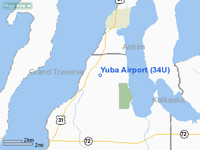
Location & QuickFacts
| FAA Information Effective: | 2008-09-25 |
| Airport Identifier: | 34U |
| Airport Status: | Operational |
| Longitude/Latitude: | 085-25-52.2530W/44-50-20.0080N
-85.431181/44.838891 (Estimated) |
| Elevation: | 645 ft / 196.60 m (Estimated) |
| Land: | 80 acres |
| From nearest city: | 4 nautical miles S of Elk Rapids, MI |
| Location: | Grand Traverse County, MI |
| Magnetic Variation: | 04W (1985) |
Owner & Manager
| Ownership: | Privately owned |
| Owner: | Dorance Amos |
| Address: | 8443 Cairn Hwy
Elk Rapids, MI 49629 |
| Phone number: | 231-620-4300 |
| Manager: | Julia Pollister Amos |
| Address: | 8443 Carin Hwy
Elk Rapids, MI 49629 |
| Phone number: | 231-620-4300
AMGR EVENINGS 231-264-8884 |
Airport Operations and Facilities
| Airport Use: | Open to public |
| Wind indicator: | Yes |
| Segmented Circle: | No |
| Control Tower: | No |
| Sectional chart: | Green Bay |
| Region: | AGL - Great Lakes |
| Boundary ARTCC: | ZMP - Minneapolis |
| Tie-in FSS: | LAN - Lansing |
| FSS Toll Free: | 1-800-WX-BRIEF |
| NOTAMs Facility: | LAN (NOTAM-d service avaliable) |
Airport Communications
Runway Information
Runway 18/36
| Dimension: | 2975 x 100 ft / 906.8 x 30.5 m |
| Surface: | TURF, Fair Condition |
| |
Runway 18 |
Runway 36 |
| Longitude: | 085-25-53.2500W | 085-25-53.2500W |
| Latitude: | 44-50-37.6800N | 44-50-08.3100N |
| Elevation: | 625.00 ft | 625.00 ft |
| Traffic Pattern: | Left | Left |
| Obstruction: | 30 ft trees, 70 ft left of centerline | 64 ft pline, 1600.0 ft from runway, 25:1 slope to clear |
|
Radio Navigation Aids
| ID |
Type |
Name |
Ch |
Freq |
Var |
Dist |
| TV | NDB | Gwenn | | 365.00 | 05W | 6.3 nm |
| CXK | NDB | Clam Lake | | 251.00 | 05W | 8.9 nm |
| GYG | NDB | Grayling | | 359.00 | 06W | 26.3 nm |
| CVX | NDB | Charlevoix | | 392.00 | 05W | 28.7 nm |
| BFA | NDB | Boyne Falls | | 263.00 | 06W | 29.3 nm |
| CAD | NDB | Cadillac | | 269.00 | 04W | 33.9 nm |
| CGG | VOR | Grayling | | 109.80 | 06W | 31.4 nm |
| GLR | VOR/DME | Gaylord | 029X | 109.20 | 06W | 32.6 nm |
| HTL | VOR/DME | Houghton Lake | 053X | 111.60 | 05W | 43.7 nm |
| MBL | VOR/DME | Manistee | 051X | 111.40 | 05W | 49.1 nm |
| TVC | VORTAC | Traverse City | 093X | 114.60 | 02W | 11.5 nm |
Remarks
- ORCHARD BOTH SIDES OF RY.
- RY SLOPES DOWN FM SOUTH TO NORTH.
- ARPT CLSD NOV THRU APR.
- PROVIDED OBSTRUCTIONS BE REMOVED/LOWERED OR RY END DSPLCD TO PROVIDE A CLEAR 20:1 APPROACH;PROVIDED A CLEAR 250' WIDE PRIMARY SURFACE & ESTABLISH A BUILDING RESTRICTION LINE 200' FM RY CL;NO OBSTRUCTIONS WITHIN 200' EITHER SIDE OF RY CL.
Images and information placed above are from
http://www.airport-data.com/airport/34U/
We thank them for the data!
| General Info
|
| Country |
United States
|
| State |
MICHIGAN
|
| FAA ID |
34U
|
| Latitude |
44-50-20.008N
|
| Longitude |
085-25-52.253W
|
| Elevation |
645 feet
|
| Near City |
ELK RAPIDS
|
We don't guarantee the information is fresh and accurate. The data may
be wrong or outdated.
For more up-to-date information please refer to other sources.
|
|


