 |
|
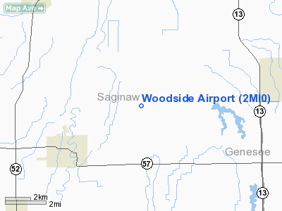
Location & QuickFacts
| FAA Information Effective: | 2008-09-25 |
| Airport Identifier: | 2MI0 |
| Airport Status: | Operational |
| Longitude/Latitude: | 084-02-49.9020W/43-13-00.0950N
-84.047195/43.216693 (Estimated) |
| Elevation: | 615 ft / 187.45 m (Estimated) |
| Land: | 0 acres |
| From nearest city: | 5 nautical miles NE of Chesaning, MI |
| Location: | Saginaw County, MI |
| Magnetic Variation: | 05W (1985) |
Owner & Manager
| Ownership: | Privately owned |
| Owner: | Donald Brettrager |
| Address: | 14401 Gasper Road
Chesaning, MI 48616 |
| Phone number: | 517-845-3509 |
| Manager: | Donald Brettrager |
| Address: | 14401 Gasper Road
Chesaning, MI 48616 |
| Phone number: | 517-845-3509 |
Airport Operations and Facilities
| Airport Use: | Private |
| Wind indicator: | Yes |
| Segmented Circle: | No |
| Control Tower: | No |
| Sectional chart: | Detroit |
| Region: | AGL - Great Lakes |
| Boundary ARTCC: | ZOB - Cleveland |
| Tie-in FSS: | LAN - Lansing |
| FSS on Airport: | No |
| FSS Toll Free: | 1-800-WX-BRIEF |
Runway Information
Runway 09/27
| Dimension: | 2400 x 75 ft / 731.5 x 22.9 m |
| Surface: | TURF, |
| |
Runway 09 |
Runway 27 |
| Traffic Pattern: | Right | Left |
|
Radio Navigation Aids
| ID |
Type |
Name |
Ch |
Freq |
Var |
Dist |
| HYX | NDB | Browne | | 385.00 | 06W | 15.3 nm |
| AMN | NDB | Alma | | 329.00 | 05W | 32.9 nm |
| OZW | NDB | Howell | | 243.00 | 05W | 35.1 nm |
| GDW | NDB | Wiggins | | 209.00 | 04W | 49.0 nm |
| MBS | VOR/DME | Saginaw | 076X | 112.90 | 03W | 19.0 nm |
| MOP | VOR/DME | Mount Pleasant | 043X | 110.60 | 05W | 38.8 nm |
| FNT | VORTAC | Flint | 116X | 116.90 | 06W | 20.0 nm |
| PSI | VORTAC | Pontiac | 047X | 111.00 | 03W | 38.4 nm |
| LAN | VORTAC | Lansing | 045X | 110.80 | 05W | 41.5 nm |
Images and information placed above are from
http://www.airport-data.com/airport/2MI0/
We thank them for the data!
| General Info
|
| Country |
United States
|
| State |
MICHIGAN
|
| FAA ID |
2MI0
|
| Latitude |
43-13-00.095N
|
| Longitude |
084-02-49.902W
|
| Elevation |
615 feet
|
| Near City |
CHESANING
|
We don't guarantee the information is fresh and accurate. The data may
be wrong or outdated.
For more up-to-date information please refer to other sources.
|
|


