 |
|
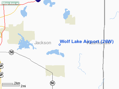
Location & QuickFacts
| FAA Information Effective: | 2008-09-25 |
| Airport Identifier: | 26W |
| Airport Status: | Operational |
| Longitude/Latitude: | 084-13-54.0000W/42-12-35.0000N
-84.231667/42.209722 (Estimated) |
| Elevation: | 980 ft / 298.70 m (Estimated) |
| Land: | 10 acres |
| From nearest city: | 4 nautical miles NE of Napoleon, MI |
| Location: | Jackson County, MI |
| Magnetic Variation: | 05W (1990) |
Owner & Manager
| Ownership: | Privately owned |
| Owner: | Grey Towers Estate |
| Address: | 3700 Grey Tower Road
Jackson, MI 49201 |
| Phone number: | 517-522-5927 |
| Manager: | John H. Coleman |
| Address: | 3700 Grey Tower Road
Jackson, MI 49201 |
| Phone number: | 517-522-5927 |
Airport Operations and Facilities
| Airport Use: | Open to public |
| Wind indicator: | Yes |
| Segmented Circle: | No |
| Control Tower: | No |
| Sectional chart: | Detroit |
| Region: | AGL - Great Lakes |
| Boundary ARTCC: | ZOB - Cleveland |
| Tie-in FSS: | LAN - Lansing |
| FSS on Airport: | No |
| FSS Toll Free: | 1-800-WX-BRIEF |
| NOTAMs Facility: | LAN (NOTAM-d service avaliable) |
Airport Communications
Airport Services
Runway Information
Runway 18/36
| Dimension: | 2155 x 100 ft / 656.8 x 30.5 m |
| Surface: | TURF, Fair Condition |
| Edge Lights: | Non-standard lighting system
NSTD LIRL NOT FAA APPROVED L-800 SERIES FOR SPACING; NOT FOR PUBLIC USE. |
| |
Runway 18 |
Runway 36 |
| Longitude: | 084-14-00.1000W | 084-14-00.8000W |
| Latitude: | 42-12-39.1000N | 42-12-17.8000N |
| Traffic Pattern: | Left | Left |
| Obstruction: | 57 ft trees, 50L/ ft right of centerline
RWY 18 ALSO 40 FT TREES, 20 FT DSTC, 51 FT R, APCH RATIO 0:1. | 43 ft trees, 474.0 ft from runway, 55 ft left of centerline, 11:1 slope to clear
RWY 36, ALSO 55 FT TREE, 660 FT DSTC, 125 FT R APCH RATIO 12:1.
RWY 36 ALSO APCH RATIO 12:1 OVER 55 FT TREE, 660 FT DSTC, 125 FT R. |
|
Radio Navigation Aids
| ID |
Type |
Name |
Ch |
Freq |
Var |
Dist |
| TCU | NDB | Tecumseh | | 239.00 | 04W | 18.8 nm |
| ADG | NDB | Adrian | | 278.00 | 06W | 21.5 nm |
| OZW | NDB | Howell | | 243.00 | 05W | 27.7 nm |
| USE | NDB | Fulton | | 375.00 | 05W | 36.4 nm |
| BT | NDB | Batol | | 272.00 | 04W | 43.3 nm |
| BYN | NDB | Bryan | | 260.00 | 04W | 45.1 nm |
| RYS | NDB | Grosse Ile | | 419.00 | 06W | 48.5 nm |
| TOL | TACAN | Toledo | 072X | | 05W | 41.8 nm |
| JXN | VOR/DME | Jackson | 033X | 109.60 | 05W | 10.5 nm |
| LFD | VOR/DME | Litchfield | 049X | 111.20 | 05W | 25.4 nm |
| DXO | VOR/DME | Detroit | 081X | 113.40 | 06W | 38.5 nm |
| SVM | VORTAC | Salem | 090X | 114.30 | 03W | 30.8 nm |
| CRL | VORTAC | Carleton | 104X | 115.70 | 03W | 35.8 nm |
| LAN | VORTAC | Lansing | 045X | 110.80 | 05W | 36.9 nm |
| PSI | VORTAC | Pontiac | 047X | 111.00 | 03W | 42.8 nm |
| BTL | VORTAC | Battle Creek | 031X | 109.40 | 02W | 45.8 nm |
| YIP | VOT | Willow Run | | 112.00 | | 31.6 nm |
| DTW | VOT | Detroit Met Wayne | | 109.80 | | 38.6 nm |
Remarks
- RWY 36, ALSO +50 FT TREES 1080 FT 101 FT R APCH RATIO 20:1.
Images and information placed above are from
http://www.airport-data.com/airport/26W/
We thank them for the data!
| General Info
|
| Country |
United States
|
| State |
MICHIGAN
|
| FAA ID |
26W
|
| Latitude |
42-12-35.000N
|
| Longitude |
084-13-54.000W
|
| Elevation |
980 feet
|
| Near City |
NAPOLEON
|
We don't guarantee the information is fresh and accurate. The data may
be wrong or outdated.
For more up-to-date information please refer to other sources.
|
|


