 |
|
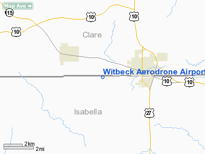
Witbeck Aerodrone Airport |
Location & QuickFacts
| FAA Information Effective: | 2008-09-25 |
| Airport Identifier: | 4MI7 |
| Airport Status: | Operational |
| Longitude/Latitude: | 084-49-18.0700W/43-48-48.0920N
-84.821686/43.813359 (Estimated) |
| Elevation: | 890 ft / 271.27 m (Estimated) |
| Land: | 0 acres |
| From nearest city: | 3 nautical miles SW of Farwell, MI |
| Location: | Isabella County, MI |
| Magnetic Variation: | 05W (1985) |
Owner & Manager
| Ownership: | Privately owned |
| Owner: | Gerald B. Witbeck |
| Address: | 1674 E. N. County Line Rd
Clare, MI 48617 |
| Phone number: | 517-386-2152 |
| Manager: | Gerald B. Witbeck |
| Address: | 1674 E. N. County Line Rd
Clare, MI 48617 |
| Phone number: | 517-386-2152 |
Airport Operations and Facilities
| Airport Use: | Private
PERSONAL USE. |
| Wind indicator: | Yes |
| Segmented Circle: | No |
| Control Tower: | No |
| Landing fee charge: | No |
| Sectional chart: | Detroit |
| Region: | AGL - Great Lakes |
| Boundary ARTCC: | ZMP - Minneapolis |
| Responsible ARTCC: | ZOB - Cleveland |
| Tie-in FSS: | LAN - Lansing |
| FSS on Airport: | No |
| FSS Toll Free: | 1-800-WX-BRIEF |
Runway Information
Runway E/W
| Dimension: | 1760 x 25 ft / 536.4 x 7.6 m |
| Surface: | TURF, |
| |
Runway E |
Runway W |
| Traffic Pattern: | Left | Left |
|
Helipad H1
| Dimension: | 100 x 100 ft / 30.5 x 30.5 m |
| Surface: | TURF, |
| |
Runway H1 |
Runway |
| Traffic Pattern: | Left | Left |
|
Radio Navigation Aids
| ID |
Type |
Name |
Ch |
Freq |
Var |
Dist |
| GDW | NDB | Wiggins | | 209.00 | 04W | 17.7 nm |
| AMN | NDB | Alma | | 329.00 | 05W | 29.5 nm |
| CAD | NDB | Cadillac | | 269.00 | 04W | 37.8 nm |
| BHW | NDB | Hardwood | | 236.00 | 06W | 41.2 nm |
| HYX | NDB | Browne | | 385.00 | 06W | 47.8 nm |
| MOP | VOR/DME | Mount Pleasant | 043X | 110.60 | 05W | 12.0 nm |
| HTL | VOR/DME | Houghton Lake | 053X | 111.60 | 05W | 33.5 nm |
| MBS | VOR/DME | Saginaw | 076X | 112.90 | 03W | 36.5 nm |
| BXZ | VOR/DME | West Branch | 079X | 113.20 | 06W | 37.8 nm |
| HIC | VOR/DME | White Cloud | 123X | 117.60 | 01W | 41.4 nm |
Remarks
- HEL ASP: ALL APCH/DEP RTE HOP ARE CONDUCTED IN AN AREA FROM 100-250 DEGS CLKWS USING THE TOUCHDOWN PAD AS THE CENTER OF A COMPASS ROSE; TKOF/LNDG AREA IS APROPLY MKD & LGTD; NON-OBSTNG WIND INDCR IS MAINTD ADJ TO THE TKOF/LNDG AREA.
Images and information placed above are from
http://www.airport-data.com/airport/4MI7/
We thank them for the data!
| General Info
|
| Country |
United States
|
| State |
MICHIGAN
|
| FAA ID |
4MI7
|
| Latitude |
43-48-48.092N
|
| Longitude |
084-49-18.070W
|
| Elevation |
890 feet
|
| Near City |
FARWELL
|
We don't guarantee the information is fresh and accurate. The data may
be wrong or outdated.
For more up-to-date information please refer to other sources.
|
|


