 |
|
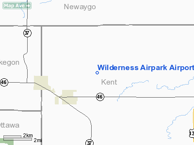
Wilderness Airpark Airport |
Location & QuickFacts
| FAA Information Effective: | 2008-09-25 |
| Airport Identifier: | 24M |
| Airport Status: | Operational |
| Longitude/Latitude: | 085-42-42.1520W/43-14-41.0870N
-85.711709/43.244746 (Estimated) |
| Elevation: | 785 ft / 239.27 m (Estimated) |
| Land: | 60 acres |
| From nearest city: | 3 nautical miles NE of Kent City, MI |
| Location: | Kent County, MI |
| Magnetic Variation: | 04W (1990) |
Owner & Manager
| Ownership: | Privately owned |
| Owner: | Wilderness Airpark Association |
| Address: | C/o Jim Norton, 15387 Sparta Ave.
Kent City, MI 49330-9763 |
| Phone number: | 616-678-5782
616-550-2054 MGR CELL. |
| Manager: | James Norton |
| Address: | 15387 Sparta Ave, 15387 Sparta Ave.
Kent City, MI 49330-9763
AMGR LIVES ON ARPT. |
| Phone number: | 616-678-5782 |
Airport Operations and Facilities
| Airport Use: | Open to public |
| Wind indicator: | Yes |
| Segmented Circle: | No |
| Control Tower: | No |
| Sectional chart: | Chicago |
| Region: | AGL - Great Lakes |
| Boundary ARTCC: | ZAU - Chicago |
| Tie-in FSS: | LAN - Lansing |
| FSS on Airport: | No |
| FSS Toll Free: | 1-800-WX-BRIEF |
| NOTAMs Facility: | LAN (NOTAM-d service avaliable) |
Airport Communications
Runway Information
Runway 09/27
| Dimension: | 2543 x 100 ft / 775.1 x 30.5 m |
| Surface: | TURF, Good Condition |
| |
Runway 09 |
Runway 27 |
| Traffic Pattern: | Left | Left |
| Displaced threshold: | 537.00 ft | 335.00 ft |
| Obstruction: | 60 ft trees, 78.0 ft from runway, 123 ft left of centerline, 1:1 slope to clear
DSPLCD THLD APCH RATIO 10:1 BASED ON 60 FT TREES 609 FT DSTC123 FT L, 20:1 BASED ON STRAIGHT OUT. | 15 ft road, 10.0 ft from runway
DSPLCD THLD APCH RATIO 20:1 BASED ON 38 FT TREES 780 FT DSTC 50 FT R. |
|
Radio Navigation Aids
| ID |
Type |
Name |
Ch |
Freq |
Var |
Dist |
| HLM | NDB | Holland | | 233.00 | 03W | 33.3 nm |
| AMN | NDB | Alma | | 329.00 | 05W | 40.8 nm |
| HIC | VOR/DME | White Cloud | 123X | 117.60 | 01W | 19.8 nm |
| GRR | VOR/DME | Grand Rapids | 106Y | 115.95 | 04W | 29.1 nm |
| MOP | VOR/DME | Mount Pleasant | 043X | 110.60 | 05W | 48.2 nm |
| PMM | VOR/DME | Pullman | 058X | 112.10 | 00E | 49.9 nm |
| MKG | VORTAC | Muskegon | 099X | 115.20 | 01W | 15.1 nm |
Remarks
- RY 09/27 AEROBATIC PRACTICE AREA OVER ARPT; 200 FT AGL TO 2500 FT MSL.
- PROVIDED AREA 125 FT EITHER SIDE RY CNTRLN & 200 FT OFF RY ENDS CLEAR OF OBSTN; OBSTN IN RY APCH SLOPE SFC REMOVED/LOWERED OR THR DSPLCD & MARKED TO PROVIDE 20:1 APCH SLOPE. RELOCATE EACH THE 240 FT.
Images and information placed above are from
http://www.airport-data.com/airport/24M/
We thank them for the data!
| General Info
|
| Country |
United States
|
| State |
MICHIGAN
|
| FAA ID |
24M
|
| Latitude |
43-14-41.087N
|
| Longitude |
085-42-42.152W
|
| Elevation |
785 feet
|
| Near City |
KENT CITY
|
We don't guarantee the information is fresh and accurate. The data may
be wrong or outdated.
For more up-to-date information please refer to other sources.
|
|


