 |
|
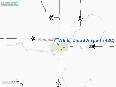
Location & QuickFacts
| FAA Information Effective: | 2008-09-25 |
| Airport Identifier: | 42C |
| Airport Status: | Operational |
| Longitude/Latitude: | 085-46-27.1900W/43-33-35.0690N
-85.774219/43.559741 (Estimated) |
| Elevation: | 914 ft / 278.59 m (Estimated) |
| Land: | 110 acres |
| From nearest city: | 1 nautical miles N of White Cloud, MI |
| Location: | Newaygo County, MI |
| Magnetic Variation: | 04W (1985) |
Owner & Manager
| Ownership: | Publicly owned |
| Owner: | City Of White Cloud |
| Address: | 12 N. Charles St., Po Box 607
White Cloud, MI 49349 |
| Phone number: | 231-689-1194 |
| Manager: | Robert Kakoczki |
| Address: | 3067 N. Felch Ave.
White Cloud, MI 49349 |
| Phone number: | 231-689-5891 |
Airport Operations and Facilities
| Airport Use: | Open to public |
| Wind indicator: | Yes |
| Segmented Circle: | Yes |
| Control Tower: | No |
| Lighting Schedule: | RDO-CTL
ACTVT MIRL RY 18/36 - CTAF. |
| Landing fee charge: | No |
| Sectional chart: | Chicago |
| Region: | AGL - Great Lakes |
| Boundary ARTCC: | ZMP - Minneapolis |
| Tie-in FSS: | LAN - Lansing |
| FSS on Airport: | No |
| FSS Toll Free: | 1-800-WX-BRIEF |
| NOTAMs Facility: | LAN (NOTAM-d service avaliable) |
| Federal Agreements: | N |
Airport Communications
| CTAF: | 122.800 |
| Unicom: | 122.800 |
Airport Services
| Fuel available: | 100LL |
| Airframe Repair: | MINOR
REPAIRS ON CALL 231-689-1621. |
| Power Plant Repair: | MINOR |
| Bottled Oxygen: | NONE |
| Bulk Oxygen: | NONE |
Runway Information
Runway 18/36
| Dimension: | 2917 x 60 ft / 889.1 x 18.3 m |
| Surface: | ASPH, Good Condition |
| Edge Lights: | Medium |
| |
Runway 18 |
Runway 36 |
| Longitude: | 085-46-37.9400W | 085-46-32.4300W |
| Latitude: | 43-33-44.2900N | 43-33-15.8300N |
| Elevation: | 915.00 ft | 915.00 ft |
| Traffic Pattern: | Left | Left |
| Markings: | Basic, Good Condition | Basic, Good Condition |
| Displaced threshold: | 500.00 ft | 0.00 ft |
| Runway End Identifier: | No | No |
| Centerline Lights: | No | No |
| Touchdown Lights: | No | No |
| Obstruction: | 32 ft tree, 510.0 ft from runway, 10:1 slope to clear
APCH RATIO 34:1 AT DSPLCD THLD. | 15 ft road, 201.0 ft from runway, 103 ft left of centerline
+15 FT ROAD. |
|
Radio Navigation Aids
| ID |
Type |
Name |
Ch |
Freq |
Var |
Dist |
| LDM | NDB | Ludington | | 341.00 | 03W | 36.7 nm |
| AMN | NDB | Alma | | 329.00 | 05W | 45.4 nm |
| CAD | NDB | Cadillac | | 269.00 | 04W | 45.7 nm |
| HLM | NDB | Holland | | 233.00 | 03W | 48.9 nm |
| HIC | VOR/DME | White Cloud | 123X | 117.60 | 01W | 2.7 nm |
| MOP | VOR/DME | Mount Pleasant | 043X | 110.60 | 05W | 45.3 nm |
| MBL | VOR/DME | Manistee | 051X | 111.40 | 05W | 47.5 nm |
| GRR | VOR/DME | Grand Rapids | 106Y | 115.95 | 04W | 48.0 nm |
| MKG | VORTAC | Muskegon | 099X | 115.20 | 01W | 26.2 nm |
Remarks
- CALL AMGR AT 231-689-6126 (RES) OR ASST MGR AT 231-689-6383 (RES)OR 231-629-1774 (CELL) TO VERIFY SNOW REMOVAL.
- EST PRIOR TO 1959
Images and information placed above are from
http://www.airport-data.com/airport/42C/
We thank them for the data!
| General Info
|
| Country |
United States
|
| State |
MICHIGAN
|
| FAA ID |
42C
|
| Latitude |
43-33-35.069N
|
| Longitude |
085-46-27.190W
|
| Elevation |
914 feet
|
| Near City |
WHITE CLOUD
|
We don't guarantee the information is fresh and accurate. The data may
be wrong or outdated.
For more up-to-date information please refer to other sources.
|
|


