 |
|
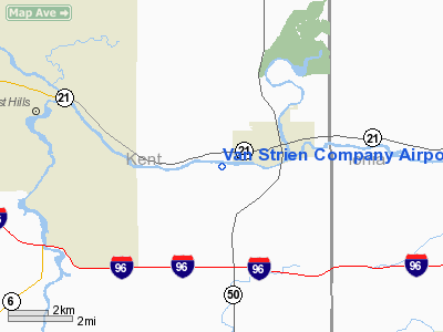
Van Strien Company Airport |
Location & QuickFacts
| FAA Information Effective: | 2008-09-25 |
| Airport Identifier: | 26MI |
| Airport Status: | Operational |
| Longitude/Latitude: | 085-22-41.0630W/42-55-26.1120N
-85.378073/42.923920 (Estimated) |
| Elevation: | 624 ft / 190.20 m (Surveyed) |
| Land: | 0 acres |
| From nearest city: | 2 nautical miles SW of Lowell, MI |
| Location: | Kent County, MI |
| Magnetic Variation: | 03W (1985) |
Owner & Manager
| Ownership: | Privately owned |
| Owner: | Robert Van Strien |
| Address: | 8960 28th St.
Ada, MI 49301 |
| Phone number: | 616-897-7929 |
| Manager: | Greg Van Strien |
| Address: | 1170 Grindle
Lowell, MI 49331 |
| Phone number: | 616-897-5569 |
Airport Operations and Facilities
| Airport Use: | Private
PERSONAL USE |
| Wind indicator: | Yes |
| Segmented Circle: | No |
| Control Tower: | No |
| Sectional chart: | Chicago |
| Region: | AGL - Great Lakes |
| Boundary ARTCC: | ZAU - Chicago |
| Tie-in FSS: | LAN - Lansing |
| FSS Toll Free: | 1-800-WX-BRIEF |
Runway Information
Runway 09/27
| Dimension: | 2700 x 65 ft / 823.0 x 19.8 m |
| Surface: | TURF, |
| |
Runway 09 |
Runway 27 |
| Traffic Pattern: | Left | Right |
|
Radio Navigation Aids
| ID |
Type |
Name |
Ch |
Freq |
Var |
Dist |
| BT | NDB | Batol | | 272.00 | 04W | 34.8 nm |
| HLM | NDB | Holland | | 233.00 | 03W | 35.2 nm |
| AMN | NDB | Alma | | 329.00 | 05W | 35.4 nm |
| GRR | VOR/DME | Grand Rapids | 106Y | 115.95 | 04W | 9.8 nm |
| HIC | VOR/DME | White Cloud | 123X | 117.60 | 01W | 41.8 nm |
| AZO | VOR/DME | Kalamazoo | 027X | 109.00 | 01W | 42.0 nm |
| PMM | VOR/DME | Pullman | 058X | 112.10 | 00E | 42.3 nm |
| LAN | VORTAC | Lansing | 045X | 110.80 | 05W | 32.5 nm |
| MKG | VORTAC | Muskegon | 099X | 115.20 | 01W | 32.6 nm |
| BTL | VORTAC | Battle Creek | 031X | 109.40 | 02W | 37.3 nm |
Images and information placed above are from
http://www.airport-data.com/airport/26MI/
We thank them for the data!
| General Info
|
| Country |
United States
|
| State |
MICHIGAN
|
| FAA ID |
26MI
|
| Latitude |
42-55-26.112N
|
| Longitude |
085-22-41.063W
|
| Elevation |
624 feet
|
| Near City |
LOWELL
|
We don't guarantee the information is fresh and accurate. The data may
be wrong or outdated.
For more up-to-date information please refer to other sources.
|
|


