 |
|
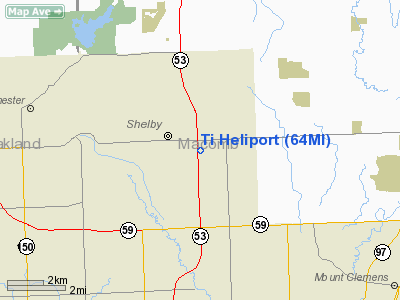
Location & QuickFacts
| FAA Information Effective: | 2008-09-25 |
| Airport Identifier: | 64MI |
| Airport Status: | Operational |
| Longitude/Latitude: | 083-00-44.0000W/42-39-53.0000N
-83.012222/42.664722 (Estimated) |
| Elevation: | 680 ft / 207.26 m (Estimated) |
| Land: | 0 acres |
| From nearest city: | 2 nautical miles NE of Utica, MI |
| Location: | Macomb County, MI |
| Magnetic Variation: | 07W (1995) |
Owner & Manager
| Ownership: | Privately owned |
| Owner: | Ti-coating Inc. |
| Address: | 50500 Corporate Drive
Utica, MI 48315 |
| Phone number: | 810-726-1900 |
| Manager: | William C Ziohichi |
| Address: | 50500 Corporate Drive
Utica, MI 48315 |
| Phone number: | 810-726-1900 |
Airport Operations and Facilities
| Airport Use: | Private |
| Segmented Circle: | No |
| Control Tower: | No |
| Sectional chart: | Detroit |
| Region: | AGL - Great Lakes |
| Boundary ARTCC: | ZOB - Cleveland |
| Tie-in FSS: | LAN - Lansing |
| FSS on Airport: | No |
| FSS Toll Free: | 1-800-WX-BRIEF |
Runway Information
Helipad H1
| Dimension: | 12 x 12 ft / 3.7 x 3.7 m |
| Surface: | CONC,
ROOFTOP. |
| |
Runway H1 |
Runway |
| Traffic Pattern: | Left | Left |
|
Radio Navigation Aids
| ID |
Type |
Name |
Ch |
Freq |
Var |
Dist |
| VQ | NDB | Cargl | | 230.00 | 05W | 18.7 nm |
| QG | NDB | Windsor | | 353.00 | 06W | 22.1 nm |
| G | NDB | Golf | | 398.00 | 05W | 25.3 nm |
| RYS | NDB | Grosse Ile | | 419.00 | 06W | 34.4 nm |
| ZR | NDB | Sarnia | | 404.00 | 06W | 38.1 nm |
| OZW | NDB | Howell | | 243.00 | 05W | 43.2 nm |
| 4L | NDB | Chatham | | 236.00 | 06W | 46.5 nm |
| MTC | TACAN | Selfridge | 064X | | 06W | 8.6 nm |
| YQG | VOR/DME | Windsor | 085X | 113.80 | 06W | 26.2 nm |
| DXO | VOR/DME | Detroit | 081X | 113.40 | 06W | 31.4 nm |
| PSI | VORTAC | Pontiac | 047X | 111.00 | 03W | 23.1 nm |
| SVM | VORTAC | Salem | 090X | 114.30 | 03W | 30.0 nm |
| FNT | VORTAC | Flint | 116X | 116.90 | 06W | 37.1 nm |
| ECK | VORTAC | Peck | 087X | 114.00 | 07W | 37.8 nm |
| CRL | VORTAC | Carleton | 104X | 115.70 | 03W | 42.0 nm |
| DET | VOT | Detroit City | | 111.60 | | 15.6 nm |
| DTW | VOT | Detroit Met Wayne | | 109.80 | | 30.6 nm |
| YIP | VOT | Willow Run | | 112.00 | | 34.4 nm |
Remarks
- PROVIDED (A) APCH/DEP FM 200 DEG CLKWS TO 340 DEG AND FM 080 CLKWS TO 100 DEG (B) AREA IS MKD (C) COMPLY WITH FAR PART 91.126 (B)(2).
Images and information placed above are from
http://www.airport-data.com/airport/64MI/
We thank them for the data!
| General Info
|
| Country |
United States
|
| State |
MICHIGAN
|
| FAA ID |
64MI
|
| Latitude |
42-39-53.000N
|
| Longitude |
083-00-38.500W
|
| Elevation |
610 feet
|
| Near City |
UTICA
|
We don't guarantee the information is fresh and accurate. The data may
be wrong or outdated.
For more up-to-date information please refer to other sources.
|
|


