 |
|
Location & QuickFacts
| FAA Information Effective: | 2008-09-25 |
| Airport Identifier: | 7Y2 |
| Airport Status: | Operational |
| Longitude/Latitude: | 085-58-30.3030W/44-31-00.0050N
-85.975084/44.516668 (Estimated) |
| Elevation: | 793 ft / 241.71 m (Surveyed) |
| Land: | 120 acres |
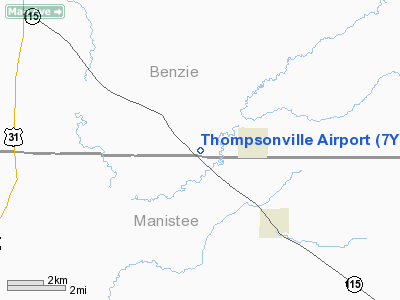
| From nearest city: | 2 nautical miles W of Thompsonville, MI |
| Location: | Benzie County, MI |
| Magnetic Variation: | 04W (1985) |
Owner & Manager
| Ownership: | Publicly owned |
| Owner: | Village Of Thompsonville |
| Address: | 14714 Lincoln Ave.
Thompsonville, MI 49683 |
| Phone number: | 231-378-2575 |
| Manager: | Sue Besey |
| Address: | 15337 King Rd
Thompsonville, MI 49683 |
| Phone number: | 231-378-2119
231-631-9222 AMGR CELL PH. |
Airport Operations and Facilities
| Airport Use: | Open to public |
| Wind indicator: | Yes |
| Segmented Circle: | Yes |
| Control Tower: | No |
| Lighting Schedule: | RDO-CTL
ACTVT LIRL RY 09/27 & PAPI RY 27 - CTAF. |
| Beacon Color: | Clear-Green (lighted land airport)
ARPT ROTG BCN ON SKI HILL, 450 FT ABV ARPT ELEV, 1.0 MI NW. |
| Landing fee charge: | No |
| Sectional chart: | Green Bay |
| Region: | AGL - Great Lakes |
| Boundary ARTCC: | ZMP - Minneapolis |
| Tie-in FSS: | LAN - Lansing |
| FSS on Airport: | No |
| FSS Toll Free: | 1-800-WX-BRIEF |
| NOTAMs Facility: | LAN (NOTAM-d service avaliable) |
Airport Communications
Airport Services
Runway Information
Runway 09/27
| Dimension: | 2900 x 75 ft / 883.9 x 22.9 m |
| Surface: | ASPH, Good Condition
SFC ROUGH. |
| Weight Limit: | Dual wheel: 12500 lbs. |
| Edge Lights: | Low |
| |
Runway 09 |
Runway 27 |
| Longitude: | 085-58-58.8200W | 085-58-17.4100W |
| Latitude: | 44-31-03.6800N | 44-31-03.6800N |
| Elevation: | 793.00 ft | 793.00 ft |
| Traffic Pattern: | Right | Left |
| Markings: | Basic, Fair Condition | Basic, Fair Condition |
| Crossing Height: | 0.00 ft | 20.00 ft |
| Displaced threshold: | 50.00 ft | 0.00 ft |
| VASI: | | 2-light PAPI on left side |
| Visual Glide Angle: | 0.00° | 4.00° |
| Touchdown Lights: | No | No |
| Obstruction: | 14 ft road, 240.0 ft from runway, 2:1 slope to clear
APCH RATIO 16:1 AT DSPLCD THLD. OVR +286 FT TREES ON SKI HILL, 4763 FT DSTC 1190 FT L.
RY 9 + 4 FT FENCE, 185 FT DSTC L/R. | 12 ft trees, 248.0 ft from runway, 4:1 slope to clear |
|
Runway 17/35
| Dimension: | 2475 x 150 ft / 754.4 x 45.7 m |
| Surface: | TURF, Fair Condition
SFC ROUGH. |
| |
Runway 17 |
Runway 35 |
| Longitude: | 085-58-26.0000W | 085-58-19.6300W |
| Latitude: | 44-31-08.3300N | 44-30-44.3200N |
| Elevation: | 793.00 ft | 793.00 ft |
| Traffic Pattern: | Left | Right |
| Displaced threshold: | 1220.00 ft | 1100.00 ft |
| Touchdown Lights: | No | No |
| Obstruction: | 63 ft trees, 50.0 ft from runway, 75 ft left of centerline
APCH RATIO 20:1 AT DSPLCD THLD. OVR 68 FT TREES 1360 FT DSTC, 0-200 FT L. | 57 ft trees, 40.0 ft from runway
APCH RATIO 20:1 AT DSPLCD THR. |
|
Radio Navigation Aids
| ID |
Type |
Name |
Ch |
Freq |
Var |
Dist |
| TV | NDB | Gwenn | | 365.00 | 05W | 26.8 nm |
| CAD | NDB | Cadillac | | 269.00 | 04W | 28.1 nm |
| LDM | NDB | Ludington | | 341.00 | 03W | 38.2 nm |
| CXK | NDB | Clam Lake | | 251.00 | 05W | 38.9 nm |
| MBL | VOR/DME | Manistee | 051X | 111.40 | 05W | 19.0 nm |
| TVC | VORTAC | Traverse City | 093X | 114.60 | 02W | 20.3 nm |
Remarks
- RY 17/35 CLSD NOV THRU MARCH & WHEN SNOW COVERED.
- +450 FT UNLGTD SKI HILL 1/2 MILE W OF ARPT.
- ESTB PRIOR TO 1959.
Images and information placed above are from
http://www.airport-data.com/airport/7Y2/
We thank them for the data!
| General Info
|
| Country |
United States
|
| State |
MICHIGAN
|
| FAA ID |
7Y2
|
| Latitude |
44-31-00.005N
|
| Longitude |
085-58-30.303W
|
| Elevation |
793 feet
|
| Near City |
THOMPSONVILLE
|
We don't guarantee the information is fresh and accurate. The data may
be wrong or outdated.
For more up-to-date information please refer to other sources.
|
|


