 |
|
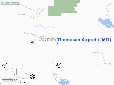
Location & QuickFacts
| FAA Information Effective: | 2008-09-25 |
| Airport Identifier: | 1MI7 |
| Airport Status: | Operational |
| Longitude/Latitude: | 084-03-59.9880W/44-19-00.0660N
-84.066663/44.316685 (Estimated) |
| Elevation: | 857 ft / 261.21 m (Estimated) |
| Land: | 5 acres |
| From nearest city: | 0 nautical miles SE of Selkirk, MI |
| Location: | Ogemaw County, MI |
| Magnetic Variation: | 06W (1985) |
Owner & Manager
| Ownership: | Privately owned |
| Owner: | Ernest L. Thompson |
| Address: | 1402 E. State Rd
West Branch, MI 48661 |
| Phone number: | 517-345-1630 |
| Address: |
|
Airport Operations and Facilities
| Airport Use: | Private |
| Wind indicator: | Yes |
| Segmented Circle: | No |
| Control Tower: | No |
| Landing fee charge: | No |
| Sectional chart: | Lake Huron |
| Region: | AGL - Great Lakes |
| Boundary ARTCC: | ZMP - Minneapolis |
| Tie-in FSS: | LAN - Lansing |
| FSS on Airport: | No |
| FSS Toll Free: | 1-800-WX-BRIEF |
Airport Services
| Airframe Repair: | MINOR |
| Power Plant Repair: | MINOR |
Runway Information
Runway 15/33
| Dimension: | 1800 x 100 ft / 548.6 x 30.5 m |
| Surface: | TURF, |
| |
Runway 15 |
Runway 33 |
| Traffic Pattern: | Left | Left |
| Obstruction: | 28 ft pline, 60.0 ft from runway | 28 ft pline, 75.0 ft from runway |
|
Radio Navigation Aids
| ID |
Type |
Name |
Ch |
Freq |
Var |
Dist |
| BHW | NDB | Hardwood | | 236.00 | 06W | 4.2 nm |
| GDW | NDB | Wiggins | | 209.00 | 04W | 27.3 nm |
| GYG | NDB | Grayling | | 359.00 | 06W | 41.8 nm |
| CGG | VOR | Grayling | | 109.80 | 06W | 35.9 nm |
| BXZ | VOR/DME | West Branch | 079X | 113.20 | 06W | 6.7 nm |
| HTL | VOR/DME | Houghton Lake | 053X | 111.60 | 05W | 25.9 nm |
| ASP | VOR/DME | Au Sable | 108X | 116.10 | 07W | 30.0 nm |
| MBS | VOR/DME | Saginaw | 076X | 112.90 | 03W | 47.2 nm |
| GLR | VOR/DME | Gaylord | 029X | 109.20 | 06W | 49.9 nm |
Images and information placed above are from
http://www.airport-data.com/airport/1MI7/
We thank them for the data!
| General Info
|
| Country |
United States
|
| State |
MICHIGAN
|
| FAA ID |
1MI7
|
| Latitude |
44-19-00.066N
|
| Longitude |
084-03-59.988W
|
| Elevation |
857 feet
|
| Near City |
SELKIRK
|
We don't guarantee the information is fresh and accurate. The data may
be wrong or outdated.
For more up-to-date information please refer to other sources.
|
|


