 |
|
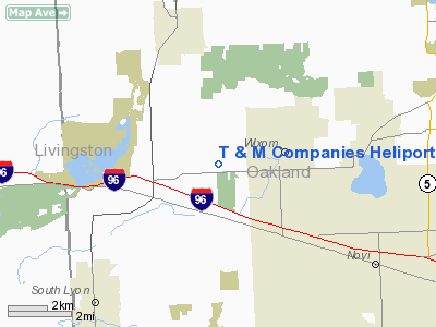
Location & QuickFacts
| FAA Information Effective: | 2008-09-25 |
| Airport Identifier: | MI91 |
| Airport Status: | Operational |
| Longitude/Latitude: | 083-34-31.7790W/42-31-37.1190N
-83.575494/42.526978 (Estimated) |
| Elevation: | 940 ft / 286.51 m (Estimated) |
| Land: | 17 acres |
| From nearest city: | 2 nautical miles W of Wixom, MI |
| Location: | Oakland County, MI |
| Magnetic Variation: | 05W (1985) |
Owner & Manager
| Ownership: | Privately owned |
| Owner: | The T & M Companies |
| Address: | 4755 Old Plank Rd
Milford, MI 48381 |
| Phone number: | 313-684-2300 |
| Manager: | Thomas M. Ford |
| Address: | 4755 Old Plank Rd
Milford, MI 48381 |
| Phone number: | 313-685-0550 |
Airport Operations and Facilities
| Airport Use: | Private |
| Wind indicator: | Yes |
| Segmented Circle: | No |
| Control Tower: | No |
| Lighting Schedule: | PHONE REQ
FOR FLOODLIGHTS PHONE 313-685-0550. |
| Sectional chart: | Detroit |
| Region: | AGL - Great Lakes |
| Boundary ARTCC: | ZOB - Cleveland |
| Tie-in FSS: | LAN - Lansing |
| FSS on Airport: | No |
| FSS Toll Free: | 1-800-WX-BRIEF |
Runway Information
Helipad H1
| Dimension: | 50 x 50 ft / 15.2 x 15.2 m |
| Surface: | ASPH, |
| |
Runway H1 |
Runway |
| Traffic Pattern: | Left | Left |
|
Radio Navigation Aids
| ID |
Type |
Name |
Ch |
Freq |
Var |
Dist |
| OZW | NDB | Howell | | 243.00 | 05W | 19.3 nm |
| G | NDB | Golf | | 398.00 | 05W | 29.0 nm |
| VQ | NDB | Cargl | | 230.00 | 05W | 29.4 nm |
| RYS | NDB | Grosse Ile | | 419.00 | 06W | 31.7 nm |
| TCU | NDB | Tecumseh | | 239.00 | 04W | 32.5 nm |
| QG | NDB | Windsor | | 353.00 | 06W | 33.9 nm |
| ADG | NDB | Adrian | | 278.00 | 06W | 45.4 nm |
| MTC | TACAN | Selfridge | 064X | | 06W | 33.3 nm |
| DXO | VOR/DME | Detroit | 081X | 113.40 | 06W | 21.0 nm |
| YQG | VOR/DME | Windsor | 085X | 113.80 | 06W | 37.1 nm |
| JXN | VOR/DME | Jackson | 033X | 109.60 | 05W | 42.4 nm |
| SVM | VORTAC | Salem | 090X | 114.30 | 03W | 7.1 nm |
| PSI | VORTAC | Pontiac | 047X | 111.00 | 03W | 10.6 nm |
| FNT | VORTAC | Flint | 116X | 116.90 | 06W | 27.5 nm |
| CRL | VORTAC | Carleton | 104X | 115.70 | 03W | 29.3 nm |
| YIP | VOT | Willow Run | | 112.00 | | 17.8 nm |
| DTW | VOT | Detroit Met Wayne | | 109.80 | | 20.3 nm |
| DET | VOT | Detroit City | | 111.60 | | 25.9 nm |
Remarks
- PROVIDING 8:1 APCH SFC & 2:1 TRANSITIONAL SFC OVER OBSTRUCTIONS.
Images and information placed above are from
http://www.airport-data.com/airport/MI91/
We thank them for the data!
| General Info
|
| Country |
United States
|
| State |
MICHIGAN
|
| FAA ID |
MI91
|
| Latitude |
42-31-37.119N
|
| Longitude |
083-34-31.779W
|
| Elevation |
938 feet
|
| Near City |
WIXOM
|
We don't guarantee the information is fresh and accurate. The data may
be wrong or outdated.
For more up-to-date information please refer to other sources.
|
|


