 |
|
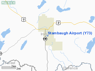
Location & QuickFacts
| FAA Information Effective: | 2008-09-25 |
| Airport Identifier: | Y73 |
| Airport Status: | Operational |
| Longitude/Latitude: | 088-38-07.7700W/46-04-43.5500N
-88.635492/46.078764 (Estimated) |
| Elevation: | 1622 ft / 494.39 m (Estimated) |
| Land: | 80 acres |
| From nearest city: | 1 nautical miles SS of Iron River, MI |
| Location: | Iron County, MI |
| Magnetic Variation: | 02W (1985) |
Owner & Manager
| Ownership: | Publicly owned |
| Owner: | Iron County Board Of Commissioners |
| Address: | Courthouse 2 S 67th Street
Crystal Falls, MI 49920 |
| Phone number: | 906-875-3301 |
| Manager: | Krist Atanasoff |
| Address: | 303 Selden Rd, 303 Selden Road
Iron River, MI 49935 |
| Phone number: | 906-265-6144
AMGR RES 906-265-9087. |
Airport Operations and Facilities
| Airport Use: | Open to public |
| Wind indicator: | Yes |
| Segmented Circle: | Yes |
| Control Tower: | No |
| Lighting Schedule: | RDO-CTL
ACTVT LIRL RY 17/35 - 121.9. |
| Landing fee charge: | No |
| Sectional chart: | Green Bay |
| Region: | AGL - Great Lakes |
| Traffic Pattern Alt: | 1000 ft |
| Boundary ARTCC: | ZMP - Minneapolis |
| Tie-in FSS: | GRB - Green Bay |
| FSS on Airport: | No |
| FSS Toll Free: | 1-800-WX-BRIEF |
| NOTAMs Facility: | GRB (NOTAM-d service avaliable) |
Airport Communications
Airport Services
| Airframe Repair: | NONE |
| Bottled Oxygen: | NONE |
| Bulk Oxygen: | NONE |
Runway Information
Runway 17/35
| Dimension: | 2000 x 40 ft / 609.6 x 12.2 m |
| Surface: | ASPH, Poor Condition
NUMEROUS CRACKS IN RY.
NUMEROUS CRACKS & VEGETATION IN RY |
| Edge Lights: | Non-standard lighting system
NSTD LIRL 26 FT FROM RY EDGE. |
| |
Runway 17 |
Runway 35 |
| Longitude: | 088-37-48.1100W | 088-37-43.0600W |
| Latitude: | 46-04-39.5200N | 46-04-20.0900N |
| Elevation: | 1622.00 ft | 1622.00 ft |
| Traffic Pattern: | Left | Left |
| Markings: | Nonstandard, Good Condition
RWY 17 /35 NSTD BASIC MKG; DOES NOT START AT PAVEMENT EDGE. | Nonstandard, Good Condition |
| Runway End Identifier: | No | No |
| Centerline Lights: | No | No |
| Touchdown Lights: | No | No |
| Obstruction: | 25 ft trees, 1050.0 ft from runway, 130 ft left of centerline, 34:1 slope to clear | , 50:1 slope to clear |
|
Radio Navigation Aids
| ID |
Type |
Name |
Ch |
Freq |
Var |
Dist |
| LNL | NDB | Land O Lakes | | 396.00 | 02W | 24.3 nm |
| EGV | NDB | Eagle River | | 341.00 | 02W | 27.6 nm |
| RXW | NDB | Watersmeet | | 407.00 | 01E | 29.6 nm |
| BDJ | NDB | Boulder Junction | | 206.00 | 02E | 42.6 nm |
| ARV | NDB | Arbor Vitae | | 221.00 | 01W | 46.6 nm |
| DO | NDB | Dougy | | 236.00 | 01W | 48.1 nm |
| IMT | VOR/DME | Iron Mountain | 049X | 111.20 | 02W | 27.0 nm |
| RHI | VORTAC | Rhinelander | 029X | 109.20 | 02E | 43.6 nm |
Remarks
- DEER ON & INVOF ARPT.
- 100 FT DROP OFF AT EACH RY END.
- RY 17/35 SLOPES DOWN FM S TO N.
- RY 17/35 SLOPES DOWN FM S TO N.
- 100 FT DROP OFF AT EACH RY END.
- ESTABLISHED PRIOR TO 1959.
Images and information placed above are from
http://www.airport-data.com/airport/Y73/
We thank them for the data!
| General Info
|
| Country |
United States
|
| State |
MICHIGAN
|
| FAA ID |
Y73
|
| Latitude |
46-04-43.550N
|
| Longitude |
088-38-07.770W
|
| Elevation |
1622 feet
|
| Near City |
STAMBAUGH
|
We don't guarantee the information is fresh and accurate. The data may
be wrong or outdated.
For more up-to-date information please refer to other sources.
|
|


