 |
|
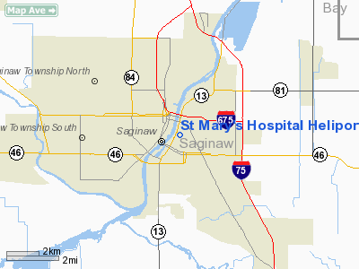
St Mary's Hospital Heliport (10MI) |
Location & QuickFacts
| FAA Information Effective: | 2008-09-25 |
| Airport Identifier: | 10MI |
| Airport Status: | Operational |
| Longitude/Latitude: | 083-56-18.9030W/43-25-33.0910N
-83.938584/43.425859 (Estimated) |
| Elevation: | 595 ft / 181.36 m (Estimated) |
| Land: | 0 acres |
| From nearest city: | 1 nautical miles S of Saginaw, MI |
| Location: | Saginaw County, MI |
| Magnetic Variation: | 05W (1980) |
Owner & Manager
| Ownership: | Privately owned |
| Owner: | St. Mary's Hospital |
| Address: | 830 S Jefferson Ave
Saginaw, MI 48601 |
| Phone number: | 517-776-8000 |
| Manager: | Patrick Murtha |
| Address: | 830 S Jefferson Ave
Saginaw, MI 48601 |
| Phone number: | 517-752-9335 |
Airport Operations and Facilities
| Airport Use: | Private
MEDICAL USE. |
| Wind indicator: | Yes |
| Segmented Circle: | No |
| Control Tower: | No |
| Sectional chart: | Detroit |
| Region: | AGL - Great Lakes |
| Boundary ARTCC: | ZOB - Cleveland |
| Tie-in FSS: | LAN - Lansing |
| FSS Toll Free: | 1-800-WX-BRIEF |
Runway Information
Helipad H1
| Dimension: | 100 x 100 ft / 30.5 x 30.5 m |
| Surface: | CONC, |
| |
Runway H1 |
Runway |
| Traffic Pattern: | Left | Left |
|
Radio Navigation Aids
| ID |
Type |
Name |
Ch |
Freq |
Var |
Dist |
| HYX | NDB | Browne | | 385.00 | 06W | 3.5 nm |
| AMN | NDB | Alma | | 329.00 | 05W | 37.5 nm |
| GDW | NDB | Wiggins | | 209.00 | 04W | 40.2 nm |
| OZW | NDB | Howell | | 243.00 | 05W | 47.7 nm |
| BHW | NDB | Hardwood | | 236.00 | 06W | 49.9 nm |
| MBS | VOR/DME | Saginaw | 076X | 112.90 | 03W | 8.8 nm |
| MOP | VOR/DME | Mount Pleasant | 043X | 110.60 | 05W | 36.8 nm |
| BAX | VOR/DME | Bad Axe | 019X | 108.20 | 05W | 46.8 nm |
| FNT | VORTAC | Flint | 116X | 116.90 | 06W | 28.8 nm |
| PSI | VORTAC | Pontiac | 047X | 111.00 | 03W | 47.1 nm |
Remarks
- PRVDD OPNS CONDUCTED TO/FROM 180 DEG ONLY; AREA IS MKD; WIND INDICATOR MNTD; TREES SOUTH ARE REMOVED; LGT POLES SHOULD BE OBSTRUCTION LGTD.
Images and information placed above are from
http://www.airport-data.com/airport/10MI/
We thank them for the data!
| General Info
|
| Country |
United States
|
| State |
MICHIGAN
|
| FAA ID |
10MI
|
| Latitude |
43-25-33.091N
|
| Longitude |
083-56-18.903W
|
| Elevation |
595 feet
|
| Near City |
SAGINAW
|
We don't guarantee the information is fresh and accurate. The data may
be wrong or outdated.
For more up-to-date information please refer to other sources.
|
|


