 |
|
Location & QuickFacts
| FAA Information Effective: | 2008-09-25 |
| Airport Identifier: | 3MI2 |
| Airport Status: | Operational |
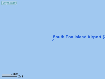
| Longitude/Latitude: | 085-49-48.2900W/45-23-56.9800N
-85.830081/45.399161 (Estimated) |
| Elevation: | 616 ft / 187.76 m (Surveyed) |
| Land: | 0 acres |
| From nearest city: | 18 nautical miles NW of Northport, MI |
| Location: | Leelanau County, MI |
| Magnetic Variation: | 04W (1990) |
Owner & Manager
| Ownership: | Privately owned |
| Owner: | Mirada Ranch Inc |
| Address: | 27400 Northwestern Hy-ste 400
Southfield, MI 48034 |
| Phone number: | 810-354-8300 |
| Manager: | Ken Chio |
| Address: | 27400 Northwestern Hy-ste 400
Southfield, MI 48034 |
| Phone number: | 810-354-8300 |
Airport Operations and Facilities
| Airport Use: | Private |
| Wind indicator: | Yes |
| Segmented Circle: | No |
| Control Tower: | No |
| Lighting Schedule: | PHONE REQ
FOR MIRL RY 17/35 & PVASI RYS 17 & 35 CALL AMGR ON 616-620-0758. |
| Sectional chart: | Green Bay |
| Region: | AGL - Great Lakes |
| Boundary ARTCC: | ZMP - Minneapolis |
| Tie-in FSS: | LAN - Lansing |
| FSS Toll Free: | 1-800-WX-BRIEF |
Airport Communications
Runway Information
Runway 17/35
| Dimension: | 4200 x 145 ft / 1280.2 x 44.2 m |
| Surface: | TURF, |
| Edge Lights: | Medium |
| |
Runway 17 |
Runway 35 |
| Traffic Pattern: | Left | Left |
| VASI: | pulsating/steady burning on left side | pulsating/steady burning on left side |
|
Radio Navigation Aids
| ID |
Type |
Name |
Ch |
Freq |
Var |
Dist |
| SJX | NDB | St James | | 382.00 | 05W | 21.1 nm |
| CVX | NDB | Charlevoix | | 392.00 | 05W | 24.4 nm |
| CXK | NDB | Clam Lake | | 251.00 | 05W | 39.1 nm |
| BFA | NDB | Boyne Falls | | 263.00 | 06W | 40.9 nm |
| TV | NDB | Gwenn | | 365.00 | 05W | 43.4 nm |
| ISQ | VOR/DME | Schoolcraft County | 041X | 110.40 | 05W | 37.6 nm |
| TVC | VORTAC | Traverse City | 093X | 114.60 | 02W | 45.5 nm |
Remarks
- PRVDD ANY OBSTRUCTION IN RY APCH SLOPE SFC BE REMOVED/LOWERED OR RY THR BE DSPLCD & MKD TO PRVD A MIN 20:1 APCH CLNC OVER OBSTRUCTION & AREA 125 FT EITHER SIDE OF RY CNTRLN & 200 FT OFF RY END BE CLEAR OF ANY OBSTRUCTIONS.
Images and information placed above are from
http://www.airport-data.com/airport/3MI2/
We thank them for the data!
| General Info
|
| Country |
United States
|
| State |
MICHIGAN
|
| FAA ID |
3MI2
|
| Latitude |
45-23-56.980N
|
| Longitude |
085-49-48.290W
|
| Elevation |
616 feet
|
| Near City |
NORTHPORT
|
We don't guarantee the information is fresh and accurate. The data may
be wrong or outdated.
For more up-to-date information please refer to other sources.
|
|


