 |
|
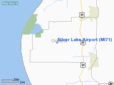
Location & QuickFacts
| FAA Information Effective: | 2008-09-25 |
| Airport Identifier: | MI71 |
| Airport Status: | Operational |
| Longitude/Latitude: | 086-27-10.2790W/43-38-40.0240N
-86.452855/43.644451 (Estimated) |
| Elevation: | 772 ft / 235.31 m (Estimated) |
| Land: | 80 acres |
| From nearest city: | 3 nautical miles NE of Mears, MI |
| Location: | Oceana County, MI |
| Magnetic Variation: | 03W (1985) |
Owner & Manager
| Ownership: | Privately owned |
| Owner: | Ronald A. Biritz |
| Address: | 221 S. Triplet Lake Dr
Casselberry, FL 32707 |
| Phone number: | 407-695-7190 |
| Address: |
|
Airport Operations and Facilities
| Airport Use: | Private |
| Wind indicator: | Yes |
| Segmented Circle: | No |
| Control Tower: | No |
| Sectional chart: | Chicago |
| Region: | AGL - Great Lakes |
| Boundary ARTCC: | ZMP - Minneapolis |
| Tie-in FSS: | LAN - Lansing |
| FSS Toll Free: | 1-800-WX-BRIEF |
Airport Communications
Runway Information
Runway 08/26
| Dimension: | 2660 x 400 ft / 810.8 x 121.9 m |
| Surface: | TURF, |
| |
Runway 08 |
Runway 26 |
| Traffic Pattern: | Left | Left |
|
Radio Navigation Aids
| ID |
Type |
Name |
Ch |
Freq |
Var |
Dist |
| LDM | NDB | Ludington | | 341.00 | 03W | 19.2 nm |
| HIC | VOR/DME | White Cloud | 123X | 117.60 | 01W | 32.3 nm |
| MBL | VOR/DME | Manistee | 051X | 111.40 | 05W | 38.6 nm |
| MKG | VORTAC | Muskegon | 099X | 115.20 | 01W | 33.8 nm |
Remarks
- PRVDD 20:1 APCH SFC CLNC; 125 FT EITHER SIDE CLEAR FM OBSTNS.
Images and information placed above are from
http://www.airport-data.com/airport/MI71/
We thank them for the data!
| General Info
|
| Country |
United States
|
| State |
MICHIGAN
|
| FAA ID |
MI71
|
| Latitude |
43-38-40.024N
|
| Longitude |
086-27-10.279W
|
| Elevation |
772 feet
|
| Near City |
MEARS
|
We don't guarantee the information is fresh and accurate. The data may
be wrong or outdated.
For more up-to-date information please refer to other sources.
|
|


