 |
|
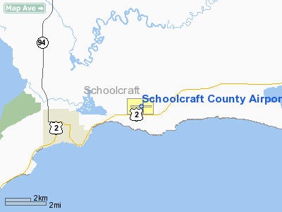
Schoolcraft County Airport |
Location & QuickFacts
| FAA Information Effective: | 2008-09-25 |
| Airport Identifier: | ISQ |
| Airport Status: | Operational |
| Longitude/Latitude: | 086-10-18.1000W/45-58-28.5000N
-86.171694/45.974583 (Estimated) |
| Elevation: | 685 ft / 208.79 m (Surveyed) |
| Land: | 335 acres |
| From nearest city: | 3 nautical miles NE of Manistique, MI |
| Location: | Schoolcraft County, MI |
| Magnetic Variation: | 05W (1995) |
Owner & Manager
| Ownership: | Publicly owned |
| Owner: | Schoolcraft County |
| Address: | 300 Walnut St
Manistique, MI 49854 |
| Phone number: | 906-341-3618 |
| Manager: | James Hursey |
| Address: | 5910 W Us Hwy 2
Manistique, MI 49836 |
| Phone number: | 906-341-5522
AMGR RES 906-450-5633. |
Airport Operations and Facilities
| Airport Use: | Open to public |
| Wind indicator: | Yes |
| Segmented Circle: | Yes |
| Control Tower: | No |
| Lighting Schedule: | DUSK-DAWN
ACTVT MIRL RY 10/28 & PAPI RYS 10 & 28 & REIL RY 28 - CTAF. |
| Beacon Color: | Clear-Green (lighted land airport) |
| Landing fee charge: | No |
| Sectional chart: | Green Bay |
| Region: | AGL - Great Lakes |
| Boundary ARTCC: | ZMP - Minneapolis |
| Tie-in FSS: | GRB - Green Bay |
| FSS on Airport: | No |
| FSS Toll Free: | 1-800-WX-BRIEF |
| NOTAMs Facility: | ISQ (NOTAM-d service avaliable) |
| Federal Agreements: | NGY |
Airport Communications
| CTAF: | 122.800 |
| Unicom: | 122.800 |
Airport Services
| Fuel available: | 100LLA |
| Bottled Oxygen: | NONE |
| Bulk Oxygen: | NONE |
Runway Information
Runway 01/19
| Dimension: | 2500 x 50 ft / 762.0 x 15.2 m |
| Surface: | ASPH, Fair Condition
RWY HAS CRACKS & VEGETATION IN PAVEMENT.
RWY 01/19 HAS CRACKS & VEGETATION IN PAVEMENT. |
| Weight Limit: | Single wheel: 26000 lbs.
Dual wheel: 45000 lbs. |
| |
Runway 01 |
Runway 19 |
| Longitude: | 086-10-12.6700W | 086-10-13.2900W |
| Latitude: | 45-58-13.4300N | 45-58-38.1100N |
| Alignment: | 127 | 127 |
| Traffic Pattern: | Left | Left |
| Markings: | Basic, Fair Condition | Basic, Fair Condition |
| Obstruction: | 41 ft trees, 1040.0 ft from runway, 110 ft left of centerline, 20:1 slope to clear | 55 ft trees, 1300.0 ft from runway, 150 ft right of centerline, 20:1 slope to clear |
|
Runway 10/28
| Dimension: | 5000 x 100 ft / 1524.0 x 30.5 m |
| Surface: | ASPH, Good Condition
RWY HAS CRACKS & VEGETATION IN PAVEMENT.
RWY 01/19 HAS CRACKS & VEGETATION IN PAVEMENT. |
| Weight Limit: | Single wheel: 26000 lbs.
Dual wheel: 45000 lbs. |
| Edge Lights: | Medium |
| |
Runway 10 |
Runway 28 |
| Longitude: | 086-10-56.1070W | 086-09-45.3270W |
| Latitude: | 45-58-29.9050N | 45-58-29.8160N |
| Elevation: | 685.00 ft | 673.00 ft |
| Alignment: | 90 | 127 |
| Traffic Pattern: | Left | Left |
| Markings: | Non-precision instrument, Poor Condition
RWY 10 MARKINGS FADED. | Non-precision instrument, Poor Condition
RWY 28 MARKINGS FADED. |
| Crossing Height: | 35.00 ft | 38.00 ft |
| VASI: | 2-light PAPI on left side
PAPI OTS INDEFLY. | 2-light PAPI on left side |
| Visual Glide Angle: | 3.00° | 3.00° |
| Runway End Identifier: | No | Yes
RY 28 S SIDE REIL OTS INDEFLY. |
| Obstruction: | 65 ft trees, 1500.0 ft from runway, 342 ft right of centerline, 20:1 slope to clear | 47 ft trees, 1140.0 ft from runway, 20:1 slope to clear |
|
Radio Navigation Aids
| ID |
Type |
Name |
Ch |
Freq |
Var |
Dist |
| SJX | NDB | St James | | 382.00 | 05W | 30.7 nm |
| ISQ | VOR/DME | Schoolcraft County | 041X | 110.40 | 05W | 0.1 nm |
| ERY | VOR/DME | Newberry | 019X | 108.20 | 06W | 35.8 nm |
| ESC | VOR/DME | Escanaba | 045X | 110.80 | 00E | 41.3 nm |
Remarks
- BIRDS & DEER ON & INVOF ARPT.
- RY 19 +100 FT UNMARKED PLINE 1 MILE NORTH OF RY END.
Images and information placed above are from
http://www.airport-data.com/airport/ISQ/
We thank them for the data!
| General Info
|
| Country |
United States
|
| State |
MICHIGAN
|
| FAA ID |
ISQ
|
| Latitude |
45-58-28.706N
|
| Longitude |
086-10-18.590W
|
| Elevation |
685 feet
|
| Near City |
MANISTIQUE
|
We don't guarantee the information is fresh and accurate. The data may
be wrong or outdated.
For more up-to-date information please refer to other sources.
|
|


