 |
|
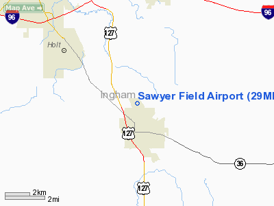
Location & QuickFacts
| FAA Information Effective: | 2008-09-25 |
| Airport Identifier: | 29MI |
| Airport Status: | Operational |
| Longitude/Latitude: | 084-26-59.9050W/42-36-00.1290N
-84.449974/42.600036 (Estimated) |
| Elevation: | 910 ft / 277.37 m (Estimated) |
| Land: | 23 acres |
| From nearest city: | 2 nautical miles NW of Mason, MI |
| Location: | Ingham County, MI |
| Magnetic Variation: | 04W (1985) |
Owner & Manager
| Ownership: | Privately owned |
| Owner: | James Sawyer |
| Address: | 1192 Hagadorn Road
Mason, MI 48854 |
| Phone number: | 517-244-0993 |
| Manager: | James Sawyer |
| Address: | 1192 Hagadorn Road
Mason, MI 48854 |
| Phone number: | 517-244-0993 |
Airport Operations and Facilities
| Airport Use: | Private |
| Wind indicator: | Yes |
| Segmented Circle: | No |
| Control Tower: | No |
| Landing fee charge: | No |
| Sectional chart: | Detroit |
| Region: | AGL - Great Lakes |
| Boundary ARTCC: | ZOB - Cleveland |
| Tie-in FSS: | LAN - Lansing |
| FSS Toll Free: | 1-800-WX-BRIEF |
Runway Information
Runway 09/27
| Dimension: | 2100 x 150 ft / 640.1 x 45.7 m |
| Surface: | TURF, Good Condition |
| |
Runway 09 |
Runway 27 |
| Traffic Pattern: | Left | Right |
| Displaced threshold: | 440.00 ft | 0.00 ft |
| Obstruction: | 20 ft pline | 45 ft , 60.0 ft from runway |
|
Radio Navigation Aids
| ID |
Type |
Name |
Ch |
Freq |
Var |
Dist |
| OZW | NDB | Howell | | 243.00 | 05W | 20.5 nm |
| BT | NDB | Batol | | 272.00 | 04W | 35.6 nm |
| TCU | NDB | Tecumseh | | 239.00 | 04W | 42.3 nm |
| AMN | NDB | Alma | | 329.00 | 05W | 45.9 nm |
| ADG | NDB | Adrian | | 278.00 | 06W | 46.9 nm |
| JXN | VOR/DME | Jackson | 033X | 109.60 | 05W | 20.5 nm |
| LFD | VOR/DME | Litchfield | 049X | 111.20 | 05W | 35.2 nm |
| GRR | VOR/DME | Grand Rapids | 106Y | 115.95 | 04W | 47.6 nm |
| LAN | VORTAC | Lansing | 045X | 110.80 | 05W | 13.0 nm |
| FNT | VORTAC | Flint | 116X | 116.90 | 06W | 38.0 nm |
| SVM | VORTAC | Salem | 090X | 114.30 | 03W | 39.6 nm |
| BTL | VORTAC | Battle Creek | 031X | 109.40 | 02W | 39.6 nm |
| PSI | VORTAC | Pontiac | 047X | 111.00 | 03W | 41.0 nm |
| YIP | VOT | Willow Run | | 112.00 | | 46.7 nm |
Remarks
- NO SNOW REMOVAL, CALL 517-244-0993 TO CONFRM RY COND.
- AMGR MONITORS 122.75.
- NO OBJECTION
Images and information placed above are from
http://www.airport-data.com/airport/29MI/
We thank them for the data!
| General Info
|
| Country |
United States
|
| State |
MICHIGAN
|
| FAA ID |
29MI
|
| Latitude |
42-36-00.129N
|
| Longitude |
084-26-59.905W
|
| Elevation |
910 feet
|
| Near City |
MASON
|
We don't guarantee the information is fresh and accurate. The data may
be wrong or outdated.
For more up-to-date information please refer to other sources.
|
|


