 |
|
Location & QuickFacts
| FAA Information Effective: | 2008-09-25 |
| Airport Identifier: | 31MI |
| Airport Status: | Operational |
| Longitude/Latitude: | 086-10-38.0230W/41-46-47.1720N
-86.177229/41.779770 (Estimated) |
| Elevation: | 800 ft / 243.84 m (Estimated) |
| Land: | 0 acres |
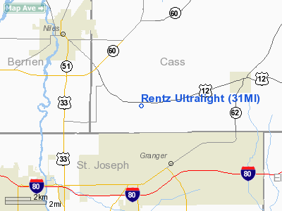
| From nearest city: | 4 nautical miles E of Niles, MI |
| Location: | Cass County, MI |
| Magnetic Variation: | 02W (1985) |
Owner & Manager
| Ownership: | Privately owned |
| Owner: | Randy Rentz |
| Address: | 2716 E Us 12
Niles, MI 49120 |
| Phone number: | 616-683-2594 |
| Address: |
|
Airport Operations and Facilities
| Airport Use: | Private
PERSONAL USE |
| Wind indicator: | Yes |
| Segmented Circle: | No |
| Control Tower: | No |
| Sectional chart: | Chicago |
| Region: | AGL - Great Lakes |
| Boundary ARTCC: | ZAU - Chicago |
| Tie-in FSS: | LAN - Lansing |
| FSS Toll Free: | 1-800-WX-BRIEF |
Runway Information
Runway 14/32
| Dimension: | 1100 x 50 ft / 335.3 x 15.2 m |
| Surface: | TURF, |
| |
Runway 14 |
Runway 32 |
| Traffic Pattern: | Left | Left |
| Obstruction: | 30 ft pline, 400.0 ft from runway | 30 ft trees, 10.0 ft from runway |
|
Radio Navigation Aids
| ID |
Type |
Name |
Ch |
Freq |
Var |
Dist |
| HAI | NDB | Three Rivers | | 407.00 | 02W | 28.3 nm |
| MGC | NDB | Michigan City | | 203.00 | 01W | 29.0 nm |
| IUL | NDB | La Porte | | 356.00 | 03W | 31.6 nm |
| IRS | NDB | Sturgis | | 382.00 | 04W | 33.4 nm |
| CPB | NDB | Culver | | 391.00 | 01W | 35.1 nm |
| VP | NDB | Sedly | | 212.00 | 02W | 37.2 nm |
| RCR | NDB | Rochester | | 216.00 | 03W | 43.0 nm |
| RWN | NDB | Winamac/dcmsnd | | 335.00 | 00W | 45.5 nm |
| ANQ | NDB | Angola | | 347.00 | 05W | 49.6 nm |
| OLK | VOR | Wolf Lake | | 110.40 | 03W | 44.3 nm |
| ELX | VOR/DME | Keeler | 113X | 116.60 | 00E | 22.1 nm |
| OXI | VOR/DME | Knox | 103X | 115.60 | 00E | 34.8 nm |
| AZO | VOR/DME | Kalamazoo | 027X | 109.00 | 01W | 39.1 nm |
| PMM | VOR/DME | Pullman | 058X | 112.10 | 00E | 41.4 nm |
| GIJ | VORTAC | Gipper | 101X | 115.40 | 00E | 6.4 nm |
| GSH | VORTAC | Goshen | 084X | 113.70 | 00E | 16.7 nm |
Images and information placed above are from
http://www.airport-data.com/airport/31MI/
We thank them for the data!
| General Info
|
| Country |
United States
|
| State |
MICHIGAN
|
| FAA ID |
31MI
|
| Latitude |
41-46-47.172N
|
| Longitude |
086-10-38.023W
|
| Elevation |
800 feet
|
| Near City |
NILES
|
We don't guarantee the information is fresh and accurate. The data may
be wrong or outdated.
For more up-to-date information please refer to other sources.
|
|


