 |
|
Location & QuickFacts
| FAA Information Effective: | 2008-09-25 |
| Airport Identifier: | 57D |
| Airport Status: | Operational |
| Longitude/Latitude: | 082-53-24.7320W/42-44-15.1120N
-82.890203/42.737531 (Estimated) |
| Elevation: | 632 ft / 192.63 m (Surveyed) |
| Land: | 93 acres |
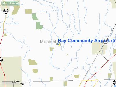
| From nearest city: | 2 nautical miles SE of Ray, MI |
| Location: | Macomb County, MI |
| Magnetic Variation: | 06W (1985) |
Owner & Manager
| Ownership: | Privately owned |
| Owner: | Macomb Airways Inc. |
| Address: | 59819 Indian Trail
Ray, MI 48096 |
| Manager: | George L Fox |
| Address: | 59819 Indian Trail
Ray, MI 48096 |
| Phone number: | 586-612-9910
PHONE ADMIN BLDG 586-749-9558. |
Airport Operations and Facilities
| Airport Use: | Open to public |
| Wind indicator: | Yes |
| Segmented Circle: | Yes |
| Control Tower: | No |
| Lighting Schedule: | RDO-CTL
ACTVT ROTG BCN - CTAF. |
| Beacon Color: | Clear-Green (lighted land airport) |
| Landing fee charge: | No |
| Sectional chart: | Detroit |
| Region: | AGL - Great Lakes |
| Boundary ARTCC: | ZOB - Cleveland |
| Tie-in FSS: | LAN - Lansing |
| FSS on Airport: | No |
| FSS Toll Free: | 1-800-WX-BRIEF |
| NOTAMs Facility: | LAN (NOTAM-d service avaliable) |
Airport Communications
| CTAF: | 122.700 |
| Unicom: | 122.700 |
Airport Services
| Fuel available: | 100LL |
| Airframe Repair: | MAJOR
MAJOR RPRS AVBL WEEKENDS & BY PRIOR ARRANGEMENT CALL 586-749-6507. |
| Power Plant Repair: | MAJOR
PWR PLANT RPRS AVBL WEEKENDS & BY PRIOR ARRANGEMENT CALL 586-749-6507. |
| Bottled Oxygen: | NONE |
| Bulk Oxygen: | NONE |
Runway Information
Runway 09/27
| Dimension: | 2500 x 60 ft / 762.0 x 18.3 m |
| Surface: | ASPH, Good Condition
RY 18 ASPH CRACKING AND PEELING. |
| Edge Lights: | Medium |
| |
Runway 09 |
Runway 27 |
| Longitude: | 082-53-46.4800W | 082-53-12.9800W |
| Latitude: | 42-44-16.5100N | 42-44-16.5100N |
| Elevation: | 632.00 ft | 632.00 ft |
| Traffic Pattern: | Left | Left |
| Markings: | Basic, Good Condition
RWY 9/27 MARKINGS FADED. | Basic, Good Condition |
| Crossing Height: | 40.00 ft | 0.00 ft |
| Displaced threshold: | 0.00 ft | 210.00 ft |
| VASI: | 2-light PAPI on left side | 2-light PAPI on left side |
| Visual Glide Angle: | 3.00° | 0.00° |
| Runway End Identifier: | Yes | |
| Obstruction: | 47 ft trees, 905.0 ft from runway, 140 ft right of centerline, 15:1 slope to clear | 63 ft trees, 432.0 ft from runway, 110 ft right of centerline, 3:1 slope to clear
APCH RATIO 10:1 AT DSPLCD THLD, +63 FT TREE, 642 FT DSTC 110 FT R.
ROAD 65 FT FM RY END. |
|
Runway 18/36
| Dimension: | 2187 x 123 ft / 666.6 x 37.5 m |
| Surface: | ASPH-TURF, Fair Condition
RY 18 ASPH CRACKING AND PEELING. |
| |
Runway 18 |
Runway 36 |
| Longitude: | 082-53-20.0100W | 082-53-20.0100W |
| Latitude: | 42-44-25.1900N | 42-44-03.4600N |
| Elevation: | 632.00 ft | 632.00 ft |
| Traffic Pattern: | Left | Left |
| Markings: | Basic, Good Condition
RY 18 MARKINGS FADED. | ,
RY 18/36 MARKED WITH CONES. |
| Displaced threshold: | 140.00 ft | 0.00 ft |
| Obstruction: | 60 ft trees, 1300.0 ft from runway, 18:1 slope to clear
APCH RATIO 24:1 AT DSPLCD THLD.
RWY 18 +4 FT SIGN 95 FT DSTC. | 30 ft trees, 432.0 ft from runway, 14:1 slope to clear |
|
Radio Navigation Aids
| ID |
Type |
Name |
Ch |
Freq |
Var |
Dist |
| VQ | NDB | Cargl | | 230.00 | 05W | 23.1 nm |
| QG | NDB | Windsor | | 353.00 | 06W | 25.5 nm |
| G | NDB | Golf | | 398.00 | 05W | 30.5 nm |
| ZR | NDB | Sarnia | | 404.00 | 06W | 31.4 nm |
| RYS | NDB | Grosse Ile | | 419.00 | 06W | 40.0 nm |
| 4L | NDB | Chatham | | 236.00 | 06W | 44.1 nm |
| OZW | NDB | Howell | | 243.00 | 05W | 48.9 nm |
| MTC | TACAN | Selfridge | 064X | | 06W | 7.9 nm |
| YQG | VOR/DME | Windsor | 085X | 113.80 | 06W | 29.4 nm |
| DXO | VOR/DME | Detroit | 081X | 113.40 | 06W | 37.9 nm |
| PSI | VORTAC | Pontiac | 047X | 111.00 | 03W | 28.5 nm |
| ECK | VORTAC | Peck | 087X | 114.00 | 07W | 32.1 nm |
| SVM | VORTAC | Salem | 090X | 114.30 | 03W | 36.9 nm |
| FNT | VORTAC | Flint | 116X | 116.90 | 06W | 40.2 nm |
| CRL | VORTAC | Carleton | 104X | 115.70 | 03W | 48.5 nm |
| DET | VOT | Detroit City | | 111.60 | | 20.8 nm |
| DTW | VOT | Detroit Met Wayne | | 109.80 | | 37.2 nm |
| YIP | VOT | Willow Run | | 112.00 | | 41.2 nm |
Remarks
- DEER ON & INVOF ARPT.
- ULTRALIGHT OPS ON & INVOF ARPT.
- ESTAB PRIOR TO 1959.
Images and information placed above are from
http://www.airport-data.com/airport/57D/
We thank them for the data!
| General Info
|
| Country |
United States
|
| State |
MICHIGAN
|
| FAA ID |
57D
|
| Latitude |
42-44-15.112N
|
| Longitude |
082-53-24.732W
|
| Elevation |
632 feet
|
| Near City |
NEW HAVEN
|
We don't guarantee the information is fresh and accurate. The data may
be wrong or outdated.
For more up-to-date information please refer to other sources.
|
|


