|
|
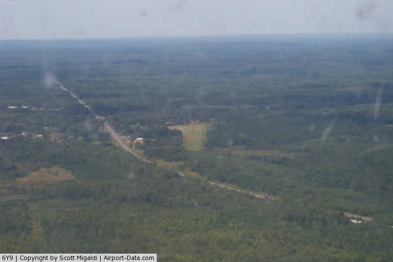
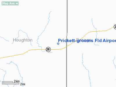
Prickett - Grooms Fld Airport |
|
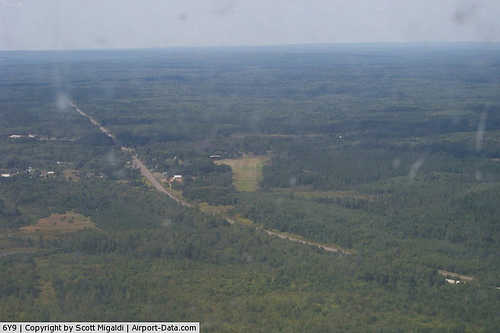 |
(Click on the photo to enlarge) |
Location & QuickFacts
| FAA Information Effective: | 2008-09-25 |
| Airport Identifier: | 6Y9 |
| Airport Status: | Operational |
| Longitude/Latitude: | 088-42-00.4980W/46-30-59.7910N
-88.700138/46.516609 (Estimated) |
| Elevation: | 1372 ft / 418.19 m (Surveyed) |
| Land: | 80 acres |
| From nearest city: | 1 nautical miles NE of Sidnaw, MI |
| Location: | Houghton County, MI |
| Magnetic Variation: | 02W (1985) |
Owner & Manager
| Ownership: | Privately owned |
| Owner: | Shcaha
SOUTHERN HOUGHTON COUNTY AIRPORT & HERITAGE ASSOCIATION |
| Address: | 7370 Broadmoor Ave. S.e.
Caledonia, MI 49316 |
| Phone number: | 616-554-8860 |
| Manager: | Edward Frederick
AMGR LIVES ADJACENT TO THE AIRPORT. |
| Address: | 7025 68th St Se
Caledonia, MI 49316 |
| Phone number: | 616-822-7151 |
Airport Operations and Facilities
| Airport Use: | Open to public |
| Wind indicator: | Yes |
| Segmented Circle: | No |
| Control Tower: | No |
| Landing fee charge: | No |
| Sectional chart: | Green Bay |
| Region: | AGL - Great Lakes |
| Boundary ARTCC: | ZMP - Minneapolis |
| Tie-in FSS: | GRB - Green Bay |
| FSS on Airport: | No |
| FSS Toll Free: | 1-800-WX-BRIEF |
| NOTAMs Facility: | GRB (NOTAM-d service avaliable) |
Airport Communications
Airport Services
| Airframe Repair: | NONE |
| Power Plant Repair: | NONE |
| Bottled Oxygen: | NONE |
| Bulk Oxygen: | NONE |
Runway Information
Runway 10/28
| Dimension: | 2000 x 100 ft / 609.6 x 30.5 m |
| Surface: | TURF, Good Condition
SOFT WHEN WET; CALL 906-355-2257 TO VFY COND. |
| |
Runway 10 |
Runway 28 |
| Traffic Pattern: | Left | Left |
| Displaced threshold: | 300.00 ft | 0.00 ft |
| Runway End Identifier: | No | No |
| Centerline Lights: | No | No |
| Touchdown Lights: | No | No |
| Obstruction: | 50 ft trees, 300.0 ft from runway, 67 ft right of centerline, 6:1 slope to clear
12:1 AT DSPLCD THLD AND 20:1 BASED ON STRAIGHT OUT. | 50 ft trees, 0.0 ft from runway, 60 ft right of centerline
APCH RATIO 20:1 BASED ON STRAIGHT OUT. |
|
Radio Navigation Aids
| ID |
Type |
Name |
Ch |
Freq |
Var |
Dist |
| RXW | NDB | Watersmeet | | 407.00 | 01E | 27.6 nm |
| LNL | NDB | Land O Lakes | | 396.00 | 02W | 30.6 nm |
| OGM | NDB | Ontonagon | | 375.00 | 00W | 34.0 nm |
| CM | NDB | Galey | | 275.00 | 02W | 38.1 nm |
| EGV | NDB | Eagle River | | 341.00 | 02W | 42.2 nm |
| BDJ | NDB | Boulder Junction | | 206.00 | 02E | 45.9 nm |
| CMX | VOR/DME | Houghton | 075X | 112.80 | 02W | 40.3 nm |
| MQT | VOR/DME | Marquette/dcmsnd | 114X | 116.70 | 02W | 46.1 nm |
| IMT | VOR/DME | Iron Mountain | 049X | 111.20 | 02W | 48.7 nm |
Remarks
- RYS NOT PLOWED. ARPT CLSD NOV-APR & WHEN SNOW COVERED.
- CAMPING & CABINS ADJACENT, 906-355-2257
- PRVDD AREA 125 FT EITHER SIDE RY CNTRLN & 200 FT OF EACH END CLEAR OF OBSTN; AREA 60 FT EITHER SIDE RY CNTRLN & 240 FT OFF EACH END SUITABLE FOR REDUCING RISK OF ACFT DAMAGE IN THE EVENT ACFT RUNS OFF RY;
Images and information placed above are from
http://www.airport-data.com/airport/6Y9/
We thank them for the data!
| General Info
|
| Country |
United States
|
| State |
MICHIGAN
|
| FAA ID |
6Y9
|
| Latitude |
46-30-59.791N
|
| Longitude |
088-42-00.498W
|
| Elevation |
1372 feet
|
| Near City |
SIDNAW
|
We don't guarantee the information is fresh and accurate. The data may
be wrong or outdated.
For more up-to-date information please refer to other sources.
|
|