 |
|
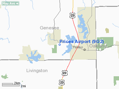
Location & QuickFacts
| FAA Information Effective: | 2008-09-25 |
| Airport Identifier: | 9G2 |
| Airport Status: | Operational |
| Longitude/Latitude: | 083-46-11.6640W/42-48-27.4090N
-83.769907/42.807614 (Estimated) |
| Elevation: | 920 ft / 280.42 m (Estimated) |
| Land: | 70 acres |
| From nearest city: | 1 nautical miles S of Linden, MI |
| Location: | Genesee County, MI |
| Magnetic Variation: | 06W (2000) |
Owner & Manager
| Ownership: | Publicly owned |
| Owner: | State Of Michigan - Aeronautics |
| Address: | 2700 East Airport Service Dr
Lansing, MI 48906 |
| Phone number: | 517-335-8521 |
| Manager: | Cody Welch |
| Address: | 8529 Pineview Lake Drive, P O Box 267
Linden, MI 48451 |
| Phone number: | 810-735-6569 |
Airport Operations and Facilities
| Airport Use: | Open to public |
| Wind indicator: | Yes |
| Segmented Circle: | No |
| Control Tower: | No |
| Lighting Schedule: | DUSK-DAWN
ACTVT MIRL RY 09/27 & REIL RY 09 - CTAF. |
| Beacon Color: | Clear-Green (lighted land airport) |
| Landing fee charge: | No |
| Sectional chart: | Detroit |
| Region: | AGL - Great Lakes |
| Boundary ARTCC: | ZOB - Cleveland |
| Tie-in FSS: | LAN - Lansing |
| FSS on Airport: | No |
| FSS Toll Free: | 1-800-WX-BRIEF |
| NOTAMs Facility: | LAN (NOTAM-d service avaliable) |
Airport Communications
| CTAF: | 123.000 |
| Unicom: | 123.000 |
Airport Services
Runway Information
Runway 09/27
| Dimension: | 4000 x 75 ft / 1219.2 x 22.9 m |
| Surface: | ASPH, Good Condition |
| Edge Lights: | Medium |
| |
Runway 09 |
Runway 27 |
| Longitude: | 083-46-36.9100W | 083-45-43.2500W |
| Latitude: | 42-48-27.1700N | 42-48-27.6700N |
| Elevation: | 918.00 ft | 906.00 ft |
| Alignment: | 89 | 127 |
| Traffic Pattern: | Left | Left |
| Markings: | Non-precision instrument, Good Condition | Non-precision instrument, Good Condition |
| Displaced threshold: | 268.00 ft | 800.00 ft |
| Runway End Identifier: | Yes | No |
| Obstruction: | 60 ft trees, 201.0 ft from runway, 160 ft left of centerline, 4:1 slope to clear
APCH RATIO 22:1 AT DSPLCD THLD, +51' TREE 1122 FT DSTC. | 46 ft trees, 350.0 ft from runway, 3:1 slope to clear
APCH RATIO 25:1 AT DSPLCD THLD. |
|
Radio Navigation Aids
| ID |
Type |
Name |
Ch |
Freq |
Var |
Dist |
| OZW | NDB | Howell | | 243.00 | 05W | 14.2 nm |
| HYX | NDB | Browne | | 385.00 | 06W | 37.7 nm |
| VQ | NDB | Cargl | | 230.00 | 05W | 45.2 nm |
| G | NDB | Golf | | 398.00 | 05W | 46.6 nm |
| TCU | NDB | Tecumseh | | 239.00 | 04W | 46.6 nm |
| QG | NDB | Windsor | | 353.00 | 06W | 49.8 nm |
| MTC | TACAN | Selfridge | 064X | | 06W | 43.1 nm |
| DXO | VOR/DME | Detroit | 081X | 113.40 | 06W | 40.0 nm |
| JXN | VOR/DME | Jackson | 033X | 109.60 | 05W | 44.9 nm |
| MBS | VOR/DME | Saginaw | 076X | 112.90 | 03W | 45.6 nm |
| FNT | VORTAC | Flint | 116X | 116.90 | 06W | 9.6 nm |
| PSI | VORTAC | Pontiac | 047X | 111.00 | 03W | 12.3 nm |
| SVM | VORTAC | Salem | 090X | 114.30 | 03W | 25.2 nm |
| LAN | VORTAC | Lansing | 045X | 110.80 | 05W | 41.3 nm |
| CRL | VORTAC | Carleton | 104X | 115.70 | 03W | 47.7 nm |
| YIP | VOT | Willow Run | | 112.00 | | 36.2 nm |
| DTW | VOT | Detroit Met Wayne | | 109.80 | | 39.2 nm |
| DET | VOT | Detroit City | | 111.60 | | 41.2 nm |
Remarks
- DEER & BIRDS ON & INVOF ARPT.
Images and information placed above are from
http://www.airport-data.com/airport/9G2/
We thank them for the data!
| General Info
|
| Country |
United States
|
| State |
MICHIGAN
|
| FAA ID |
9G2
|
| Latitude |
42-48-27.409N
|
| Longitude |
083-46-11.664W
|
| Elevation |
920 feet
|
| Near City |
LINDEN
|
We don't guarantee the information is fresh and accurate. The data may
be wrong or outdated.
For more up-to-date information please refer to other sources.
|
|


