 |
|
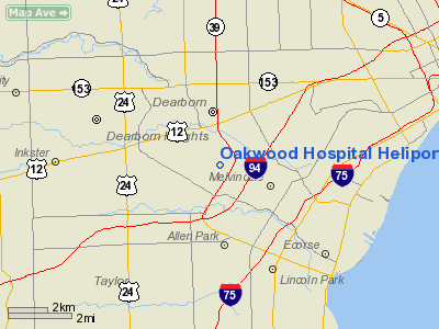
Oakwood Hospital Heliport |
Location & QuickFacts
| FAA Information Effective: | 2008-09-25 |
| Airport Identifier: | 56MI |
| Airport Status: | Operational |
| Longitude/Latitude: | 083-12-49.0000W/42-17-30.0000N
-83.213611/42.291667 (Estimated) |
| Elevation: | 597 ft / 181.97 m (Estimated) |
| Land: | 0 acres |
| From nearest city: | 0 nautical miles N of Dearborn, MI |
| Location: | Wayne County, MI |
| Magnetic Variation: | 06W (1995) |
Owner & Manager
| Ownership: | Privately owned |
| Owner: | Oakwood Hospital |
| Address: | 18101 Oakwood Blvd
Dearborn, MI 48123-2500 |
| Phone number: | 313-593-7000 |
| Manager: | Larry Hicks |
| Address: | 18101 Oakwood Blvd
Dearborn, MI 48123-2500 |
| Phone number: | 313-593-7358 |
Airport Operations and Facilities
| Airport Use: | Private
MEDICAL USE. |
| Segmented Circle: | No |
| Control Tower: | No |
| Lighting Schedule: | PHONE REQ
FOR FLOOD LGT CALL 313-593-7358. |
| Sectional chart: | Detroit |
| Region: | AGL - Great Lakes |
| Boundary ARTCC: | ZOB - Cleveland |
| Tie-in FSS: | LAN - Lansing |
| FSS on Airport: | No |
| FSS Toll Free: | 1-800-WX-BRIEF |
Runway Information
Helipad H1
| Dimension: | 60 x 60 ft / 18.3 x 18.3 m |
| Surface: | CONC,
CIRCULAR PAD. |
| |
Runway H1 |
Runway |
| Traffic Pattern: | Left | Left |
|
Radio Navigation Aids
| ID |
Type |
Name |
Ch |
Freq |
Var |
Dist |
| G | NDB | Golf | | 398.00 | 05W | 7.9 nm |
| RYS | NDB | Grosse Ile | | 419.00 | 06W | 11.8 nm |
| VQ | NDB | Cargl | | 230.00 | 05W | 12.2 nm |
| QG | NDB | Windsor | | 353.00 | 06W | 15.4 nm |
| TCU | NDB | Tecumseh | | 239.00 | 04W | 33.4 nm |
| PT | NDB | Pelee Island | | 283.00 | 05W | 39.2 nm |
| OZW | NDB | Howell | | 243.00 | 05W | 40.0 nm |
| ADG | NDB | Adrian | | 278.00 | 06W | 46.1 nm |
| PCW | NDB | Port Clinton | | 423.00 | 06W | 49.0 nm |
| MTC | TACAN | Selfridge | 064X | | 06W | 25.7 nm |
| TOL | TACAN | Toledo | 072X | | 05W | 49.5 nm |
| DXO | VOR/DME | Detroit | 081X | 113.40 | 06W | 8.3 nm |
| YQG | VOR/DME | Windsor | 085X | 113.80 | 06W | 17.3 nm |
| CRL | VORTAC | Carleton | 104X | 115.70 | 03W | 18.2 nm |
| SVM | VORTAC | Salem | 090X | 114.30 | 03W | 18.3 nm |
| PSI | VORTAC | Pontiac | 047X | 111.00 | 03W | 28.4 nm |
| FNT | VORTAC | Flint | 116X | 116.90 | 06W | 46.9 nm |
| DTW | VOT | Detroit Met Wayne | | 109.80 | | 7.7 nm |
| DET | VOT | Detroit City | | 111.60 | | 11.1 nm |
| YIP | VOT | Willow Run | | 112.00 | | 14.2 nm |
Remarks
- ALL APCH/DEP FROM 130 DEG CLKWS TO 160 DEG AND FROM 240 DEG CLKWS TO 280 DEG PRVDD TREES AND LGT POLES ARE REMOVED; AREA IS MKD; WIND INDICATOR ID MNTND; COMPLY WITH FAR PART 91.126 (B) (2).
Images and information placed above are from
http://www.airport-data.com/airport/56MI/
We thank them for the data!
| General Info
|
| Country |
United States
|
| State |
MICHIGAN
|
| FAA ID |
56MI
|
| Latitude |
42-17-30.000N
|
| Longitude |
083-12-49.000W
|
| Elevation |
597 feet
|
| Near City |
DEARBORN
|
We don't guarantee the information is fresh and accurate. The data may
be wrong or outdated.
For more up-to-date information please refer to other sources.
|
|


