 |
|
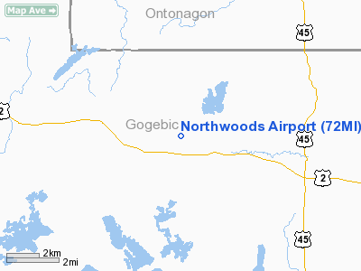
Location & QuickFacts
| FAA Information Effective: | 2008-09-25 |
| Airport Identifier: | 72MI |
| Airport Status: | Operational |
| Longitude/Latitude: | 089-16-39.0800W/46-17-09.0600N
-89.277522/46.285850 (Estimated) |
| Elevation: | 1642 ft / 500.48 m (Estimated) |
| Land: | 3000 acres |
| From nearest city: | 5 nautical miles W of Watersmeet, MI |
| Location: | Gogebic County, MI |
| Magnetic Variation: | 02W (1995) |
Owner & Manager
| Ownership: | Privately owned |
| Owner: | Institute In Basic Life Principles |
| Address: | Box 1
Oak Brook, IL 60521 |
| Phone number: | 630-323-9800 |
| Manager: | Dwayne Juzyk |
| Address: | E 21800 Wolf Lake Road
Watersmeet, MI 49969 |
| Phone number: | 906-358-4500 |
Airport Operations and Facilities
| Airport Use: | Private |
| Wind indicator: | Yes |
| Segmented Circle: | No |
| Control Tower: | No |
| Lighting Schedule: | DUSK-DAWN
FOR RY LGTS CALL 906-358-4500. |
| Beacon Color: | Clear-Green (lighted land airport) |
| Landing fee charge: | No |
| Sectional chart: | Green Bay |
| Region: | AGL - Great Lakes |
| Boundary ARTCC: | ZMP - Minneapolis |
| Tie-in FSS: | GRB - Green Bay |
| FSS on Airport: | No |
| FSS Toll Free: | 1-800-WX-BRIEF |
Airport Communications
| Unicom: | 122.750
UNICOM MONITORED BY PRIOR REQ ONLY. |
Runway Information
Runway 09/27
| Dimension: | 5000 x 75 ft / 1524.0 x 22.9 m |
| Surface: | ASPH, Good Condition |
| Weight Limit: | Single wheel: 75000 lbs.
Dual wheel: 95000 lbs.
& A36: GWT PRVDD BY ARPT OWNER. |
| Edge Lights: | Medium |
| |
Runway 09 |
Runway 27 |
| Longitude: | 089-17-14.6000W | 089-16-03.5600W |
| Latitude: | 46-17-10.7200N | 46-17-07.4000N |
| Elevation: | 1642.00 ft | 1613.00 ft |
| Traffic Pattern: | Left | Left |
| Markings: | Non-precision instrument, Good Condition | Non-precision instrument, Good Condition |
| VASI: | 2-box on left side | 2-box on left side |
| Visual Glide Angle: | 4.50° | 4.00° |
| Runway End Identifier: | Yes | Yes |
| Obstruction: | 144 ft trees, 1500.0 ft from runway, 9:1 slope to clear | 88 ft trees, 1000.0 ft from runway, 9:1 slope to clear |
|
Radio Navigation Aids
| ID |
Type |
Name |
Ch |
Freq |
Var |
Dist |
| RXW | NDB | Watersmeet | | 407.00 | 01E | 0.2 nm |
| LNL | NDB | Land O Lakes | | 396.00 | 02W | 8.6 nm |
| BDJ | NDB | Boulder Junction | | 206.00 | 02E | 18.2 nm |
| EGV | NDB | Eagle River | | 341.00 | 02W | 21.2 nm |
| MHA | NDB | Manitowish | | 364.00 | 01W | 27.0 nm |
| ARV | NDB | Arbor Vitae | | 221.00 | 01W | 28.7 nm |
| DO | NDB | Dougy | | 236.00 | 01W | 33.1 nm |
| OGM | NDB | Ontonagon | | 375.00 | 00W | 34.1 nm |
| IWD | VORTAC | Ironwood | 025X | 108.80 | 01E | 38.2 nm |
| RHI | VORTAC | Rhinelander | 029X | 109.20 | 02E | 39.9 nm |
Remarks
- DEER AND WATERFOWL ON AND IN VICINITY OF AIRPORT.
Images and information placed above are from
http://www.airport-data.com/airport/72MI/
We thank them for the data!
| General Info
|
| Country |
United States
|
| State |
MICHIGAN
|
| FAA ID |
72MI
|
| Latitude |
46.285850
46° 17' 09.06" N
|
| Longitude |
-89.277522
089° 16' 39.08" W
|
| Elevation |
1642 feet
500 meters
|
| Magnetic Variation |
002° W (01/06)
|
| Beacon |
Yes
|
| Operating Agency |
PRIVATE
|
| Daylight Saving Time |
Second Sunday in March at 0200 to first Sunday in November at 0200 local time (Exception Arizona and that portion of Indiana in the Eastern Time Zone)
|
We don't guarantee the information is fresh and accurate. The data may
be wrong or outdated.
For more up-to-date information please refer to other sources.
|
|


