 |
|
| Newman's Airport |
 |
| IATA: none – ICAO: none – FAA LID: 4N0 |
| Summary |
| Airport type |
Public |
| Operator |
Daniel Wilkinson |
| Location |
Kalamazoo, Michigan |
| Elevation AMSL |
840 ft / 256 m |
| Coordinates |
42°17′20″N 085°45′00″W / 42.28889°N 85.75°W / 42.28889; -85.75Coordinates: 42°17′20″N 085°45′00″W / 42.28889°N 85.75°W / 42.28889; -85.75 |
| Runways |
| Direction |
Length |
Surface |
| ft |
m |
| 18/36 |
2,697 |
822 |
Sod |
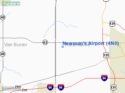
Newman's Airport (FAA LID: 4N0) is a privately owned, public airport located 7 mi (11.3 km) west of Kalamazoo, Michigan, United States. It is a choice for many pilots in the area who wish to avoid the Kalamazoo-Battle Creek International Airport. Newmans is an airpark community. The airport offers tie-downs, and hangars.
On average, 96 aircraft operations occur per week, with 90% being local general aviation. No commercial airlines service Newman's. 20 aircraft are based on the field.
The above content comes from Wikipedia and is published under free licenses – click here to read more.
Location & QuickFacts
| FAA Information Effective: | 2008-09-25 |
| Airport Identifier: | 4N0 |
| Airport Status: | Operational |
| Longitude/Latitude: | 085-45-00.0380W/42-17-20.1350N
-85.750011/42.288926 (Estimated) |
| Elevation: | 840 ft / 256.03 m (Estimated) |
| Land: | 90 acres |
| From nearest city: | 7 nautical miles W of Kalamazoo, MI |
| Location: | Kalamazoo County, MI |
| Magnetic Variation: | 03W (1985) |
Owner & Manager
| Ownership: | Privately owned |
| Owner: | Daniel V Wilkinson |
| Address: | 10432 Stadium Drive
Kalamazoo, MI 49009 |
| Phone number: | 269-372-1800 |
| Manager: | Daniel V Wilkinson |
| Address: | 10432 Stadium Dr
Kalamazoo, MI 49009 |
| Phone number: | 269-372-1800 |
Airport Operations and Facilities
| Airport Use: | Open to public |
| Wind indicator: | Yes |
| Segmented Circle: | Yes |
| Control Tower: | No |
| Lighting Schedule: | RDO-CTL
ACTVT LIRL RY 18/36 - 122.9. |
| Landing fee charge: | No |
| Sectional chart: | Chicago |
| Region: | AGL - Great Lakes |
| Boundary ARTCC: | ZAU - Chicago |
| Tie-in FSS: | LAN - Lansing |
| FSS on Airport: | No |
| FSS Toll Free: | 1-800-WX-BRIEF |
| NOTAMs Facility: | LAN (NOTAM-d service avaliable) |
Airport Communications
Airport Services
| Airframe Repair: | NONE |
| Power Plant Repair: | NONE |
| Bulk Oxygen: | NONE |
Runway Information
Runway 18/36
| Dimension: | 2697 x 125 ft / 822.0 x 38.1 m |
| Surface: | TURF, Good Condition |
| Edge Lights: | Low |
| |
Runway 18 |
Runway 36 |
| Traffic Pattern: | Left | Left |
| Displaced threshold: | 191.00 ft | 385.00 ft |
| Obstruction: | 27 ft trees, 99 ft left of centerline
APCH RATIO 10:1 AT DSPLCD THLD, 27 FT TREES 270 FT DSTC 85 FT L. | 25 ft tree, 30.0 ft from runway, 108 ft left of centerline, 1:1 slope to clear
RWY 36 APCH RATIO 20:1 AT DSPLCD THLD BASED ON 46 FT TREE, 933 FT DST, 55L. |
|
Radio Navigation Aids
| ID |
Type |
Name |
Ch |
Freq |
Var |
Dist |
| HAI | NDB | Three Rivers | | 407.00 | 02W | 21.1 nm |
| BT | NDB | Batol | | 272.00 | 04W | 25.5 nm |
| IRS | NDB | Sturgis | | 382.00 | 04W | 31.9 nm |
| HLM | NDB | Holland | | 233.00 | 03W | 35.4 nm |
| ANQ | NDB | Angola | | 347.00 | 05W | 49.0 nm |
| AZO | VOR/DME | Kalamazoo | 027X | 109.00 | 01W | 9.3 nm |
| ELX | VOR/DME | Keeler | 113X | 116.60 | 00E | 18.7 nm |
| PMM | VOR/DME | Pullman | 058X | 112.10 | 00E | 19.0 nm |
| GRR | VOR/DME | Grand Rapids | 106Y | 115.95 | 04W | 31.9 nm |
| LFD | VOR/DME | Litchfield | 049X | 111.20 | 05W | 45.9 nm |
| BTL | VORTAC | Battle Creek | 031X | 109.40 | 02W | 22.2 nm |
| GIJ | VORTAC | Gipper | 101X | 115.40 | 00E | 40.3 nm |
| GSH | VORTAC | Goshen | 084X | 113.70 | 00E | 47.6 nm |
Remarks
- DEER INVOF OF RY.
- RY 36 +31 FT PLINE; 393 FT DSTC; 12:1 AT RY END.
- ALL OBSTACLES WITHIN RY APCH SLOPE SFCS REMOVED/LOWERED TO PRVD AN UNOBSTD 20:1 APCH SLOPE; 20:1 APCH SLOPE CLNC OVER ALL OBSTNS; IF 25 FT AGL PLINE CANNOT BE LOWERED OR BURIED.
Images and information placed above are from
http://www.airport-data.com/airport/4N0/
We thank them for the data!
| General Info
|
| Country |
United States
|
| State |
MICHIGAN
|
| FAA ID |
4N0
|
| Latitude |
42-17-20.135N
|
| Longitude |
085-45-00.038W
|
| Elevation |
840 feet
|
| Near City |
KALAMAZOO
|
We don't guarantee the information is fresh and accurate. The data may
be wrong or outdated.
For more up-to-date information please refer to other sources.
|
|


