 |
|
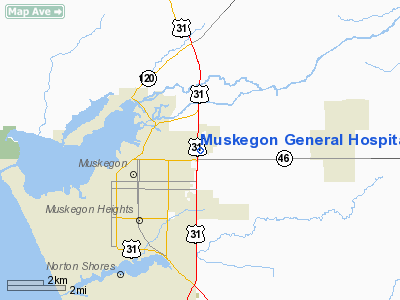
Muskegon General Hospital Heliport |
Location & QuickFacts
| FAA Information Effective: | 2008-09-25 |
| Airport Identifier: | 8MI6 |
| Airport Status: | Operational |
| Longitude/Latitude: | 086-12-08.2070W/43-14-20.0550N
-86.202280/43.238904 (Estimated) |
| Elevation: | 635 ft / 193.55 m (Estimated) |
| Land: | 0 acres |
| From nearest city: | 3 nautical miles SE of Muskegon, MI |
| Location: | Muskegon County, MI |
| Magnetic Variation: | 03W (1985) |
Owner & Manager
| Ownership: | Privately owned |
| Owner: | Muskegon General Hospital |
| Address: | 1700 Oak Avenue
Muskegon, MI 49442 |
| Phone number: | 616-773-3311 |
| Manager: | Joel T. Martin, D.o. |
| Address: |
|
| Phone number: | 616-773-3311 |
Airport Operations and Facilities
| Airport Use: | Private
MEDICAL USE. |
| Wind indicator: | Yes |
| Segmented Circle: | No |
| Control Tower: | No |
| Landing fee charge: | No |
| Sectional chart: | Chicago |
| Region: | AGL - Great Lakes |
| Boundary ARTCC: | ZAU - Chicago |
| Tie-in FSS: | LAN - Lansing |
| FSS on Airport: | No |
| FSS Toll Free: | 1-800-WX-BRIEF |
Runway Information
Helipad H1
| Dimension: | 40 x 40 ft / 12.2 x 12.2 m |
| Surface: | CONC, |
| |
Runway H1 |
Runway |
| Traffic Pattern: | Left | Left |
|
Radio Navigation Aids
| ID |
Type |
Name |
Ch |
Freq |
Var |
Dist |
| HLM | NDB | Holland | | 233.00 | 03W | 26.7 nm |
| LDM | NDB | Ludington | | 341.00 | 03W | 44.4 nm |
| HIC | VOR/DME | White Cloud | 123X | 117.60 | 01W | 29.3 nm |
| GRR | VOR/DME | Grand Rapids | 106Y | 115.95 | 04W | 41.2 nm |
| PMM | VOR/DME | Pullman | 058X | 112.10 | 00E | 46.7 nm |
| MKG | VORTAC | Muskegon | 099X | 115.20 | 01W | 8.3 nm |
Remarks
- ALL OPERATIONS ARE CONDUCTED IN AN AREA FROM 215 DEGS CLOCKWISE TO 350 DEGS; AREA IS APPROPRIATELY MARKED & LIGHTED; WIND INDICATOR IS MAINTAINED.
Images and information placed above are from
http://www.airport-data.com/airport/8MI6/
We thank them for the data!
| General Info
|
| Country |
United States
|
| State |
MICHIGAN
|
| FAA ID |
8MI6
|
| Latitude |
43-14-20.055N
|
| Longitude |
086-12-08.207W
|
| Elevation |
635 feet
|
| Near City |
MUSKEGON
|
We don't guarantee the information is fresh and accurate. The data may
be wrong or outdated.
For more up-to-date information please refer to other sources.
|
|


