 |
|
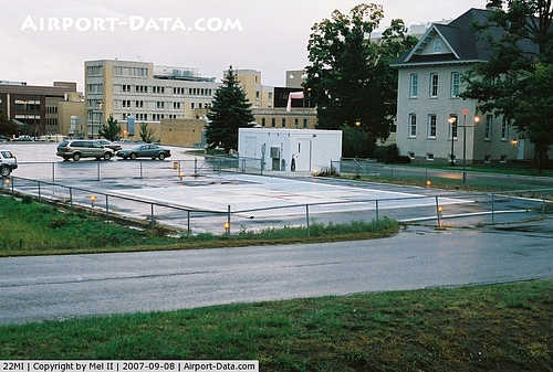
Munson Medical Center Heliport |
|
 |
(Click on the photo to enlarge) |
Location & QuickFacts
| FAA Information Effective: | 2008-09-25 |
| Airport Identifier: | 22MI |
| Airport Status: | Operational |
| Longitude/Latitude: | 085-38-38.2760W/44-45-38.0030N
-85.643966/44.760556 (Estimated) |
| Elevation: | 629 ft / 191.72 m (Estimated) |
| Land: | 0 acres |
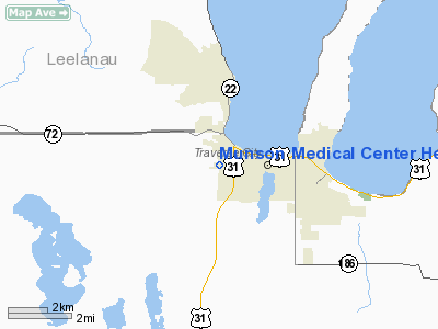
| From nearest city: | 1 nautical miles W of Traverse City, MI |
| Location: | Grand Traverse County, MI |
| Magnetic Variation: | 04W (1985) |
Owner & Manager
| Ownership: | Privately owned |
| Owner: | Munson Medical Center |
| Address: | Sixth & Madison Streets
Traverse City, MI 49684 |
| Phone number: | 616-922-9000 |
| Manager: | Joel Baillie |
| Address: | 1840 Stults Dr
Traverse City, MI 49684 |
| Phone number: | 616-922-9900 |
Airport Operations and Facilities
| Airport Use: | Private
MEDICAL USE. |
| Wind indicator: | Yes |
| Segmented Circle: | No |
| Control Tower: | No |
| Lighting Schedule: | PHONE REQ
FOR BCN CALL 616-922-9900. |
| Beacon Color: | Clear-Green-Yellow (heliport) |
| Landing fee charge: | No |
| Sectional chart: | Green Bay |
| Region: | AGL - Great Lakes |
| Boundary ARTCC: | ZMP - Minneapolis |
| Tie-in FSS: | LAN - Lansing |
| FSS on Airport: | No |
| FSS Toll Free: | 1-800-WX-BRIEF |
Runway Information
Helipad H1
| Dimension: | 100 x 100 ft / 30.5 x 30.5 m |
| Surface: | ASPH-CONC, |
| |
Runway H1 |
Runway |
| Traffic Pattern: | Left | Left |
| Markings: | Basic, | , |
|
Radio Navigation Aids
| ID |
Type |
Name |
Ch |
Freq |
Var |
Dist |
| TV | NDB | Gwenn | | 365.00 | 05W | 9.3 nm |
| CXK | NDB | Clam Lake | | 251.00 | 05W | 19.1 nm |
| CAD | NDB | Cadillac | | 269.00 | 04W | 30.8 nm |
| GYG | NDB | Grayling | | 359.00 | 06W | 34.8 nm |
| CVX | NDB | Charlevoix | | 392.00 | 05W | 36.2 nm |
| BFA | NDB | Boyne Falls | | 263.00 | 06W | 39.2 nm |
| CGG | VOR | Grayling | | 109.80 | 06W | 39.4 nm |
| MBL | VOR/DME | Manistee | 051X | 111.40 | 05W | 39.4 nm |
| GLR | VOR/DME | Gaylord | 029X | 109.20 | 06W | 42.8 nm |
| HTL | VOR/DME | Houghton Lake | 053X | 111.60 | 05W | 48.4 nm |
| TVC | VORTAC | Traverse City | 093X | 114.60 | 02W | 6.9 nm |
Remarks
- PROVIDED OPERATIONS ARE CONDUCTED FROM 170-190 & FROM 350-010; AREA IS MARKED; TREE IS REMOVED; WIND INDICATOR IS MAINTAINED; LTR OF AGREEMENT WITH TRAVERSE CITY ATCT.
Images and information placed above are from
http://www.airport-data.com/airport/22MI/
We thank them for the data!
| General Info
|
| Country |
United States
|
| State |
MICHIGAN
|
| FAA ID |
22MI
|
| Latitude |
44-45-38.003N
|
| Longitude |
085-38-38.276W
|
| Elevation |
629 feet
|
| Near City |
TRAVERSE CITY
|
We don't guarantee the information is fresh and accurate. The data may
be wrong or outdated.
For more up-to-date information please refer to other sources.
|
|


