 |
|
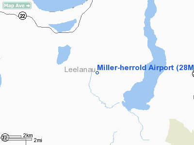
Location & QuickFacts
| FAA Information Effective: | 2008-09-25 |
| Airport Identifier: | 28MI |
| Airport Status: | Operational |
| Longitude/Latitude: | 085-47-33.3050W/44-52-27.9960N
-85.792585/44.874443 (Estimated) |
| Elevation: | 624 ft / 190.20 m (Surveyed) |
| Land: | 0 acres |
| From nearest city: | 2 nautical miles N of Cedar, MI |
| Location: | Leelanau County, MI |
| Magnetic Variation: | 04W (1985) |
Owner & Manager
| Ownership: | Privately owned |
| Owner: | Robert P. Miller |
| Address: | 3334 Gatzke Road
Cedar, MI 49621 |
| Phone number: | 231-228-5336 |
| Manager: | Robert P. Miller |
| Address: | 3334 Gatzke Road
Cedar, MI 49621 |
| Phone number: | 231-228-5336 |
Airport Operations and Facilities
| Airport Use: | Private
PERSONAL USE. |
| Wind indicator: | Yes |
| Segmented Circle: | No |
| Control Tower: | No |
| Sectional chart: | Chicago |
| Region: | AGL - Great Lakes |
| Boundary ARTCC: | ZMP - Minneapolis |
| Tie-in FSS: | LAN - Lansing |
| FSS on Airport: | No |
| FSS Toll Free: | 1-800-WX-BRIEF |
Runway Information
Runway 02/20
| Dimension: | 2600 x 60 ft / 792.5 x 18.3 m |
| Surface: | TURF, |
| |
Runway 02 |
Runway 20 |
| Traffic Pattern: | Left | Left |
| Markings: | Basic, | Basic, |
| Displaced threshold: | 300.00 ft | 0.00 ft |
| Obstruction: | 4 ft hwy, 10.0 ft from runway | |
|
Radio Navigation Aids
| ID |
Type |
Name |
Ch |
Freq |
Var |
Dist |
| TV | NDB | Gwenn | | 365.00 | 05W | 17.6 nm |
| CXK | NDB | Clam Lake | | 251.00 | 05W | 23.6 nm |
| CVX | NDB | Charlevoix | | 392.00 | 05W | 33.9 nm |
| CAD | NDB | Cadillac | | 269.00 | 04W | 39.5 nm |
| BFA | NDB | Boyne Falls | | 263.00 | 06W | 41.0 nm |
| GYG | NDB | Grayling | | 359.00 | 06W | 41.8 nm |
| CGG | VOR | Grayling | | 109.80 | 06W | 46.8 nm |
| MBL | VOR/DME | Manistee | 051X | 111.40 | 05W | 41.3 nm |
| GLR | VOR/DME | Gaylord | 029X | 109.20 | 06W | 47.0 nm |
| TVC | VORTAC | Traverse City | 093X | 114.60 | 02W | 16.2 nm |
Remarks
- NOT ANALYZED, DETERMINATION PENDING.
Images and information placed above are from
http://www.airport-data.com/airport/28MI/
We thank them for the data!
| General Info
|
| Country |
United States
|
| State |
MICHIGAN
|
| FAA ID |
28MI
|
| Latitude |
44-52-27.996N
|
| Longitude |
085-47-33.305W
|
| Elevation |
624 feet
|
| Near City |
CEDAR
|
We don't guarantee the information is fresh and accurate. The data may
be wrong or outdated.
For more up-to-date information please refer to other sources.
|
|


