 |
|
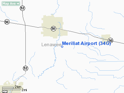
Location & QuickFacts
| FAA Information Effective: | 2008-09-25 |
| Airport Identifier: | 34G |
| Airport Status: | Operational |
| Longitude/Latitude: | 083-55-30.7890W/41-58-30.1620N
-83.925219/41.975045 (Estimated) |
| Elevation: | 820 ft / 249.94 m (Estimated) |
| Land: | 28 acres |
| From nearest city: | 3 nautical miles SE of Tecumseh, MI |
| Location: | Lenawee County, MI |
| Magnetic Variation: | 05W (1985) |
Owner & Manager
| Ownership: | Privately owned |
| Owner: | James N Merillat |
| Address: | 5763 N. Rogers Highway
Tecumseh, MI 49286 |
| Phone number: | 517-423-7600 |
| Manager: | Jeff Wright
MGR LIVES AT ARPT. |
| Address: | 5763 N. Rogers Highway
Tecumseh, MI 49286 |
| Phone number: | 517-423-7600 |
Airport Operations and Facilities
| Airport Use: | Open to public |
| Wind indicator: | Yes |
| Segmented Circle: | Yes |
| Control Tower: | No |
| Lighting Schedule: | RDO-CTL
ACTVT ROTG BCN - CTAF |
| Beacon Color: | Clear (unlighted land airport) |
| Landing fee charge: | No |
| Sectional chart: | Detroit |
| Region: | AGL - Great Lakes |
| Boundary ARTCC: | ZOB - Cleveland |
| Tie-in FSS: | LAN - Lansing |
| FSS on Airport: | No |
| FSS Toll Free: | 1-800-WX-BRIEF |
| NOTAMs Facility: | LAN (NOTAM-d service avaliable) |
Airport Communications
| CTAF: | 122.800 |
| Unicom: | 122.800 |
Airport Services
| Fuel available: | 100LL |
| Airframe Repair: | MAJOR
& A72 AIRFRAME & PWR PLANT RPRS BY PRIOR ARRANGEMENT. CALL ARPT ATTENDANT 517-423-7600. |
| Power Plant Repair: | MAJOR |
| Bottled Oxygen: | NONE |
| Bulk Oxygen: | NONE |
Runway Information
Runway 18/36
| Dimension: | 3608 x 100 ft / 1099.7 x 30.5 m |
| Surface: | TURF, Good Condition |
| Edge Lights: | Low
LIRL NOT FOR PUBLIC USE. |
| |
Runway 18 |
Runway 36 |
| Longitude: | 083-55-24.3000W | 083-55-24.5400W |
| Latitude: | 41-58-26.1600N | 41-57-50.5200N |
| Elevation: | 820.00 ft | 820.00 ft |
| Traffic Pattern: | Left | Left |
| Displaced threshold: | 261.00 ft | 486.00 ft |
| Obstruction: | 78 ft trees, 468.0 ft from runway, 160 ft right of centerline, 6:1 slope to clear
RWY 18 APCH RATIO TO DSPLCD THLD 9:1, BASED ON +78 FT TREES 729 FT DSTC. | 4 ft fence, 6.0 ft from runway, 1:1 slope to clear
RWY 36 DSPLCD THLD 34:1; +15 FT RD 521 FT FM DSPLCD THLD. |
|
Radio Navigation Aids
| ID |
Type |
Name |
Ch |
Freq |
Var |
Dist |
| TCU | NDB | Tecumseh | | 239.00 | 04W | 4.2 nm |
| ADG | NDB | Adrian | | 278.00 | 06W | 9.3 nm |
| USE | NDB | Fulton | | 375.00 | 05W | 23.9 nm |
| RYS | NDB | Grosse Ile | | 419.00 | 06W | 35.3 nm |
| BYN | NDB | Bryan | | 260.00 | 04W | 38.4 nm |
| OZW | NDB | Howell | | 243.00 | 05W | 39.7 nm |
| G | NDB | Golf | | 398.00 | 05W | 42.3 nm |
| DFI | NDB | Defiance | | 246.00 | 05W | 44.6 nm |
| VQ | NDB | Cargl | | 230.00 | 05W | 49.0 nm |
| TOL | TACAN | Toledo | 072X | | 05W | 23.6 nm |
| DXO | VOR/DME | Detroit | 081X | 113.40 | 06W | 28.7 nm |
| JXN | VOR/DME | Jackson | 033X | 109.60 | 05W | 29.3 nm |
| VWV | VOR/DME | Waterville | 078X | 113.10 | 02W | 34.0 nm |
| LFD | VOR/DME | Litchfield | 049X | 111.20 | 05W | 37.9 nm |
| CRL | VORTAC | Carleton | 104X | 115.70 | 03W | 21.3 nm |
| SVM | VORTAC | Salem | 090X | 114.30 | 03W | 30.0 nm |
| PSI | VORTAC | Pontiac | 047X | 111.00 | 03W | 47.0 nm |
| YIP | VOT | Willow Run | | 112.00 | | 23.8 nm |
| DTW | VOT | Detroit Met Wayne | | 109.80 | | 29.2 nm |
| DET | VOT | Detroit City | | 111.60 | | 48.0 nm |
Remarks
- ULTRALIGHT ACTIVITY ON & INVOF ARPT.
- RY 18/36 OPP RY END NOT VISIBLE FM TH.
- PRVDD ALL TFC PTN OPNS CONDD EAST OF N/S RWY, VFR WX CONDS ONLY.
Images and information placed above are from
http://www.airport-data.com/airport/34G/
We thank them for the data!
| General Info
|
| Country |
United States
|
| State |
MICHIGAN
|
| FAA ID |
34G
|
| Latitude |
41-58-30.162N
|
| Longitude |
083-55-30.789W
|
| Elevation |
820 feet
|
| Near City |
TECUMSEH
|
We don't guarantee the information is fresh and accurate. The data may
be wrong or outdated.
For more up-to-date information please refer to other sources.
|
|


