 |
|
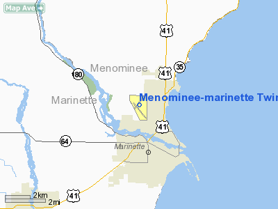
Menominee - Marinette Twin County Airport |
Location & QuickFacts
| FAA Information Effective: | 2008-09-25 |
| Airport Identifier: | MNM |
| Airport Status: | Operational |
| Longitude/Latitude: | 087-38-18.3860W/45-07-35.9410N
-87.638441/45.126650 (Estimated) |
| Elevation: | 625 ft / 190.50 m (Surveyed) |
| Land: | 600 acres |
| From nearest city: | 1 nautical miles NW of Menominee, MI |
| Location: | Menominee County, MI |
| Magnetic Variation: | 03W (1990) |
Owner & Manager
| Ownership: | Publicly owned |
| Owner: | Twin County Airport Commission |
| Address: | 2801 N 22nd St
Menominee, MI 49858 |
| Phone number: | 906-863-8408 |
| Manager: | Anthony Kryhsiak |
| Address: | 2801 North 22nd St
Menominee, MI 49858-3401 |
| Phone number: | 906-863-8408 |
Airport Operations and Facilities
| Airport Use: | Open to public |
| Wind indicator: | Yes |
| Segmented Circle: | No |
| Control Tower: | No |
| Lighting Schedule: | DUSK-DAWN
ACTVT HIRL RY 03/21; MIRL RY 14/32; PAPI RY 21 & MALSR RY 03 - CTAF. |
| Beacon Color: | Clear-Green (lighted land airport) |
| Landing fee charge: | No |
| Sectional chart: | Green Bay |
| Region: | AGL - Great Lakes |
| Boundary ARTCC: | ZMP - Minneapolis |
| Tie-in FSS: | GRB - Green Bay |
| FSS on Airport: | No |
| FSS Toll Free: | 1-800-WX-BRIEF |
| NOTAMs Facility: | MNM (NOTAM-d service avaliable) |
| Federal Agreements: | NGY3 |
Airport Communications
| CTAF: | 122.800 |
| Unicom: | 122.800 |
Airport Services
| Fuel available: | 100LLA
24 HR SELF-SERVE 100 LL WITH MAJOR CREDIT CARD |
| Airframe Repair: | MINOR |
| Power Plant Repair: | MINOR |
| Bottled Oxygen: | NONE |
| Bulk Oxygen: | NONE |
Runway Information
Runway 03/21
| Dimension: | 6000 x 100 ft / 1828.8 x 30.5 m |
| Surface: | ASPH, Good Condition |
| Surface Treatment: | Porous Friction Course |
| Weight Limit: | Single wheel: 80000 lbs.
Dual wheel: 100000 lbs.
Dual tandem wheel: 175000 lbs. |
| Edge Lights: | High |
| |
Runway 03 |
Runway 21 |
| Longitude: | 087-38-39.9030W | 087-37-56.9450W |
| Latitude: | 45-07-23.5870N | 45-08-14.4150N |
| Elevation: | 614.00 ft | 622.00 ft |
| Alignment: | 31 | 127 |
| ILS Type: | ILS
| |
| Traffic Pattern: | Left | Left |
| Markings: | Precision instrument, Fair Condition | Precision instrument, Fair Condition |
| Crossing Height: | 0.00 ft | 43.00 ft |
| VASI: | | 4-light PAPI on left side |
| Visual Glide Angle: | 0.00° | 3.00° |
| Approach lights: | MALSR | |
|
Runway 14/32
| Dimension: | 5100 x 100 ft / 1554.5 x 30.5 m |
| Surface: | ASPH, Good Condition |
| Weight Limit: | Single wheel: 30000 lbs.
Dual wheel: 35000 lbs.
Dual tandem wheel: 60000 lbs. |
| Edge Lights: | Medium |
| |
Runway 14 |
Runway 32 |
| Longitude: | 087-38-42.0840W | 087-37-56.2090W |
| Latitude: | 45-07-40.1060N | 45-07-01.6290N |
| Elevation: | 621.00 ft | 605.00 ft |
| Alignment: | 127 | 127 |
| Traffic Pattern: | Left | Left |
| Markings: | Non-precision instrument, Good Condition | Non-precision instrument, Good Condition |
| Crossing Height: | 41.00 ft | 42.00 ft |
| VASI: | 4-box on left side | 4-box on left side |
| Visual Glide Angle: | 3.00° | 3.00° |
| Runway End Identifier: | No | No |
| Touchdown Lights: | No | No |
| Obstruction: | 34 ft trees, 880.0 ft from runway, 135 ft left of centerline, 20:1 slope to clear | 33 ft tree, 860.0 ft from runway, 300 ft left of centerline, 20:1 slope to clear |
|
Radio Navigation Aids
| ID |
Type |
Name |
Ch |
Freq |
Var |
Dist |
| OCQ | NDB | Oconto | | 388.00 | 03W | 19.0 nm |
| SUE | NDB | Sturgeon Bay | | 414.00 | 03W | 19.7 nm |
| SG | NDB | Depre | | 332.00 | 02W | 48.6 nm |
| MNM | VOR/DME | Menominee | 033X | 109.60 | 00E | 3.2 nm |
| ESC | VOR/DME | Escanaba | 045X | 110.80 | 00E | 42.7 nm |
| IMT | VOR/DME | Iron Mountain | 049X | 111.20 | 02W | 46.0 nm |
| GRB | VORTAC | Green Bay | 102X | 115.50 | 01E | 41.7 nm |
Remarks
- DEER & GULLS ON & INVOF ARPT.
- 48 HRS PPR FOR UNSKED ACR OPNS WITH MORE THAN 30 PSGR SEATS CALL 906-863-8408.
- AVOID OVER FLIGHT OF NOISE SENSITIVE AREA LCTD 7 MILES S OF ARPT.
- 72 FT PLINE 2600 FT, 0.5 MILE NORTHEAST OF ARPT.
Images and information placed above are from
http://www.airport-data.com/airport/MNM/
We thank them for the data!
| General Info
|
| Country |
United States
|
| State |
MICHIGAN
|
| FAA ID |
MNM
|
| Latitude |
45-07-35.941N
|
| Longitude |
087-38-18.386W
|
| Elevation |
625 feet
|
| Near City |
MENOMINEE
|
We don't guarantee the information is fresh and accurate. The data may
be wrong or outdated.
For more up-to-date information please refer to other sources.
|
|


