 |
|
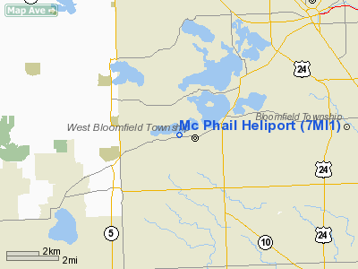
Location & QuickFacts
| FAA Information Effective: | 2008-09-25 |
| Airport Identifier: | 7MI1 |
| Airport Status: | Operational |
| Longitude/Latitude: | 083-23-39.7690W/42-34-20.1180N
-83.394380/42.572255 (Estimated) |
| Elevation: | 970 ft / 295.66 m (Estimated) |
| Land: | 0 acres |
| From nearest city: | 0 nautical miles N of Orchard Lake, MI |
| Location: | Oakland County, MI |
| Magnetic Variation: | 06W (1985) |
Owner & Manager
| Ownership: | Privately owned |
| Owner: | Walter S. Mc Phail |
| Address: | 5600 Pontiac Trail
Orchard Lake, MI 48033 |
| Phone number: | 313-681-3939 |
| Manager: | Walter S. Mc Phail |
| Address: | 5600 Pontiac Trail
Orchard Lake, MI 48033 |
| Phone number: | 313-681-3939 |
Airport Operations and Facilities
| Airport Use: | Private
PERSONAL USE. |
| Wind indicator: | Yes |
| Segmented Circle: | No |
| Control Tower: | No |
| Lighting Schedule: | PHONE REQ
FOR PERIMETER LGTS CALL 313-681-3939. |
| Landing fee charge: | No |
| Sectional chart: | Detroit |
| Region: | AGL - Great Lakes |
| Boundary ARTCC: | ZOB - Cleveland |
| Tie-in FSS: | LAN - Lansing |
| FSS on Airport: | No |
| FSS Toll Free: | 1-800-WX-BRIEF |
Runway Information
Helipad H1
| Dimension: | 350 x 250 ft / 106.7 x 76.2 m |
| Surface: | TURF, |
| |
Runway H1 |
Runway |
| Traffic Pattern: | Left | Left |
|
Radio Navigation Aids
| ID |
Type |
Name |
Ch |
Freq |
Var |
Dist |
| VQ | NDB | Cargl | | 230.00 | 05W | 23.4 nm |
| G | NDB | Golf | | 398.00 | 05W | 25.0 nm |
| OZW | NDB | Howell | | 243.00 | 05W | 26.5 nm |
| QG | NDB | Windsor | | 353.00 | 06W | 28.1 nm |
| RYS | NDB | Grosse Ile | | 419.00 | 06W | 30.3 nm |
| TCU | NDB | Tecumseh | | 239.00 | 04W | 38.8 nm |
| MTC | TACAN | Selfridge | 064X | | 06W | 25.0 nm |
| DXO | VOR/DME | Detroit | 081X | 113.40 | 06W | 21.6 nm |
| YQG | VOR/DME | Windsor | 085X | 113.80 | 06W | 31.7 nm |
| PSI | VORTAC | Pontiac | 047X | 111.00 | 03W | 9.9 nm |
| SVM | VORTAC | Salem | 090X | 114.30 | 03W | 13.2 nm |
| FNT | VORTAC | Flint | 116X | 116.90 | 06W | 28.4 nm |
| CRL | VORTAC | Carleton | 104X | 115.70 | 03W | 31.6 nm |
| DET | VOT | Detroit City | | 111.60 | | 19.5 nm |
| DTW | VOT | Detroit Met Wayne | | 109.80 | | 20.7 nm |
| YIP | VOT | Willow Run | | 112.00 | | 21.1 nm |
Remarks
- PROVIDED APCH/DEP ROUTE HELICOPTER OPERATIONS ARE CONDUCTED IN AN AREA FROM 330 CLOCKWISE TO 200 USING THE PAD AS THE CENTER OF A COMPAS ROSE; A NON-OBSTRUCTING WIND INDICATOR IS MAINTAINED ADJACENT TO TAKEOFF/LANDING AREA.
Images and information placed above are from
http://www.airport-data.com/airport/7MI1/
We thank them for the data!
| General Info
|
| Country |
United States
|
| State |
MICHIGAN
|
| FAA ID |
7MI1
|
| Latitude |
42-34-20.118N
|
| Longitude |
083-23-39.769W
|
| Elevation |
970 feet
|
| Near City |
ORCHARD LAKE
|
We don't guarantee the information is fresh and accurate. The data may
be wrong or outdated.
For more up-to-date information please refer to other sources.
|
|


