 |
|
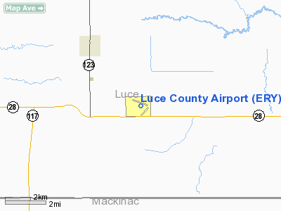
Location & QuickFacts
| FAA Information Effective: | 2008-09-25 |
| Airport Identifier: | ERY |
| Airport Status: | Operational |
| Longitude/Latitude: | 085-27-26.3390W/46-18-40.2730N
-85.457316/46.311187 (Estimated) |
| Elevation: | 869 ft / 264.87 m (Estimated) |
| Land: | 160 acres |
| From nearest city: | 3 nautical miles SE of Newberry, MI |
| Location: | Luce County, MI |
| Magnetic Variation: | 06W (1995) |
Owner & Manager
| Ownership: | Publicly owned |
| Owner: | Luce County |
| Address: | Luce County Government Bldg, 407 W. Harrie St
Newberry, MI 49868 |
| Phone number: | 906-293-5521 |
| Manager: | Jay Hollnagel |
| Address: | Luce Co. Govt Bldg, 407 W. Harrie
Newberry, MI 49868 |
| Phone number: | 906-293-2926 |
Airport Operations and Facilities
| Airport Use: | Open to public |
| Wind indicator: | Yes |
| Segmented Circle: | Yes |
| Control Tower: | No |
| Lighting Schedule: | DUSK-DAWN
ACTVT MIRL RY 11/29; REIL RYS 11 & 29; PAPI RYS 11 & 29; & WIND CONE - CTAF. |
| Beacon Color: | Clear-Green (lighted land airport) |
| Landing fee charge: | No |
| Sectional chart: | Green Bay |
| Region: | AGL - Great Lakes |
| Boundary ARTCC: | ZMP - Minneapolis |
| Tie-in FSS: | GRB - Green Bay |
| FSS on Airport: | No |
| FSS Toll Free: | 1-800-WX-BRIEF |
| NOTAMs Facility: | ERY (NOTAM-d service avaliable) |
| Federal Agreements: | NGY |
Airport Communications
| CTAF: | 122.800 |
| Unicom: | 122.800 |
Airport Services
| Fuel available: | 100LL |
| Airframe Repair: | NONE |
| Power Plant Repair: | NONE |
| Bottled Oxygen: | NONE |
| Bulk Oxygen: | NONE |
Runway Information
Runway 04/22
| Dimension: | 2900 x 150 ft / 883.9 x 45.7 m |
| Surface: | TURF, Good Condition |
| |
Runway 04 |
Runway 22 |
| Longitude: | 085-27-24.3840W | 085-27-01.3840W |
| Latitude: | 46-18-14.9970N | 46-18-38.9980N |
| Elevation: | 853.00 ft | 852.00 ft |
| Traffic Pattern: | Left | Left |
| Displaced threshold: | 969.00 ft | 0.00 ft |
| Touchdown Lights: | No | No |
| Obstruction: | 16 ft trees, 64.0 ft from runway, 125 ft right of centerline, 4:1 slope to clear
RY 04 APCH RATIO 20:1 AT DSPLCD THR OVR +80 FT TREES 1600 FT FM DSPLCD THR. | 24 ft trees, 440.0 ft from runway, 18:1 slope to clear |
|
Runway 11/29
| Dimension: | 4300 x 75 ft / 1310.6 x 22.9 m |
| Surface: | ASPH, Good Condition |
| Weight Limit: | Single wheel: 8000 lbs. |
| Edge Lights: | Medium |
| |
Runway 11 |
Runway 29 |
| Longitude: | 085-28-04.1580W | 085-27-06.6670W |
| Latitude: | 46-18-56.5520N | 46-18-41.9000N |
| Elevation: | 871.00 ft | 851.00 ft |
| Alignment: | 110 | 127 |
| Traffic Pattern: | Left | Left |
| Markings: | Non-precision instrument, Poor Condition
RY 11/29 MARKINGS BADLY FADED. | Non-precision instrument, Poor Condition |
| Crossing Height: | 25.00 ft | 35.00 ft |
| VASI: | 4-light PAPI on left side | 4-light PAPI on left side |
| Visual Glide Angle: | 3.00° | 3.00° |
| Runway End Identifier: | Yes | Yes |
| Centerline Lights: | No | No |
| Touchdown Lights: | No | No |
| Obstruction: | 88 ft trees, 1960.0 ft from runway, 460 ft right of centerline, 20:1 slope to clear | 37 ft trees, 1125.0 ft from runway, 100 ft right of centerline, 25:1 slope to clear |
|
Radio Navigation Aids
| ID |
Type |
Name |
Ch |
Freq |
Var |
Dist |
| A | NDB | Gros Cap | | 286.00 | 06W | 36.9 nm |
| SJX | NDB | St James | | 382.00 | 05W | 37.4 nm |
| CI | NDB | Koloe | | 400.00 | 06W | 38.0 nm |
| ERY | VOR/DME | Newberry | 019X | 108.20 | 06W | 0.3 nm |
| ISQ | VOR/DME | Schoolcraft County | 041X | 110.40 | 05W | 36.0 nm |
| SSM | VOR/DME | Sault Ste Marie | 059X | 112.20 | 04W | 47.8 nm |
Remarks
- RY 04/22 CLSD NOV-MAR & WHEN SNOW COVERED.
Images and information placed above are from
http://www.airport-data.com/airport/ERY/
We thank them for the data!
| General Info
|
| Country |
United States
|
| State |
MICHIGAN
|
| FAA ID |
ERY
|
| Latitude |
46-18-40.273N
|
| Longitude |
085-27-26.339W
|
| Elevation |
869 feet
|
| Near City |
NEWBERRY
|
We don't guarantee the information is fresh and accurate. The data may
be wrong or outdated.
For more up-to-date information please refer to other sources.
|
|


