 |
|
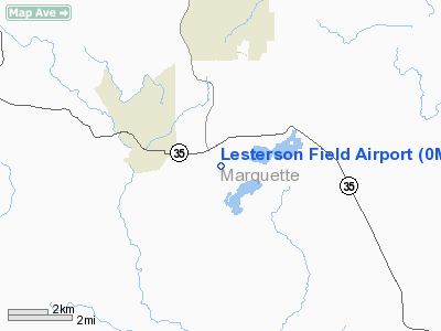
Location & QuickFacts
| FAA Information Effective: | 2008-09-25 |
| Airport Identifier: | 0MI4 |
| Airport Status: | Operational |
| Longitude/Latitude: | 087-23-11.5020W/46-16-12.8020N
-87.386528/46.270223 (Estimated) |
| Elevation: | 1120 ft / 341.38 m (Estimated) |
| Land: | 16 acres |
| From nearest city: | 3 nautical miles SE of Gwinn, MI |
| Location: | Marquette County, MI |
| Magnetic Variation: | 03W (1985) |
Owner & Manager
| Ownership: | Privately owned |
| Owner: | Robert Lesterson & Russell Dempsey |
| Address: | 805 East Airfield Road
Gwinn, MI 49841 |
| Phone number: | 906-372-9175 |
| Manager: | Robert Lesterson & Russell Dempsey |
| Address: | 805 East Airfield Road
Gwinn, MI 49841 |
| Phone number: | 906-372-9175 |
Airport Operations and Facilities
| Airport Use: | Private |
| Wind indicator: | Yes |
| Segmented Circle: | Yes |
| Control Tower: | No |
| Landing fee charge: | No |
| Sectional chart: | Green Bay |
| Region: | AGL - Great Lakes |
| Boundary ARTCC: | ZMP - Minneapolis |
| Tie-in FSS: | GRB - Green Bay |
| FSS on Airport: | No |
| FSS Toll Free: | 1-800-WX-BRIEF |
Airport Communications
Airport Services
| Airframe Repair: | NONE |
| Power Plant Repair: | NONE |
Runway Information
Runway N/S
| Dimension: | 3000 x 100 ft / 914.4 x 30.5 m |
| Surface: | TURF, |
| |
Runway N |
Runway S |
| Traffic Pattern: | Left | Left |
| Obstruction: | 75 ft trees, 800.0 ft from runway | 75 ft trees, 800.0 ft from runway |
|
Radio Navigation Aids
| ID |
Type |
Name |
Ch |
Freq |
Var |
Dist |
| SAW | VOR/DME | Sawyer | 118X | 117.10 | 04W | 5.4 nm |
| MQT | VOR/DME | Marquette/dcmsnd | 114X | 116.70 | 02W | 17.6 nm |
| ESC | VOR/DME | Escanaba | 045X | 110.80 | 00E | 35.2 nm |
| IMT | VOR/DME | Iron Mountain | 049X | 111.20 | 02W | 40.8 nm |
Remarks
- AIR SPACE DETERMIN BASED ON ATXC COMM K I SAWYER AFB CTLZ.
Images and information placed above are from
http://www.airport-data.com/airport/0MI4/
We thank them for the data!
| General Info
|
| Country |
United States
|
| State |
MICHIGAN
|
| FAA ID |
0MI4
|
| Latitude |
46-16-12.802N
|
| Longitude |
087-23-11.502W
|
| Elevation |
1120 feet
|
| Near City |
GWINN
|
We don't guarantee the information is fresh and accurate. The data may
be wrong or outdated.
For more up-to-date information please refer to other sources.
|
|


