 |
|
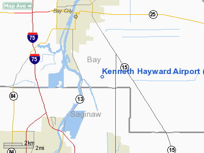
Location & QuickFacts
| FAA Information Effective: | 2008-09-25 |
| Airport Identifier: | 47MI |
| Airport Status: | Operational |
| Longitude/Latitude: | 083-51-14.9010W/43-32-00.0850N
-83.854139/43.533357 (Estimated) |
| Elevation: | 590 ft / 179.83 m (Estimated) |
| Land: | 0 acres |
| From nearest city: | 4 nautical miles SE of Bay City, MI |
| Location: | Bay County, MI |
| Magnetic Variation: | 06W (1985) |
Owner & Manager
| Ownership: | Privately owned |
| Owner: | Kenneth Hayward |
| Address: | 1993 W Russell Rd
Bay City, MI 48708 |
| Phone number: | 517-893-7108 |
| Manager: | Kenneth Hayward |
| Address: | 1993 W Russell Rd
Bay City, MI 48708 |
| Phone number: | 517-893-7108 |
Airport Operations and Facilities
| Airport Use: | Private |
| Wind indicator: | Yes |
| Segmented Circle: | No |
| Control Tower: | No |
| Sectional chart: | Detroit |
| Region: | AGL - Great Lakes |
| Boundary ARTCC: | ZOB - Cleveland |
| Tie-in FSS: | LAN - Lansing |
| FSS on Airport: | No |
| FSS Toll Free: | 1-800-WX-BRIEF |
Runway Information
Runway N/S
| Dimension: | 2270 x 80 ft / 691.9 x 24.4 m |
| Surface: | TURF, |
| |
Runway N |
Runway S |
| Traffic Pattern: | Left | Right |
|
Radio Navigation Aids
| ID |
Type |
Name |
Ch |
Freq |
Var |
Dist |
| HYX | NDB | Browne | | 385.00 | 06W | 6.1 nm |
| GDW | NDB | Wiggins | | 209.00 | 04W | 37.6 nm |
| AMN | NDB | Alma | | 329.00 | 05W | 42.6 nm |
| BHW | NDB | Hardwood | | 236.00 | 06W | 44.1 nm |
| MBS | VOR/DME | Saginaw | 076X | 112.90 | 03W | 9.7 nm |
| MOP | VOR/DME | Mount Pleasant | 043X | 110.60 | 05W | 38.8 nm |
| BAX | VOR/DME | Bad Axe | 019X | 108.20 | 05W | 40.8 nm |
| BXZ | VOR/DME | West Branch | 079X | 113.20 | 06W | 45.0 nm |
| FNT | VORTAC | Flint | 116X | 116.90 | 06W | 34.4 nm |
Remarks
- ALL TRAFFIC PATTERN OPERATIONS ARE CONDUCTED ON THE EAST SIDE OF THE ARPT.
Images and information placed above are from
http://www.airport-data.com/airport/47MI/
We thank them for the data!
| General Info
|
| Country |
United States
|
| State |
MICHIGAN
|
| FAA ID |
47MI
|
| Latitude |
43-32-00.085N
|
| Longitude |
083-51-14.901W
|
| Elevation |
590 feet
|
| Near City |
BAY CITY
|
We don't guarantee the information is fresh and accurate. The data may
be wrong or outdated.
For more up-to-date information please refer to other sources.
|
|


