 |
|
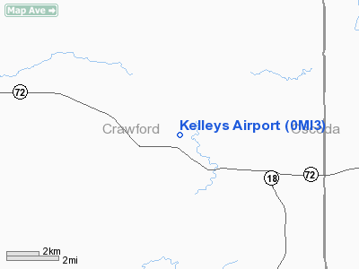
Location & QuickFacts
| FAA Information Effective: | 2008-09-25 |
| Airport Identifier: | 0MI3 |
| Airport Status: | Operational |
| Longitude/Latitude: | 084-29-00.0730W/44-38-00.0580N
-84.483354/44.633349 (Estimated) |
| Elevation: | 1000 ft / 304.80 m (Estimated) |
| Land: | 0 acres |
| From nearest city: | 10 nautical miles SE of Grayling, MI |
| Location: | Crawford County, MI |
| Magnetic Variation: | 06W (1985) |
Owner & Manager
| Ownership: | Privately owned |
| Owner: | James E Kelley |
| Address: | Box 11369
Ft Wayne, IN 46857 |
| Phone number: | 219-456-1211 |
| Address: |
|
Airport Operations and Facilities
| Airport Use: | Private |
| Wind indicator: | Yes |
| Segmented Circle: | No |
| Control Tower: | No |
| Landing fee charge: | No |
| Sectional chart: | Lake Huron |
| Region: | AGL - Great Lakes |
| Boundary ARTCC: | ZMP - Minneapolis |
| Tie-in FSS: | LAN - Lansing |
| FSS on Airport: | No |
| FSS Toll Free: | 1-800-WX-BRIEF |
Airport Services
| Airframe Repair: | NONE |
| Power Plant Repair: | NONE |
Runway Information
Runway 04/22
| Dimension: | 1800 x 100 ft / 548.6 x 30.5 m |
| Surface: | TURF, |
| |
Runway 04 |
Runway 22 |
| Traffic Pattern: | Left | Left |
|
Runway 13/31
| Dimension: | 2400 x 100 ft / 731.5 x 30.5 m |
| Surface: | TURF, |
| |
Runway 13 |
Runway 31 |
| Traffic Pattern: | Left | Left |
|
Runway 18/36
| Dimension: | 3700 x 150 ft / 1127.8 x 45.7 m |
| Surface: | TURF, |
| |
Runway 18 |
Runway 36 |
| Traffic Pattern: | Left | Left |
|
Radio Navigation Aids
| ID |
Type |
Name |
Ch |
Freq |
Var |
Dist |
| GYG | NDB | Grayling | | 359.00 | 06W | 16.3 nm |
| BHW | NDB | Hardwood | | 236.00 | 06W | 28.8 nm |
| CXK | NDB | Clam Lake | | 251.00 | 05W | 36.0 nm |
| BFA | NDB | Boyne Falls | | 263.00 | 06W | 37.1 nm |
| GDW | NDB | Wiggins | | 209.00 | 04W | 39.9 nm |
| TV | NDB | Gwenn | | 365.00 | 05W | 40.9 nm |
| CAD | NDB | Cadillac | | 269.00 | 04W | 45.4 nm |
| CGG | VOR | Grayling | | 109.80 | 06W | 10.9 nm |
| HTL | VOR/DME | Houghton Lake | 053X | 111.60 | 05W | 18.3 nm |
| GLR | VOR/DME | Gaylord | 029X | 109.20 | 06W | 24.7 nm |
| BXZ | VOR/DME | West Branch | 079X | 113.20 | 06W | 26.8 nm |
| ASP | VOR/DME | Au Sable | 108X | 116.10 | 07W | 48.0 nm |
| TVC | VORTAC | Traverse City | 093X | 114.60 | 02W | 45.7 nm |
| APN | VORTAC | Alpena | 025X | 108.80 | 07W | 47.8 nm |
Remarks
Images and information placed above are from
http://www.airport-data.com/airport/0MI3/
We thank them for the data!
| General Info
|
| Country |
United States
|
| State |
MICHIGAN
|
| FAA ID |
0MI3
|
| Latitude |
44-38-00.058N
|
| Longitude |
084-29-00.073W
|
| Elevation |
1000 feet
|
| Near City |
GRAYLING
|
We don't guarantee the information is fresh and accurate. The data may
be wrong or outdated.
For more up-to-date information please refer to other sources.
|
|


