 |
|
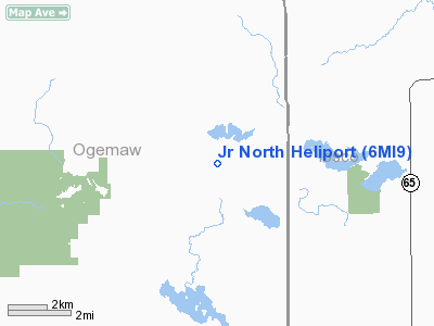
Location & QuickFacts
| FAA Information Effective: | 2008-09-25 |
| Airport Identifier: | 6MI9 |
| Airport Status: | Operational |
| Longitude/Latitude: | 083-55-44.9710W/44-24-55.0590N
-83.929159/44.415294 (Estimated) |
| Elevation: | 935 ft / 284.99 m (Estimated) |
| Land: | 3 acres |
| From nearest city: | 2 nautical miles W of Long Lake, MI |
| Location: | Ogemaw County, MI |
| Magnetic Variation: | 06W (1985) |
Owner & Manager
| Ownership: | Privately owned |
| Owner: | Frank Mandeville, Jr. |
| Address: | P.o. Box 661
Romeo, MI 48065-0661 |
| Phone number: | 313-752-5053 |
| Manager: | Frank Herd |
| Address: | 4780 Rose City Rd
Lupton, MI 48635-9724 |
| Phone number: | 517-257-3840 |
Airport Operations and Facilities
| Airport Use: | Private |
| Wind indicator: | Yes |
| Segmented Circle: | No |
| Control Tower: | No |
| Landing fee charge: | No |
| Sectional chart: | Lake Huron |
| Region: | AGL - Great Lakes |
| Boundary ARTCC: | ZMP - Minneapolis |
| Tie-in FSS: | LAN - Lansing |
| FSS on Airport: | No |
| FSS Toll Free: | 1-800-WX-BRIEF |
Runway Information
Helipad H1
| Dimension: | 650 x 110 ft / 198.1 x 33.5 m |
| Surface: | TURF, |
| |
Runway H1 |
Runway |
| Traffic Pattern: | Left | Left |
|
Helipad H2
| Dimension: | 550 x 110 ft / 167.6 x 33.5 m |
| Surface: | TURF, |
| |
Runway H2 |
Runway |
| Traffic Pattern: | Left | Left |
|
Radio Navigation Aids
| ID |
Type |
Name |
Ch |
Freq |
Var |
Dist |
| BHW | NDB | Hardwood | | 236.00 | 06W | 12.0 nm |
| GDW | NDB | Wiggins | | 209.00 | 04W | 35.6 nm |
| GYG | NDB | Grayling | | 359.00 | 06W | 43.4 nm |
| CGG | VOR | Grayling | | 109.80 | 06W | 37.8 nm |
| BXZ | VOR/DME | West Branch | 079X | 113.20 | 06W | 15.1 nm |
| ASP | VOR/DME | Au Sable | 108X | 116.10 | 07W | 23.0 nm |
| HTL | VOR/DME | Houghton Lake | 053X | 111.60 | 05W | 31.8 nm |
| GLR | VOR/DME | Gaylord | 029X | 109.20 | 06W | 48.8 nm |
| APN | VORTAC | Alpena | 025X | 108.80 | 07W | 43.2 nm |
Remarks
- ALL APCH/DEP OPNS ARE CONDUCTED IN AN AREA 360 DEGS CL0CKWISE TO 045 DEGS & FROM 090; 225 & 270 DEGS USING PAD AS CNTR OF A COMPASS ROSE; TKOF/LNDG AREA IS APPROPRIATELY; NON-OBSNTG WIND INDICATOR IS MAINTD.
Images and information placed above are from
http://www.airport-data.com/airport/6MI9/
We thank them for the data!
| General Info
|
| Country |
United States
|
| State |
MICHIGAN
|
| FAA ID |
6MI9
|
| Latitude |
44-24-55.059N
|
| Longitude |
083-55-44.971W
|
| Elevation |
935 feet
|
| Near City |
LONG LAKE
|
We don't guarantee the information is fresh and accurate. The data may
be wrong or outdated.
For more up-to-date information please refer to other sources.
|
|


