 |
|
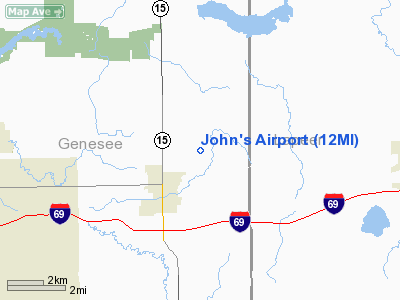
Location & QuickFacts
| FAA Information Effective: | 2008-09-25 |
| Airport Identifier: | 12MI |
| Airport Status: | Operational |
| Longitude/Latitude: | 083-29-30.8200W/43-03-06.0960N
-83.491894/43.051693 (Estimated) |
| Elevation: | 820 ft / 249.94 m (Estimated) |
| Land: | 0 acres |
| From nearest city: | 2 nautical miles SW of Davison, MI |
| Location: | Genesee County, MI |
| Magnetic Variation: | 05W (1985) |
Owner & Manager
| Ownership: | Privately owned |
| Owner: | George Strausheim |
| Address: | 543 Leona Dr
Davison, MI 48423 |
| Phone number: | 313-653-0828 |
| Address: |
|
Airport Operations and Facilities
| Airport Use: | Private |
| Segmented Circle: | No |
| Control Tower: | No |
| Sectional chart: | Detroit |
| Region: | AGL - Great Lakes |
| Boundary ARTCC: | ZOB - Cleveland |
| Tie-in FSS: | LAN - Lansing |
| FSS Toll Free: | 1-800-WX-BRIEF |
Runway Information
Runway 18/36
| Dimension: | 1852 x 100 ft / 564.5 x 30.5 m |
| Surface: | TURF, |
| |
Runway 18 |
Runway 36 |
| Traffic Pattern: | Left | Left |
| Obstruction: | 35 ft trees | 35 ft trees |
|
Radio Navigation Aids
| ID |
Type |
Name |
Ch |
Freq |
Var |
Dist |
| HYX | NDB | Browne | | 385.00 | 06W | 27.9 nm |
| OZW | NDB | Howell | | 243.00 | 05W | 33.3 nm |
| VQ | NDB | Cargl | | 230.00 | 05W | 48.1 nm |
| MTC | TACAN | Selfridge | 064X | | 06W | 39.3 nm |
| MBS | VOR/DME | Saginaw | 076X | 112.90 | 03W | 38.6 nm |
| BAX | VOR/DME | Bad Axe | 019X | 108.20 | 05W | 49.3 nm |
| FNT | VORTAC | Flint | 116X | 116.90 | 06W | 12.3 nm |
| PSI | VORTAC | Pontiac | 047X | 111.00 | 03W | 21.2 nm |
| ECK | VORTAC | Peck | 087X | 114.00 | 07W | 36.1 nm |
| SVM | VORTAC | Salem | 090X | 114.30 | 03W | 38.9 nm |
| DET | VOT | Detroit City | | 111.60 | | 44.2 nm |
| YIP | VOT | Willow Run | | 112.00 | | 49.2 nm |
| DTW | VOT | Detroit Met Wayne | | 109.80 | | 49.8 nm |
Remarks
- PRVDD TFC PATS ARE RESTRICTED TO THE E; OBS ARE REMOVED/LOWERED OR THRS DSPLCD TO PVD 20:1 APCH CLNC.
Images and information placed above are from
http://www.airport-data.com/airport/12MI/
We thank them for the data!
| General Info
|
| Country |
United States
|
| State |
MICHIGAN
|
| FAA ID |
12MI
|
| Latitude |
43-03-06.096N
|
| Longitude |
083-29-30.820W
|
| Elevation |
820 feet
|
| Near City |
DAVISON
|
We don't guarantee the information is fresh and accurate. The data may
be wrong or outdated.
For more up-to-date information please refer to other sources.
|
|


