 |
|
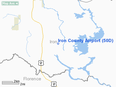
Location & QuickFacts
| FAA Information Effective: | 2008-09-25 |
| Airport Identifier: | 50D |
| Airport Status: | Operational |
| Longitude/Latitude: | 088-16-26.0400W/46-00-32.8800N
-88.273900/46.009133 (Estimated) |
| Elevation: | 1340 ft / 408.43 m (Surveyed) |
| Land: | 160 acres |
| From nearest city: | 6 nautical miles SE of Crystal Falls, MI |
| Location: | Iron County, MI |
| Magnetic Variation: | 02W (1985) |
Owner & Manager
| Ownership: | Publicly owned |
| Owner: | Iron County Board Of Commissioners |
| Address: | Court House - 2 S. 6th St - Suite 7
Crystal Falls, MI 49920-1413 |
| Phone number: | 906-875-3301 |
| Manager: | Krist Atanasoff |
| Address: | Po Box 26, 303 Selden Road
Iron River, MI 49935 |
| Phone number: | 906-265-6144
AMGR RES 906-265-9087. |
Airport Operations and Facilities
| Airport Use: | Open to public |
| Wind indicator: | Yes |
| Segmented Circle: | Yes |
| Control Tower: | No |
| Lighting Schedule: | DUSK-DAWN
ACTVT MIRL RY 12/30 - 121.7 |
| Beacon Color: | Clear-Green (lighted land airport) |
| Landing fee charge: | No |
| Sectional chart: | Green Bay |
| Region: | AGL - Great Lakes |
| Boundary ARTCC: | ZMP - Minneapolis |
| Tie-in FSS: | GRB - Green Bay |
| FSS on Airport: | No |
| FSS Toll Free: | 1-800-WX-BRIEF |
| NOTAMs Facility: | GRB (NOTAM-d service avaliable) |
| Federal Agreements: | 1 |
Airport Communications
Airport Services
| Power Plant Repair: | NONE |
| Bottled Oxygen: | NONE |
| Bulk Oxygen: | NONE |
Runway Information
Runway 02/20
| Dimension: | 2700 x 145 ft / 823.0 x 44.2 m |
| Surface: | TURF, Good Condition
RY 12/30 HAS CRUMBLED & NUMEROUS CRACKS & VEGETATION IN PAVEMENT. |
| |
Runway 02 |
Runway 20 |
| Longitude: | 088-16-22.2500W | 088-16-05.3800W |
| Latitude: | 46-00-49.2200N | 46-01-12.0400N |
| Elevation: | 1340.00 ft | 1340.00 ft |
| Traffic Pattern: | Left | Left |
| Markings: | None,
02/20 MKD WITH 3 FT YELLOW CONES. | None, |
| Obstruction: | 60 ft trees, 135 ft right of centerline | 52 ft trees, 1040.0 ft from runway, 20:1 slope to clear
RWY 20 APCH RATIO 20:1 BASED ON STRAIGHT OUT OVER 55 FT TREES 1100 FT DSTC OB. |
|
Runway 12/30
| Dimension: | 3700 x 50 ft / 1127.8 x 15.2 m |
| Surface: | ASPH, Poor Condition
RY 12/30 HAS CRUMBLED & NUMEROUS CRACKS & VEGETATION IN PAVEMENT. |
| Edge Lights: | Non-standard lighting system
MIRL NSTD; 36 FT FM RY EDGE. |
| |
Runway 12 |
Runway 30 |
| Longitude: | 088-16-41.2300W | 088-15-54.1100W |
| Latitude: | 46-01-06.7900N | 46-00-50.7800N |
| Elevation: | 1340.00 ft | 1340.00 ft |
| Traffic Pattern: | Left | Left |
| Markings: | Basic, Poor Condition
RWY 12/30 MKGS FADED | Basic, Poor Condition
RWY 12/30 MKGS FADED |
| Obstruction: | 46 ft trees, 1120.0 ft from runway, 20:1 slope to clear
+52 FT TREES, 1240 FT DSTC, 0 BOTH, APCH RATIO 20:1 BASED ON STRAIGHT OUT. | 65 ft trees, 1500.0 ft from runway, 175 ft left of centerline, 20:1 slope to clear |
|
Radio Navigation Aids
| ID |
Type |
Name |
Ch |
Freq |
Var |
Dist |
| LNL | NDB | Land O Lakes | | 396.00 | 02W | 40.0 nm |
| EGV | NDB | Eagle River | | 341.00 | 02W | 41.6 nm |
| RXW | NDB | Watersmeet | | 407.00 | 01E | 45.1 nm |
| IMT | VOR/DME | Iron Mountain | 049X | 111.20 | 02W | 13.4 nm |
| SAW | VOR/DME | Sawyer | 118X | 117.10 | 04W | 42.1 nm |
| MQT | VOR/DME | Marquette/dcmsnd | 114X | 116.70 | 02W | 42.4 nm |
Remarks
- DEER ON & INVOF ARPT.
- NO SNOW REMOVAL.
- RY PAINT MARKINGS HAVE FAILED.
Images and information placed above are from
http://www.airport-data.com/airport/50D/
We thank them for the data!
| General Info
|
| Country |
United States
|
| State |
MICHIGAN
|
| FAA ID |
50D
|
| Latitude |
46-00-32.880N
|
| Longitude |
088-16-26.040W
|
| Elevation |
1340 feet
|
| Near City |
CRYSTAL FALLS
|
We don't guarantee the information is fresh and accurate. The data may
be wrong or outdated.
For more up-to-date information please refer to other sources.
|
|


