 |
|
Location & QuickFacts
| FAA Information Effective: | 2008-09-25 |
| Airport Identifier: | 3MI6 |
| Airport Status: | Operational |
| Longitude/Latitude: | 083-39-00.7990W/42-39-25.1090N
-83.650222/42.656975 (Estimated) |
| Elevation: | 1040 ft / 316.99 m (Estimated) |
| Land: | 0 acres |
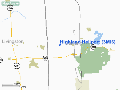
| From nearest city: | 2 nautical miles SE of Highland, MI |
| Location: | Oakland County, MI |
| Magnetic Variation: | 05W (1985) |
Owner & Manager
| Ownership: | Privately owned |
| Owner: | Bruce R. Bagley Ii |
| Address: | P.o. Box 305
Highland, MI 48357 |
| Phone number: | 313-887-5303 |
| Address: |
|
Airport Operations and Facilities
| Airport Use: | Private |
| Segmented Circle: | No |
| Control Tower: | No |
| Sectional chart: | Detroit |
| Region: | AGL - Great Lakes |
| Boundary ARTCC: | ZOB - Cleveland |
| Tie-in FSS: | LAN - Lansing |
| FSS on Airport: | No |
| FSS Toll Free: | 1-800-WX-BRIEF |
Runway Information
Helipad H1
| Dimension: | 50 x 50 ft / 15.2 x 15.2 m |
| Surface: | TURF, |
| |
Runway H1 |
Runway |
| Traffic Pattern: | Left | Left |
|
Radio Navigation Aids
| ID |
Type |
Name |
Ch |
Freq |
Var |
Dist |
| OZW | NDB | Howell | | 243.00 | 05W | 15.0 nm |
| VQ | NDB | Cargl | | 230.00 | 05W | 35.7 nm |
| G | NDB | Golf | | 398.00 | 05W | 36.5 nm |
| TCU | NDB | Tecumseh | | 239.00 | 04W | 38.7 nm |
| RYS | NDB | Grosse Ile | | 419.00 | 06W | 40.0 nm |
| QG | NDB | Windsor | | 353.00 | 06W | 40.4 nm |
| HYX | NDB | Browne | | 385.00 | 06W | 47.4 nm |
| MTC | TACAN | Selfridge | 064X | | 06W | 36.3 nm |
| DXO | VOR/DME | Detroit | 081X | 113.40 | 06W | 29.5 nm |
| JXN | VOR/DME | Jackson | 033X | 109.60 | 05W | 43.1 nm |
| YQG | VOR/DME | Windsor | 085X | 113.80 | 06W | 43.9 nm |
| PSI | VORTAC | Pontiac | 047X | 111.00 | 03W | 5.8 nm |
| SVM | VORTAC | Salem | 090X | 114.30 | 03W | 15.1 nm |
| FNT | VORTAC | Flint | 116X | 116.90 | 06W | 19.1 nm |
| CRL | VORTAC | Carleton | 104X | 115.70 | 03W | 37.6 nm |
| LAN | VORTAC | Lansing | 045X | 110.80 | 05W | 46.4 nm |
| YIP | VOT | Willow Run | | 112.00 | | 26.0 nm |
| DTW | VOT | Detroit Met Wayne | | 109.80 | | 28.7 nm |
| DET | VOT | Detroit City | | 111.60 | | 31.9 nm |
Remarks
- PROVIDED ALL INGRESS/EGRESS OPNS ARE CONDUCTED ON A MAGNETIC BEARING OF 180 DEG AND/OR 270 DEG AND/OR 360 DEG FROM THE HELIPAD USING THE HELIPAD. AS THE CENTER OF A COMPASS ROSE.
Images and information placed above are from
http://www.airport-data.com/airport/3MI6/
We thank them for the data!
| General Info
|
| Country |
United States
|
| State |
MICHIGAN
|
| FAA ID |
3MI6
|
| Latitude |
42-39-25.109N
|
| Longitude |
083-39-00.799W
|
| Elevation |
1040 feet
|
| Near City |
HIGHLAND
|
We don't guarantee the information is fresh and accurate. The data may
be wrong or outdated.
For more up-to-date information please refer to other sources.
|
|


