 |
|
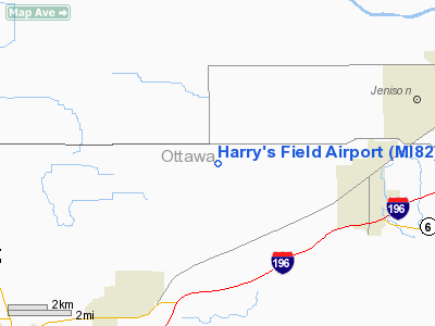
Location & QuickFacts
| FAA Information Effective: | 2008-09-25 |
| Airport Identifier: | MI82 |
| Airport Status: | Operational |
| Longitude/Latitude: | 085-57-20.1420W/42-52-35.0880N
-85.955595/42.876413 (Estimated) |
| Elevation: | 662 ft / 201.78 m (Surveyed) |
| Land: | 0 acres |
| From nearest city: | 4 nautical miles W of Hudsonville, MI |
| Location: | Ottawa County, MI |
| Magnetic Variation: | 03W (1985) |
Owner & Manager
| Ownership: | Privately owned |
| Owner: | Harry Oppenhuizen |
| Address: | 7016 Bingham St
Hudsonville, MI 49426 |
| Phone number: | 616-875-7110 |
| Address: |
|
Airport Operations and Facilities
| Airport Use: | Private |
| Wind indicator: | Yes |
| Segmented Circle: | No |
| Control Tower: | No |
| Landing fee charge: | No |
| Sectional chart: | Chicago |
| Region: | AGL - Great Lakes |
| Boundary ARTCC: | ZAU - Chicago |
| Tie-in FSS: | LAN - Lansing |
| FSS on Airport: | No |
| FSS Toll Free: | 1-800-WX-BRIEF |
Airport Services
| Airframe Repair: | NONE |
| Power Plant Repair: | NONE |
Runway Information
Runway E/W
| Dimension: | 2400 x 100 ft / 731.5 x 30.5 m |
| Surface: | TURF, |
| |
Runway E |
Runway W |
| Traffic Pattern: | Right | Right |
| Obstruction: | 35 ft pline | |
|
Radio Navigation Aids
| ID |
Type |
Name |
Ch |
Freq |
Var |
Dist |
| HLM | NDB | Holland | | 233.00 | 03W | 10.1 nm |
| BT | NDB | Batol | | 272.00 | 04W | 46.0 nm |
| GRR | VOR/DME | Grand Rapids | 106Y | 115.95 | 04W | 20.9 nm |
| PMM | VOR/DME | Pullman | 058X | 112.10 | 00E | 25.5 nm |
| AZO | VOR/DME | Kalamazoo | 027X | 109.00 | 01W | 42.4 nm |
| HIC | VOR/DME | White Cloud | 123X | 117.60 | 01W | 43.3 nm |
| ELX | VOR/DME | Keeler | 113X | 116.60 | 00E | 44.6 nm |
| MKG | VORTAC | Muskegon | 099X | 115.20 | 01W | 18.0 nm |
| BTL | VORTAC | Battle Creek | 031X | 109.40 | 02W | 46.1 nm |
Remarks
Images and information placed above are from
http://www.airport-data.com/airport/MI82/
We thank them for the data!
| General Info
|
| Country |
United States
|
| State |
MICHIGAN
|
| FAA ID |
MI82
|
| Latitude |
42-52-35.088N
|
| Longitude |
085-57-20.142W
|
| Elevation |
662 feet
|
| Near City |
HUDSONVILLE
|
We don't guarantee the information is fresh and accurate. The data may
be wrong or outdated.
For more up-to-date information please refer to other sources.
|
|


