 |
|
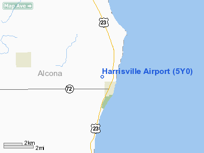
Location & QuickFacts
| FAA Information Effective: | 2008-09-25 |
| Airport Identifier: | 5Y0 |
| Airport Status: | Operational |
| Longitude/Latitude: | 083-18-18.4000W/44-40-05.6000N
-83.305111/44.668222 (Estimated) |
| Elevation: | 675 ft / 205.74 m (Surveyed) |
| Land: | 58 acres |
| From nearest city: | 1 nautical miles NW of Harrisville, MI |
| Location: | Alcona County, MI |
| Magnetic Variation: | 07W (1985) |
Owner & Manager
| Ownership: | Publicly owned |
| Owner: | Edward Gall |
| Address: | 200 Fifth St P.o. Box 278
Harrisville, MI 48740 |
| Phone number: | 989-739-3385
CITY CLERK OFC OPRS 0900-1200. |
| Manager: | Terrence Boucher |
| Address: | P.o. Box 278
Harrisville, MI 48740 |
| Phone number: | 989-724-7295
AMGR RES PHONE. |
Airport Operations and Facilities
| Airport Use: | Open to public |
| Wind indicator: | Yes |
| Segmented Circle: | Yes |
| Control Tower: | No |
| Landing fee charge: | No |
| Sectional chart: | Lake Huron |
| Region: | AGL - Great Lakes |
| Boundary ARTCC: | ZMP - Minneapolis |
| Tie-in FSS: | LAN - Lansing |
| FSS on Airport: | No |
| FSS Toll Free: | 1-800-WX-BRIEF |
| NOTAMs Facility: | LAN (NOTAM-d service avaliable) |
Airport Communications
Airport Services
| Bottled Oxygen: | NONE |
| Bulk Oxygen: | NONE |
Runway Information
Runway 03/21
| Dimension: | 2140 x 60 ft / 652.3 x 18.3 m |
| Surface: | TURF, Good Condition |
| |
Runway 03 |
Runway 21 |
| Longitude: | 083-18-26.2800W | 083-18-10.5600W |
| Latitude: | 44-39-56.6300N | 44-40-14.5400N |
| Alignment: | 32 | 127 |
| Traffic Pattern: | Left | Left |
| Displaced threshold: | 1000.00 ft | 600.00 ft |
| Obstruction: | 40 ft trees, 34.0 ft from runway, 58 ft right of centerline
APCH RATIO 0:1 AT DSPLCD THLD OVR 60 FT TREES, O FT DSTC, 120R;APCH RATIO 20:1 BASED ON STRAIGHT OUT OVR 60 FT TREES, 1200 FT DSTC. | 60 ft trees, 0.0 ft from runway, 80 ft left of centerline
APCH RATIO 12:1 AT DSPLCD THLD OVR 64 FT TREES; 768 FT FROM DSPLCD THLD; 135 FT R. 20:1 BASED ON STRAIGHT OUT. |
|
Radio Navigation Aids
| ID |
Type |
Name |
Ch |
Freq |
Var |
Dist |
| BHW | NDB | Hardwood | | 236.00 | 06W | 41.9 nm |
| PZQ | NDB | Rogers City | | 215.00 | 07W | 49.4 nm |
| ASP | VOR/DME | Au Sable | 108X | 116.10 | 07W | 13.7 nm |
| BXZ | VOR/DME | West Branch | 079X | 113.20 | 06W | 45.5 nm |
| APN | VORTAC | Alpena | 025X | 108.80 | 07W | 27.1 nm |
Remarks
- DEER & TURKEYS OCNLY ON RY.
- +15-45 FT TREES IN PRIMARY SFC; E SIDE 30 FT FM RY 03/21 CNTRLN.
- PRIOR TO 1959.
Images and information placed above are from
http://www.airport-data.com/airport/5Y0/
We thank them for the data!
| General Info
|
| Country |
United States
|
| State |
MICHIGAN
|
| FAA ID |
5Y0
|
| Latitude |
44-40-15.047N
|
| Longitude |
083-18-14.882W
|
| Elevation |
675 feet
|
| Near City |
HARRISVILLE
|
We don't guarantee the information is fresh and accurate. The data may
be wrong or outdated.
For more up-to-date information please refer to other sources.
|
|


