 |
|
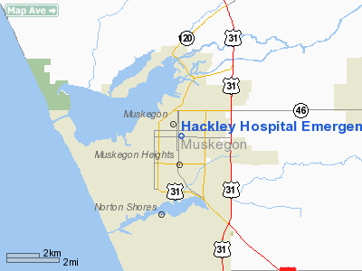
Hackley Hospital Emergency Heliport |
Location & QuickFacts
| FAA Information Effective: | 2008-09-25 |
| Airport Identifier: | MI17 |
| Airport Status: | Operational |
| Longitude/Latitude: | 086-14-32.2090W/43-13-13.0530N
-86.242280/43.220293 (Estimated) |
| Elevation: | 628 ft / 191.41 m (Estimated) |
| Land: | 0 acres |
| From nearest city: | 0 nautical miles E of Muskegon, MI |
| Location: | Muskegon County, MI |
| Magnetic Variation: | 03W (1985) |
Owner & Manager
| Ownership: | Privately owned |
| Owner: | Hackley Hospital |
| Address: | 1700 Clinton St
Muskegon, MI 49442 |
| Phone number: | 616-726-3511 |
| Manager: | Ron Owens |
| Address: |
|
Airport Operations and Facilities
| Airport Use: | Private |
| Wind indicator: | Yes |
| Segmented Circle: | No |
| Control Tower: | No |
| Lighting Schedule: | PHONE REQ
FOR BEACON & FLOOD LIGHTS CALL 616-728-4933. |
| Beacon Color: | Clear-Green-Yellow (heliport) |
| Sectional chart: | Chicago |
| Region: | AGL - Great Lakes |
| Boundary ARTCC: | ZAU - Chicago |
| Tie-in FSS: | LAN - Lansing |
| FSS Toll Free: | 1-800-WX-BRIEF |
Runway Information
Helipad H1
| Dimension: | 55 x 55 ft / 16.8 x 16.8 m |
| Surface: | ASPH, |
| |
Runway H1 |
Runway |
| Traffic Pattern: | Left | Left |
|
Radio Navigation Aids
| ID |
Type |
Name |
Ch |
Freq |
Var |
Dist |
| HLM | NDB | Holland | | 233.00 | 03W | 25.7 nm |
| LDM | NDB | Ludington | | 341.00 | 03W | 45.2 nm |
| HIC | VOR/DME | White Cloud | 123X | 117.60 | 01W | 31.3 nm |
| GRR | VOR/DME | Grand Rapids | 106Y | 115.95 | 04W | 41.9 nm |
| PMM | VOR/DME | Pullman | 058X | 112.10 | 00E | 45.7 nm |
| MKG | VORTAC | Muskegon | 099X | 115.20 | 01W | 9.4 nm |
Remarks
- PROVIDED APP/DEP FROM 230 TO 260 DEGS AND ALONG THE 020 BEARING; AREA IS MARKED; WIND INDICATOR IS MAINTAINED.
Images and information placed above are from
http://www.airport-data.com/airport/MI17/
We thank them for the data!
| General Info
|
| Country |
United States
|
| State |
MICHIGAN
|
| FAA ID |
MI17
|
| Latitude |
43-13-13.053N
|
| Longitude |
086-14-32.209W
|
| Elevation |
628 feet
|
| Near City |
MUSKEGON
|
We don't guarantee the information is fresh and accurate. The data may
be wrong or outdated.
For more up-to-date information please refer to other sources.
|
|


