 |
|
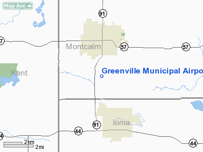
Greenville Municipal Airport |
Location & QuickFacts
| FAA Information Effective: | 2008-09-25 |
| Airport Identifier: | 6D6 |
| Airport Status: | Operational |
| Longitude/Latitude: | 085-15-13.9000W/43-08-31.7000N
-85.253861/43.142139 (Estimated) |
| Elevation: | 855 ft / 260.60 m (Surveyed) |
| Land: | 135 acres |
| From nearest city: | 3 nautical miles S of Greenville, MI |
| Location: | Montcalm County, MI |
| Magnetic Variation: | 05W (2000) |
Owner & Manager
| Ownership: | Publicly owned |
| Owner: | City Of Greenville |
| Address: | 411 S. Lafayette St
Greenville, MI 48838 |
| Phone number: | 616-754-5534 |
| Manager: | Jack D. Minikey |
| Address: | 10593 S Greenville Rd
Greenville, MI 48838 |
| Phone number: | 616-754-5534 |
Airport Operations and Facilities
| Airport Use: | Open to public |
| Wind indicator: | Yes |
| Segmented Circle: | Yes |
| Control Tower: | No |
| Lighting Schedule: | DUSK-DAWN
MIRL RY 10/28 PRESET ON LOW INTST DUSK-2300; TO INCR INTST AND AFTER 2300 & ACTVT PAPI RY 10 & 28 & REIL RY 28 - CTAF. |
| Beacon Color: | Clear-Green (lighted land airport) |
| Landing fee charge: | No |
| Sectional chart: | Chicago |
| Region: | AGL - Great Lakes |
| Boundary ARTCC: | ZAU - Chicago |
| Tie-in FSS: | LAN - Lansing |
| FSS on Airport: | No |
| FSS Toll Free: | 1-800-WX-BRIEF |
| NOTAMs Facility: | LAN (NOTAM-d service avaliable) |
| Federal Agreements: | NGY |
Airport Communications
| CTAF: | 122.800 |
| Unicom: | 122.800 |
Airport Services
| Fuel available: | 100LL |
| Airframe Repair: | MAJOR |
| Power Plant Repair: | MAJOR |
| Bottled Oxygen: | NONE |
| Bulk Oxygen: | NONE |
Runway Information
Runway 10/28
| Dimension: | 4199 x 75 ft / 1279.9 x 22.9 m |
| Surface: | ASPH, Good Condition |
| Weight Limit: | Single wheel: 23000 lbs. |
| Edge Lights: | Medium |
| |
Runway 10 |
Runway 28 |
| Longitude: | 085-15-40.9606W | 085-14-44.4918W |
| Latitude: | 43-08-33.3198N | 43-08-30.0403N |
| Elevation: | 855.00 ft | 836.00 ft |
| Alignment: | 95 | 127 |
| Traffic Pattern: | Left | Left |
| Markings: | Basic, Fair Condition | Basic, Fair Condition |
| Crossing Height: | 27.00 ft | 32.00 ft |
| VASI: | 4-light PAPI on left side | 4-light PAPI on left side |
| Visual Glide Angle: | 3.50° | 3.00° |
| Runway End Identifier: | No | Yes |
| Centerline Lights: | No | No |
| Touchdown Lights: | No | No |
| Obstruction: | 81 ft trees, 1820.0 ft from runway, 125 ft right of centerline, 20:1 slope to clear | 15 ft trees, 290.0 ft from runway, 160 ft left of centerline, 6:1 slope to clear |
|
Runway 18/36
| Dimension: | 1730 x 200 ft / 527.3 x 61.0 m |
| Surface: | TURF, Good Condition |
| |
Runway 18 |
Runway 36 |
| Longitude: | 085-15-15.8655W | 085-15-17.7098W |
| Latitude: | 43-08-40.1858N | 43-08-23.1525N |
| Elevation: | 851.00 ft | 840.00 ft |
| Alignment: | 127 | 5 |
| Traffic Pattern: | Left | Left |
| Displaced threshold: | 0.00 ft | 378.00 ft |
| Runway End Identifier: | No | No |
| Centerline Lights: | No | No |
| Touchdown Lights: | No | No |
| Obstruction: | 30 ft trees, 30.0 ft from runway, 149 ft right of centerline, 1:1 slope to clear
RY 18 IS 22:1 STRAIGHT OUT. | 75 ft trees, 975.0 ft from runway, 126 ft left of centerline, 13:1 slope to clear
RY 36 APCH RATIO AT DSPLCD THLD 20:1STRAIGHT OUT. |
|
Radio Navigation Aids
| ID |
Type |
Name |
Ch |
Freq |
Var |
Dist |
| AMN | NDB | Alma | | 329.00 | 05W | 23.2 nm |
| HLM | NDB | Holland | | 233.00 | 03W | 44.8 nm |
| BT | NDB | Batol | | 272.00 | 04W | 47.0 nm |
| GRR | VOR/DME | Grand Rapids | 106Y | 115.95 | 04W | 23.9 nm |
| HIC | VOR/DME | White Cloud | 123X | 117.60 | 01W | 32.9 nm |
| MOP | VOR/DME | Mount Pleasant | 043X | 110.60 | 05W | 36.7 nm |
| MKG | VORTAC | Muskegon | 099X | 115.20 | 01W | 34.5 nm |
| LAN | VORTAC | Lansing | 045X | 110.80 | 05W | 35.4 nm |
Remarks
- SNOW REMOVAL RY 10/28 ONLY. RY 18/36 NO PLOWING, VERIFY COND PRIOR TO LANDING.
- TREES IN 7-1 TRSN ZONE BOTH SIDES OF RY.
Images and information placed above are from
http://www.airport-data.com/airport/6D6/
We thank them for the data!
| General Info
|
| Country |
United States
|
| State |
MICHIGAN
|
| FAA ID |
6D6
|
| Latitude |
43-08-32.213N
|
| Longitude |
085-15-13.706W
|
| Elevation |
855 feet
|
| Near City |
GREENVILLE
|
We don't guarantee the information is fresh and accurate. The data may
be wrong or outdated.
For more up-to-date information please refer to other sources.
|
|


