 |
|
Location & QuickFacts
| FAA Information Effective: | 2008-09-25 |
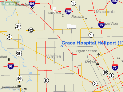
| Airport Identifier: | 17MI |
| Airport Status: | Operational |
| Longitude/Latitude: | 083-10-58.7360W/42-25-04.1310N
-83.182982/42.417814 (Estimated) |
| Elevation: | 662 ft / 201.78 m (Estimated) |
| Land: | 0 acres |
| From nearest city: | 0 nautical miles N of Detroit, MI |
| Location: | Wayne County, MI |
| Magnetic Variation: | 06W (1990) |
Owner & Manager
| Ownership: | Privately owned |
| Owner: | Grace Hospital |
| Address: | 6071 W Outer Dr
Detroit, MI 48235 |
| Phone number: | 313-966-3015 |
| Manager: | Marco Capicchioni |
| Address: | 6071 W Outer Dr
Detroit, MI 48235 |
| Phone number: | 313-966-3087 |
Airport Operations and Facilities
| Airport Use: | Private
MEDICAL USE. |
| Wind indicator: | Yes |
| Segmented Circle: | No |
| Control Tower: | No |
| Lighting Schedule: | DUSK-DAWN |
| Sectional chart: | Detroit |
| Region: | AGL - Great Lakes |
| Boundary ARTCC: | ZOB - Cleveland |
| Tie-in FSS: | LAN - Lansing |
| FSS Toll Free: | 1-800-WX-BRIEF |
Runway Information
Helipad H1
| Dimension: | 25 x 25 ft / 7.6 x 7.6 m |
| Surface: | CONC, |
| |
Runway H1 |
Runway |
| Traffic Pattern: | Left | Left |
|
Radio Navigation Aids
| ID |
Type |
Name |
Ch |
Freq |
Var |
Dist |
| VQ | NDB | Cargl | | 230.00 | 05W | 10.8 nm |
| G | NDB | Golf | | 398.00 | 05W | 12.1 nm |
| QG | NDB | Windsor | | 353.00 | 06W | 15.3 nm |
| RYS | NDB | Grosse Ile | | 419.00 | 06W | 19.1 nm |
| OZW | NDB | Howell | | 243.00 | 05W | 37.9 nm |
| TCU | NDB | Tecumseh | | 239.00 | 04W | 38.6 nm |
| PT | NDB | Pelee Island | | 283.00 | 05W | 44.7 nm |
| 4L | NDB | Chatham | | 236.00 | 06W | 49.5 nm |
| MTC | TACAN | Selfridge | 064X | | 06W | 19.5 nm |
| DXO | VOR/DME | Detroit | 081X | 113.40 | 06W | 14.8 nm |
| YQG | VOR/DME | Windsor | 085X | 113.80 | 06W | 18.7 nm |
| SVM | VORTAC | Salem | 090X | 114.30 | 03W | 18.3 nm |
| PSI | VORTAC | Pontiac | 047X | 111.00 | 03W | 23.0 nm |
| CRL | VORTAC | Carleton | 104X | 115.70 | 03W | 25.4 nm |
| FNT | VORTAC | Flint | 116X | 116.90 | 06W | 41.3 nm |
| DET | VOT | Detroit City | | 111.60 | | 7.4 nm |
| DTW | VOT | Detroit Met Wayne | | 109.80 | | 14.0 nm |
| YIP | VOT | Willow Run | | 112.00 | | 18.7 nm |
Remarks
- (A41-H1) LIGHTING 24 HOURS A DAY.
- ALL OPS ARD COND IN AN AREA 90 TO 180 DEG USING TOUCHDOWN PAD AS CENTER OF COMPASS ROSE. AREA APPROPRIATELY MKD; 250 WATT FLOODLIGHT BE SPOTTED AT GROUND. TRASH CAN & 40' LIGHT POLE ARE REMOVED.
Images and information placed above are from
http://www.airport-data.com/airport/17MI/
We thank them for the data!
| General Info
|
| Country |
United States
|
| State |
MICHIGAN
|
| FAA ID |
17MI
|
| Latitude |
42-25-04.131N
|
| Longitude |
083-10-58.736W
|
| Elevation |
662 feet
|
| Near City |
DETROIT
|
We don't guarantee the information is fresh and accurate. The data may
be wrong or outdated.
For more up-to-date information please refer to other sources.
|
|


