|
|
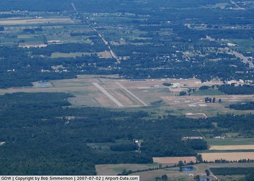
Gladwin Zettel Memorial Airport |
| Gladwin Zettel Memorial Airport |
| IATA: GDW – ICAO: KGDW |
| Summary |
| Airport type |
Public |
| Operator |
City/County of Gladwin |
| Location |
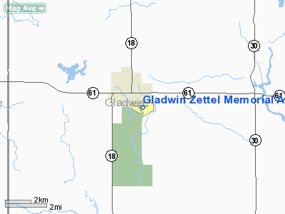
Gladwin, Michigan |
| Elevation AMSL |
776 ft / 237 m |
| Coordinates |
43°58′14.278″N 84°28′30.139″W / 43.97063278°N 84.47503861°W / 43.97063278; -84.47503861Coordinates: 43°58′14.278″N 84°28′30.139″W / 43.97063278°N 84.47503861°W / 43.97063278; -84.47503861 |
| Runways |
| Direction |
Length |
Surface |
| ft |
m |
| 9/27 |
4,700 |
1,433 |
Asphalt |
| 15/33 |
2,600 |
792 |
Turf |
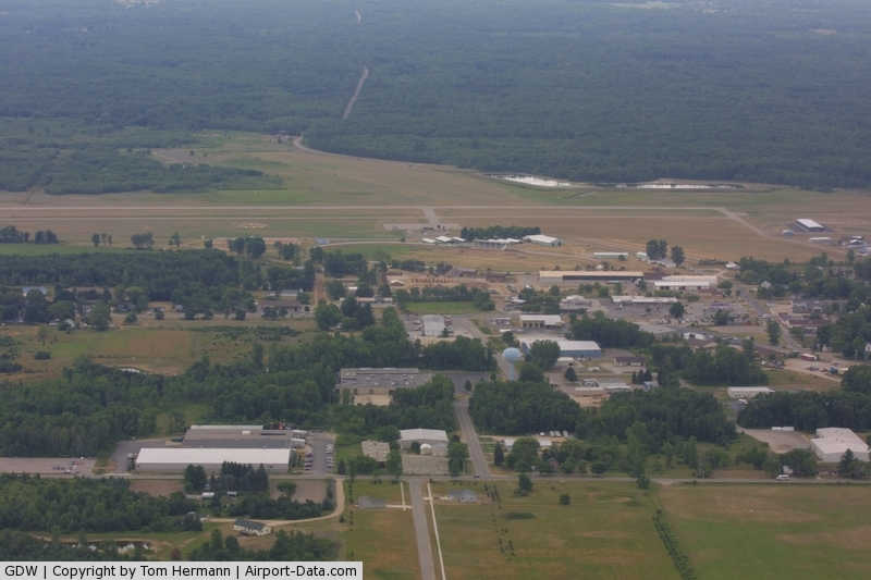
Gladwin Zettel Memorial Airport (IATA: GDW, ICAO: KGDW) is a public airport located 1 mile (2 km) southeast of Gladwin in Gladwin County, Michigan, USA. Facilities
The airport is staffed from 9AM until 5PM.
Runways
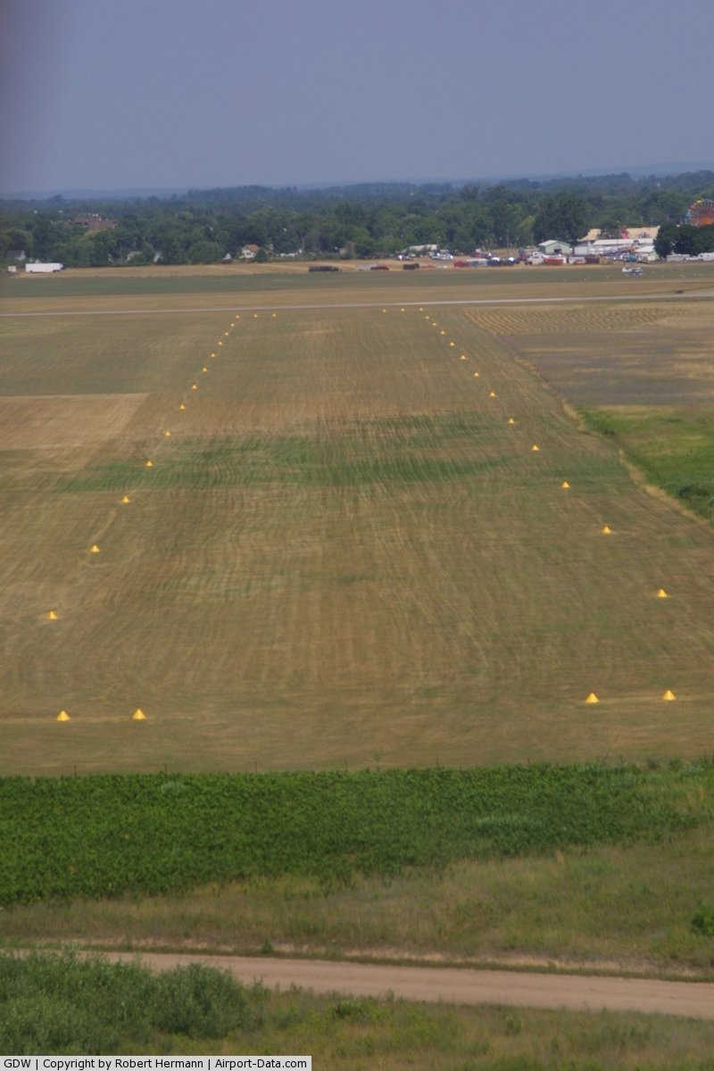
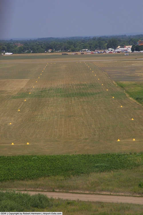
- Runway 9/27: 4,700 x 75 ft. (1,433 x 23 m), Surface: Asphalt
- Runway 15/33: 2,600 x 150 ft. (792 x 46 m), Surface: Turf
Transit
- The airport is accessible by road from State St, and is close to M-18 and M-61.
The above content comes from Wikipedia and is published under free licenses – click here to read more.
|
 |
(Click on the photo to enlarge) |
|
 |
(Click on the photo to enlarge) |
|
 |
(Click on the photo to enlarge) |
Location & QuickFacts
| FAA Information Effective: | 2008-09-25 |
| Airport Identifier: | GDW |
| Airport Status: | Operational |
| Longitude/Latitude: | 084-28-30.1390W/43-58-14.2780N
-84.475039/43.970633 (Estimated) |
| Elevation: | 776 ft / 236.52 m (Estimated) |
| Land: | 300 acres |
| From nearest city: | 1 nautical miles SE of Gladwin, MI |
| Location: | Gladwin County, MI |
| Magnetic Variation: | 04W (1980) |
Owner & Manager
| Ownership: | Publicly owned |
| Owner: | City/county Of Gladwin |
| Address: | 1000 W. Cedar Ave
Gladwin, MI 48624 |
| Phone number: | 989-426-9231
CITY HALL. |
| Manager: | Basil Bullard |
| Address: | 735 South State Street
Gladwin, MI 48624 |
| Phone number: | 989-426-4201 |
Airport Operations and Facilities
| Airport Use: | Open to public |
| Wind indicator: | Yes |
| Segmented Circle: | Yes |
| Control Tower: | No |
| Lighting Schedule: | DUSK-DAWN
ACTVT MIRL RY 09/27; PAPI & REIL RYS 09 & 27 - CTAF. |
| Beacon Color: | Clear-Green (lighted land airport) |
| Landing fee charge: | No |
| Sectional chart: | Detroit |
| Region: | AGL - Great Lakes |
| Traffic Pattern Alt: | 1000 ft |
| Boundary ARTCC: | ZMP - Minneapolis |
| Responsible ARTCC: | ZOB - Cleveland |
| Tie-in FSS: | LAN - Lansing |
| FSS on Airport: | No |
| FSS Toll Free: | 1-800-WX-BRIEF |
| NOTAMs Facility: | LAN (NOTAM-d service avaliable) |
| Federal Agreements: | NGY |
Airport Communications
| CTAF: | 122.800 |
| Unicom: | 122.800 |
Airport Services
Runway Information
Runway 09/27
| Dimension: | 4700 x 75 ft / 1432.6 x 22.9 m |
| Surface: | ASPH, Good Condition |
| Weight Limit: | Single wheel: 44000 lbs.
Dual wheel: 60000 lbs.
Dual tandem wheel: 90000 lbs. |
| Edge Lights: | Medium |
| |
Runway 09 |
Runway 27 |
| Longitude: | 084-28-58.3200W | 084-27-54.1370W |
| Latitude: | 43-58-18.2610N | 43-58-20.1250N |
| Elevation: | 770.00 ft | 772.00 ft |
| Alignment: | 88 | 127 |
| Traffic Pattern: | Left | Left |
| Markings: | Non-precision instrument, Fair Condition | Non-precision instrument, Fair Condition |
| VASI: | 2-light PAPI on left side | 2-light PAPI on left side |
| Visual Glide Angle: | 3.00° | 0.00° |
| Runway End Identifier: | Yes
REIL OTS INDEFLY. | Yes |
| Obstruction: | 48 ft trees, 1160.0 ft from runway, 240 ft right of centerline, 20:1 slope to clear | 55 ft trees, 1300.0 ft from runway, 250 ft left of centerline, 20:1 slope to clear |
|
Runway 15/33
| Dimension: | 2500 x 150 ft / 762.0 x 45.7 m |
| Surface: | TURF, Fair Condition |
| |
Runway 15 |
Runway 33 |
| Longitude: | 084-28-43.0400W | 084-28-32.2970W |
| Latitude: | 43-58-17.0780N | 43-57-53.6410N |
| Alignment: | 127 | 127 |
| Traffic Pattern: | Left | Left |
| Obstruction: | 99 ft trees, 1980.0 ft from runway, 297 ft left of centerline, 20:1 slope to clear | 33 ft trees, 672.0 ft from runway, 20:1 slope to clear |
|
Radio Navigation Aids
| ID |
Type |
Name |
Ch |
Freq |
Var |
Dist |
| BHW | NDB | Hardwood | | 236.00 | 06W | 23.8 nm |
| AMN | NDB | Alma | | 329.00 | 05W | 41.2 nm |
| HYX | NDB | Browne | | 385.00 | 06W | 42.1 nm |
| CAD | NDB | Cadillac | | 269.00 | 04W | 44.5 nm |
| GYG | NDB | Grayling | | 359.00 | 06W | 49.2 nm |
| CGG | VOR | Grayling | | 109.80 | 06W | 44.1 nm |
| BXZ | VOR/DME | West Branch | 079X | 113.20 | 06W | 20.6 nm |
| MOP | VOR/DME | Mount Pleasant | 043X | 110.60 | 05W | 23.8 nm |
| HTL | VOR/DME | Houghton Lake | 053X | 111.60 | 05W | 24.7 nm |
| MBS | VOR/DME | Saginaw | 076X | 112.90 | 03W | 31.5 nm |
Remarks
- DEER ACTIVITY ON & INVOF ARPT.
- RDO CTL ACFT OPER NEAR WEST SIDE OF RY 15/33.
Images and information placed above are from
http://www.airport-data.com/airport/GDW/
We thank them for the data!
| General Info
|
| Country |
United States
|
| State |
MICHIGAN
|
| FAA ID |
GDW
|
| Latitude |
43-58-14.278N
|
| Longitude |
084-28-30.139W
|
| Elevation |
776 feet
|
| Near City |
GLADWIN
|
We don't guarantee the information is fresh and accurate. The data may
be wrong or outdated.
For more up-to-date information please refer to other sources.
|
|