 |
|
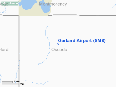
Location & QuickFacts
| FAA Information Effective: | 2008-09-25 |
| Airport Identifier: | 8M8 |
| Airport Status: | Operational |
| Longitude/Latitude: | 084-16-34.3000W/44-48-23.5000N
-84.276194/44.806528 (Estimated) |
| Elevation: | 1218 ft / 371.25 m (Estimated) |
| Land: | 115 acres |
| From nearest city: | 5 nautical miles SE of Lewiston, MI |
| Location: | Oscoda County, MI |
| Magnetic Variation: | 05W (1985) |
Owner & Manager
| Ownership: | Privately owned |
| Owner: | Eagle Ii Properties, Llc |
| Address: | 4314 Cass City Rd
Cass City, MI 48726-9465 |
| Phone number: | 810-444-8640 |
| Manager: | Gary Vollmar |
| Address: | 4314 Cass City Rd
Cass City, MI 48726-9465 |
| Phone number: | 810-444-8640 |
Airport Operations and Facilities
| Airport Use: | Open to public |
| Wind indicator: | Yes |
| Control Tower: | No |
| Lighting Schedule: | DUSK-DAWN
ACTVT MIRL RY 18/36 - CTAF. |
| Beacon Color: | Clear-Green (lighted land airport) |
| Landing fee charge: | Yes |
| Sectional chart: | Lake Huron |
| Region: | AGL - Great Lakes |
| Boundary ARTCC: | ZMP - Minneapolis |
| Tie-in FSS: | LAN - Lansing |
| FSS on Airport: | No |
| FSS Toll Free: | 1-800-WX-BRIEF |
| NOTAMs Facility: | LAN (NOTAM-d service avaliable) |
Airport Communications
| CTAF: | 122.800 |
| Unicom: | 122.800 |
Airport Services
Runway Information
Runway 18/36
| Dimension: | 5047 x 75 ft / 1538.3 x 22.9 m |
| Surface: | ASPH, Poor Condition
LARGE CRACKS IN PAVEMENT. |
| Weight Limit: | Single wheel: 15000 lbs. |
| Edge Lights: | Medium |
| |
Runway 18 |
Runway 36 |
| Longitude: | 084-16-38.0600W | 084-16-30.5600W |
| Latitude: | 44-48-48.3100N | 44-47-58.7500N |
| Traffic Pattern: | Left | Left |
| Markings: | Basic, Poor Condition
RWY MARKINGS FADED. | Basic, Poor Condition
RY 36 NUMBERS ARE FADED, DSPLCD THR ARROWHEADS FADED. |
| Crossing Height: | 0.00 ft | 41.00 ft |
| Displaced threshold: | 0.00 ft | 400.00 ft |
| VASI: | | 2-light PAPI on left side |
| Visual Glide Angle: | 0.00° | 3.00° |
| Obstruction: | 62 ft trees, 1440.0 ft from runway, 20:1 slope to clear | 50 ft trees, 800.0 ft from runway, 12:1 slope to clear
APCH RATIO 24:1 AT DSPLCD THLD. |
|
Radio Navigation Aids
| ID |
Type |
Name |
Ch |
Freq |
Var |
Dist |
| GYG | NDB | Grayling | | 359.00 | 06W | 23.8 nm |
| BHW | NDB | Hardwood | | 236.00 | 06W | 34.5 nm |
| BFA | NDB | Boyne Falls | | 263.00 | 06W | 35.0 nm |
| PZQ | NDB | Rogers City | | 215.00 | 07W | 40.8 nm |
| CXK | NDB | Clam Lake | | 251.00 | 05W | 41.4 nm |
| TV | NDB | Gwenn | | 365.00 | 05W | 49.4 nm |
| CGG | VOR | Grayling | | 109.80 | 06W | 20.7 nm |
| GLR | VOR/DME | Gaylord | 029X | 109.20 | 06W | 22.0 nm |
| HTL | VOR/DME | Houghton Lake | 053X | 111.60 | 05W | 31.7 nm |
| BXZ | VOR/DME | West Branch | 079X | 113.20 | 06W | 34.1 nm |
| ASP | VOR/DME | Au Sable | 108X | 116.10 | 07W | 43.4 nm |
| APN | VORTAC | Alpena | 025X | 108.80 | 07W | 34.8 nm |
Remarks
- FENCE AROUND AIRPORT - KEEP GATE CLSD.
- NON-AVIATION RELATED CARGO OPS ON NORTH RAMP. NO ACFT PARKING. ACFT USE WEST RAMP.
- PRVDD THE AREA 125 FT EITHER SIDE OF RY CNTRLN & 200 FT OFF RY ENDS IS CLEAR; REMOVE OR LOWER OBSTN FOR A CLEAR 20:1 APCH.
Images and information placed above are from
http://www.airport-data.com/airport/8M8/
We thank them for the data!
| General Info
|
| Country |
United States
|
| State |
MICHIGAN
|
| FAA ID |
8M8
|
| Latitude |
44-48-15.045N
|
| Longitude |
084-16-25.050W
|
| Elevation |
1218 feet
|
| Near City |
LEWISTON
|
We don't guarantee the information is fresh and accurate. The data may
be wrong or outdated.
For more up-to-date information please refer to other sources.
|
|


