 |
|
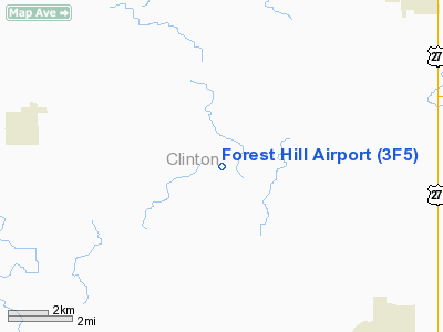
Location & QuickFacts
| FAA Information Effective: | 2008-09-25 |
| Airport Identifier: | 3F5 |
| Airport Status: | Operational |
| Longitude/Latitude: | 084-40-31.9580W/42-54-44.1210N
-84.675544/42.912256 (Estimated) |
| Elevation: | 775 ft / 236.22 m (Estimated) |
| Land: | 63 acres |
| From nearest city: | 6 nautical miles SE of Westphalia, MI |
| Location: | Clinton County, MI |
| Magnetic Variation: | 05W (1990) |
Owner & Manager
| Ownership: | Privately owned |
| Owner: | Richard L. Lyon |
| Address: | 5101 S St Clair Rd
Saint Johns, MI 48879 |
| Phone number: | 989-834-5858 |
| Manager: | Richard L. Lyon |
| Address: | 5101 S St Clair Rd
Saint Johns, MI 48879 |
| Phone number: | 989-834-5858 |
Airport Operations and Facilities
| Airport Use: | Open to public |
| Wind indicator: | Yes |
| Segmented Circle: | Yes |
| Control Tower: | No |
| Sectional chart: | Detroit |
| Region: | AGL - Great Lakes |
| Boundary ARTCC: | ZOB - Cleveland |
| Tie-in FSS: | LAN - Lansing |
| FSS Toll Free: | 1-800-WX-BRIEF |
| NOTAMs Facility: | LAN (NOTAM-d service avaliable) |
Airport Communications
Runway Information
Runway 09/27
| Dimension: | 2070 x 80 ft / 630.9 x 24.4 m |
| Surface: | TURF, Good Condition |
| |
Runway 09 |
Runway 27 |
| Traffic Pattern: | Left | Left |
| Obstruction: | 90 ft trees, 1260.0 ft from runway, 104 ft left of centerline, 14:1 slope to clear
RWY 09 APCH RATIO 20:1 STRAIGHT OUT. | 40 ft trees, 1320.0 ft from runway, 33:1 slope to clear |
|
Runway 18/36
| Dimension: | 1900 x 80 ft / 579.1 x 24.4 m |
| Surface: | TURF, Good Condition |
| |
Runway 18 |
Runway 36 |
| Traffic Pattern: | Left | Left |
| Displaced threshold: | 185.00 ft | 380.00 ft |
| Obstruction: | 15 ft road, 60.0 ft from runway, 4:1 slope to clear
RWY 18 APCH RATIO 16:1 TO DSPLCD THLD, +85 FT TREE 1,200 FT DSTC, 264 FT L. | 25 ft tree, 28.0 ft from runway, 75 ft left of centerline, 1:1 slope to clear
RWY 36 APCH RATIO 16:1 TO DSPLCD THLD. |
|
Radio Navigation Aids
| ID |
Type |
Name |
Ch |
Freq |
Var |
Dist |
| AMN | NDB | Alma | | 329.00 | 05W | 25.2 nm |
| OZW | NDB | Howell | | 243.00 | 05W | 34.7 nm |
| BT | NDB | Batol | | 272.00 | 04W | 40.0 nm |
| HYX | NDB | Browne | | 385.00 | 06W | 47.5 nm |
| GRR | VOR/DME | Grand Rapids | 106Y | 115.95 | 04W | 37.0 nm |
| JXN | VOR/DME | Jackson | 033X | 109.60 | 05W | 40.4 nm |
| MOP | VOR/DME | Mount Pleasant | 043X | 110.60 | 05W | 42.8 nm |
| MBS | VOR/DME | Saginaw | 076X | 112.90 | 03W | 45.5 nm |
| LAN | VORTAC | Lansing | 045X | 110.80 | 05W | 11.8 nm |
| FNT | VORTAC | Flint | 116X | 116.90 | 06W | 41.0 nm |
| BTL | VORTAC | Battle Creek | 031X | 109.40 | 02W | 44.3 nm |
Remarks
- RY 09 HAS A 30 FT PLINE IN APCH 606 FT FM THLD.
- RYS 09/27 & 18/36 SOFT IN SPRING.
- DEER AND BIRDS ON AND INVOF ARPT.
- PRVDD OBST REMOVED/LOWERED OR THLD DSPLCD TO PROVIDE CLEAR 20:1 SLOPE; 125 FT EITHER SIDE OF CNTRLN AND 200 FT EITHER END BE CLEAR.
Images and information placed above are from
http://www.airport-data.com/airport/3F5/
We thank them for the data!
| General Info
|
| Country |
United States
|
| State |
MICHIGAN
|
| FAA ID |
3F5
|
| Latitude |
42-54-44.121N
|
| Longitude |
084-40-31.958W
|
| Elevation |
775 feet
|
| Near City |
WESTPHALIA
|
We don't guarantee the information is fresh and accurate. The data may
be wrong or outdated.
For more up-to-date information please refer to other sources.
|
|


