 |
|
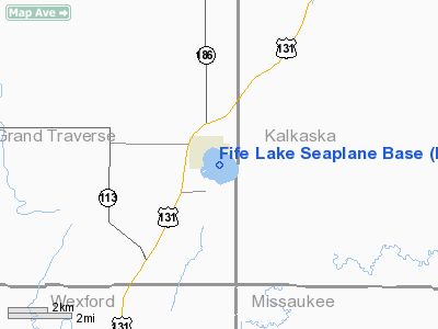
Location & QuickFacts
| FAA Information Effective: | 2008-09-25 |
| Airport Identifier: | M47 |
| Airport Status: | Operational |
| Longitude/Latitude: | 085-20-39.0000W/44-34-03.0000N
-85.344167/44.567500 (Estimated) |
| Elevation: | 1020 ft / 310.90 m (Estimated) |
| Land: | 0 acres |
| From nearest city: | 1 nautical miles E of Fife Lake, MI |
| Location: | Grand Traverse County, MI |
| Magnetic Variation: | 05W (1990) |
Owner & Manager
| Ownership: | Privately owned |
| Owner: | Cora Wilson |
| Address: | 404 State
Fife Lake, MI 49633 |
| Phone number: | 231-879-3988
231-313-6794 OWNER CELL PH. |
| Manager: | Cora Wilson |
| Address: | 404 State
Fife Lake, MI 49633 |
| Phone number: | 231-879-3988 |
Airport Operations and Facilities
| Airport Use: | Open to public |
| Segmented Circle: | No |
| Control Tower: | No |
| Sectional chart: | Green Bay |
| Region: | AGL - Great Lakes |
| Boundary ARTCC: | ZMP - Minneapolis |
| Tie-in FSS: | LAN - Lansing |
| FSS on Airport: | No |
| FSS Toll Free: | 1-800-WX-BRIEF |
| NOTAMs Facility: | LAN (NOTAM-d service avaliable) |
Airport Communications
Airport Services
| Fuel available: | 100LLMOGAS
FUEL AVBL WITH 3 DAY PRIOR NOTICE 231-313-6794. |
Runway Information
Runway E/W
| Dimension: | 5500 x 500 ft / 1676.4 x 152.4 m |
| Surface: | WATER, |
| |
Runway E |
Runway W |
| Traffic Pattern: | Left | Left |
|
Runway N/S
| Dimension: | 5500 x 500 ft / 1676.4 x 152.4 m |
| Surface: | WATER, |
| |
Runway N |
Runway S |
| Traffic Pattern: | Left | Left |
|
Runway NW/SE
| Dimension: | 6000 x 500 ft / 1828.8 x 152.4 m |
| Surface: | WATER, |
| |
Runway NW |
Runway SE |
| Traffic Pattern: | Left | Left |
|
Radio Navigation Aids
| ID |
Type |
Name |
Ch |
Freq |
Var |
Dist |
| TV | NDB | Gwenn | | 365.00 | 05W | 10.7 nm |
| CAD | NDB | Cadillac | | 269.00 | 04W | 17.8 nm |
| CXK | NDB | Clam Lake | | 251.00 | 05W | 20.4 nm |
| GYG | NDB | Grayling | | 359.00 | 06W | 24.6 nm |
| BFA | NDB | Boyne Falls | | 263.00 | 06W | 40.3 nm |
| CVX | NDB | Charlevoix | | 392.00 | 05W | 44.2 nm |
| CGG | VOR | Grayling | | 109.80 | 06W | 27.2 nm |
| HTL | VOR/DME | Houghton Lake | 053X | 111.60 | 05W | 31.7 nm |
| GLR | VOR/DME | Gaylord | 029X | 109.20 | 06W | 38.2 nm |
| MBL | VOR/DME | Manistee | 051X | 111.40 | 05W | 42.9 nm |
| TVC | VORTAC | Traverse City | 093X | 114.60 | 02W | 10.7 nm |
Remarks
- PRVDD CLEAR 20:1 APCH & REF FAR 91.115 RIGHT-OF-WAY RULES; WATER OPNS.
Images and information placed above are from
http://www.airport-data.com/airport/M47/
We thank them for the data!
| General Info
|
| Country |
United States
|
| State |
MICHIGAN
|
| FAA ID |
M47
|
| Latitude |
44-34-03.000N
|
| Longitude |
085-20-39.000W
|
| Elevation |
1020 feet
|
| Near City |
FIFE LAKE
|
We don't guarantee the information is fresh and accurate. The data may
be wrong or outdated.
For more up-to-date information please refer to other sources.
|
|


