 |
|
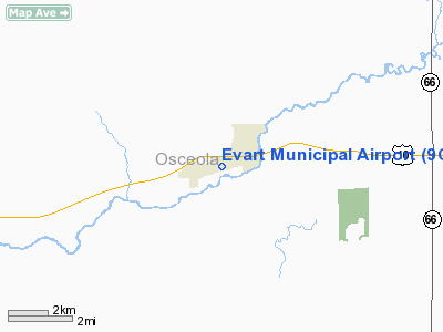
| Evart Municipal Airport |
| IATA: 9C8 – ICAO: K9C8 |
| Summary |
| Airport type |
Public |
| Operator |
City of Evart, Michigan |
| Location |
Evart, Michigan |
| Elevation AMSL |
1,018 ft / 310 m |
| Coordinates |
43°53′45.069″N 85°16′45.151″W / 43.8958525°N 85.27920861°W / 43.8958525; -85.27920861Coordinates: 43°53′45.069″N 85°16′45.151″W / 43.8958525°N 85.27920861°W / 43.8958525; -85.27920861 |
| Runways |
| Direction |
Length |
Surface |
| ft |
m |
| 6/24 |
4,185 |
1,275 |
Asphalt |
Evart Municipal Airport (IATA: 9C8, ICAO: K9C8) is a public airport located 1 mile (2 km) west of Evart in Osceola County, Michigan, USA. Facilities
The airport is unattended.
Runways
- Runway 6/24: 4,185 x 75 ft. (1,275 x 23 m), Surface: Asphalt
Transit
- The airport is accessible by road from US-10.
The above content comes from Wikipedia and is published under free licenses – click here to read more.
Location & QuickFacts
| FAA Information Effective: | 2008-09-25 |
| Airport Identifier: | 9C8 |
| Airport Status: | Operational |
| Longitude/Latitude: | 085-16-45.1510W/43-53-45.0690N
-85.279209/43.895852 (Estimated) |
| Elevation: | 1018 ft / 310.29 m (Surveyed) |
| Land: | 160 acres |
| From nearest city: | 1 nautical miles SW of Evart, MI |
| Location: | Osceola County, MI |
| Magnetic Variation: | 04W (1985) |
Owner & Manager
| Ownership: | Publicly owned |
| Owner: | City Mgr |
| Address: | 200 S Main St
Evart, MI 49631 |
| Phone number: | 231-734-2181 |
| Manager: | Roger Elkins |
| Address: | 200 S Main St
Evart, MI 49631 |
| Phone number: | 231-734-2181 |
Airport Operations and Facilities
| Airport Use: | Open to public |
| Wind indicator: | Yes |
| Segmented Circle: | Yes |
| Control Tower: | No |
| Lighting Schedule: | RDO-CTL
ACTVT MIRL RY 06/24; PAPI & REIL RYS 06 & 24 - CTAF. |
| Landing fee charge: | No |
| Sectional chart: | Chicago |
| Region: | AGL - Great Lakes |
| Boundary ARTCC: | ZMP - Minneapolis |
| Tie-in FSS: | LAN - Lansing |
| FSS on Airport: | No |
| FSS Toll Free: | 1-800-WX-BRIEF |
| NOTAMs Facility: | LAN (NOTAM-d service avaliable) |
| Federal Agreements: | N |
Airport Communications
Airport Services
Runway Information
Runway 06/24
| Dimension: | 3800 x 75 ft / 1158.2 x 22.9 m |
| Surface: | ASPH, Good Condition |
| Edge Lights: | Medium |
| |
Runway 06 |
Runway 24 |
| Longitude: | 085-17-25.8600W | 085-16-40.1500W |
| Latitude: | 43-53-30.2600N | 43-53-55.0600N |
| Elevation: | 1008.00 ft | 1020.00 ft |
| Traffic Pattern: | Left | Left |
| Markings: | Basic, Fair Condition | , Fair Condition |
| Crossing Height: | 25.00 ft | 25.00 ft |
| Displaced threshold: | 0.00 ft | 880.00 ft |
| VASI: | 2-light PAPI on left side | 2-light PAPI on left side |
| Visual Glide Angle: | 3.00° | 4.00° |
| Runway End Identifier: | Yes | Yes |
| Centerline Lights: | No | No |
| Touchdown Lights: | No | No |
| Obstruction: | 50 ft trees, 1200.0 ft from runway, 120 ft right of centerline, 20:1 slope to clear | 67 ft trees, 870.0 ft from runway, 125 ft left of centerline, 10:1 slope to clear
APCH RATIO 20:1 TO DSPLCD THLD. |
|
Radio Navigation Aids
| ID |
Type |
Name |
Ch |
Freq |
Var |
Dist |
| CAD | NDB | Cadillac | | 269.00 | 04W | 23.5 nm |
| GDW | NDB | Wiggins | | 209.00 | 04W | 35.1 nm |
| AMN | NDB | Alma | | 329.00 | 05W | 40.6 nm |
| LDM | NDB | Ludington | | 341.00 | 03W | 49.1 nm |
| HIC | VOR/DME | White Cloud | 123X | 117.60 | 01W | 27.1 nm |
| MOP | VOR/DME | Mount Pleasant | 043X | 110.60 | 05W | 28.7 nm |
| HTL | VOR/DME | Houghton Lake | 053X | 111.60 | 05W | 38.4 nm |
| MBL | VOR/DME | Manistee | 051X | 111.40 | 05W | 47.7 nm |
| TVC | VORTAC | Traverse City | 093X | 114.60 | 02W | 47.8 nm |
Remarks
- ALSO RY 24 +67 FT RADIO TWR 736 FT DIST; 187 FT R, 8:1; ALSO +15 FT ROAD 407 FT DIST, 13:1.
- AIRSPACE ANALYSIS DETERMINATION PENDING.
Images and information placed above are from
http://www.airport-data.com/airport/9C8/
We thank them for the data!
| General Info
|
| Country |
United States
|
| State |
MICHIGAN
|
| FAA ID |
9C8
|
| Latitude |
43-53-45.069N
|
| Longitude |
085-16-45.151W
|
| Elevation |
1018 feet
|
| Near City |
EVART
|
We don't guarantee the information is fresh and accurate. The data may
be wrong or outdated.
For more up-to-date information please refer to other sources.
|
|


