 |
|
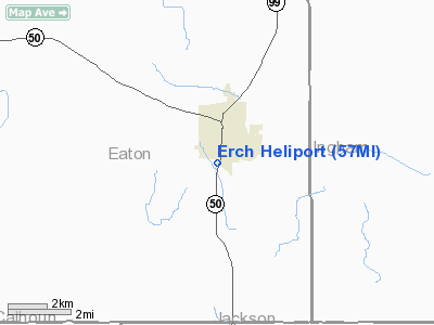
Location & QuickFacts
| FAA Information Effective: | 2008-09-25 |
| Airport Identifier: | 57MI |
| Airport Status: | Operational |
| Longitude/Latitude: | 084-39-30.9200W/42-29-44.1300N
-84.658589/42.495592 (Estimated) |
| Elevation: | 888 ft / 270.66 m (Estimated) |
| Land: | 0 acres |
| From nearest city: | 0 nautical miles S of Eaton Rapids, MI |
| Location: | Eaton County, MI |
| Magnetic Variation: | 05W (1995) |
Owner & Manager
| Ownership: | Privately owned |
| Owner: | Eaton Rapids Community Hosp |
| Address: | 1500 S Main
Eaton Rapids, MI 48827 |
| Phone number: | 517-663-2671 |
| Manager: | Joseph E Daley Jr |
| Address: | 1500 S Main
Eaton Rapids, MI 48827 |
| Phone number: | 517-663-2671 |
Airport Operations and Facilities
| Airport Use: | Private
MEDICAL USE. |
| Wind indicator: | Yes |
| Segmented Circle: | No |
| Control Tower: | No |
| Sectional chart: | Detroit |
| Region: | AGL - Great Lakes |
| Boundary ARTCC: | ZOB - Cleveland |
| Tie-in FSS: | LAN - Lansing |
| FSS on Airport: | No |
| FSS Toll Free: | 1-800-WX-BRIEF |
Runway Information
Helipad H1
| Dimension: | 60 x 60 ft / 18.3 x 18.3 m |
| Surface: | ASPH,
CIRCULAR PAD. |
| |
Runway H1 |
Runway |
| Traffic Pattern: | Left | Left |
|
Radio Navigation Aids
| ID |
Type |
Name |
Ch |
Freq |
Var |
Dist |
| BT | NDB | Batol | | 272.00 | 04W | 24.7 nm |
| OZW | NDB | Howell | | 243.00 | 05W | 30.8 nm |
| TCU | NDB | Tecumseh | | 239.00 | 04W | 44.3 nm |
| ADG | NDB | Adrian | | 278.00 | 06W | 45.7 nm |
| JXN | VOR/DME | Jackson | 033X | 109.60 | 05W | 16.8 nm |
| LFD | VOR/DME | Litchfield | 049X | 111.20 | 05W | 26.5 nm |
| GRR | VOR/DME | Grand Rapids | 106Y | 115.95 | 04W | 41.0 nm |
| AZO | VOR/DME | Kalamazoo | 027X | 109.00 | 01W | 42.7 nm |
| LAN | VORTAC | Lansing | 045X | 110.80 | 05W | 13.4 nm |
| BTL | VORTAC | Battle Creek | 031X | 109.40 | 02W | 28.6 nm |
| SVM | VORTAC | Salem | 090X | 114.30 | 03W | 47.5 nm |
| FNT | VORTAC | Flint | 116X | 116.90 | 06W | 49.2 nm |
Remarks
- APCH/DEP RT 80 DEG CLKWS TO 110 DEG AND 230 DEG CLKWS TO 270 DEG USING PAD AS CENTER; APROP MARKING AND LGTG; MNTND WND INDCR; COMPLIANCE WITH 14 CFR PART 91.136 (B) (2); LGTS INSTLD ON ANT 500 FT 225 DEG FM PAD; SECURITY PSNL PRSNT DURG OPNS TO PREVENT UNAUTHORIZED ACCESS TO PAD.
Images and information placed above are from
http://www.airport-data.com/airport/57MI/
We thank them for the data!
| General Info
|
| Country |
United States
|
| State |
MICHIGAN
|
| FAA ID |
57MI
|
| Latitude |
42-29-44.130N
|
| Longitude |
084-39-30.920W
|
| Elevation |
888 feet
|
| Near City |
EATON RAPIDS
|
We don't guarantee the information is fresh and accurate. The data may
be wrong or outdated.
For more up-to-date information please refer to other sources.
|
|


